
Bays, Harbors, Inlets and Waterways
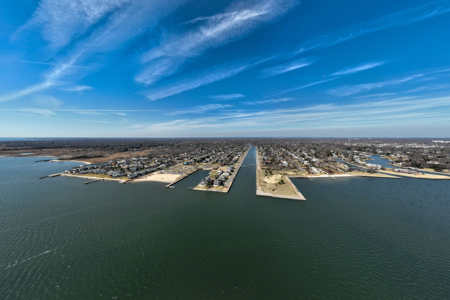
Long Island is surrounded and shaped by some of the most important coastal waters in the northeastern United States. From the broad waters of Long Island Sound and Great South Bay to the protected harbors, tidal inlets, rivers, and bays along the island’s North Shore, South Shore, North Fork, South Fork, and East End, these waterways have influenced settlement, transportation, fishing, boating, commerce, recreation, and conservation for centuries.
This guide brings together Long Island Guide pages about major named bodies of water and significant waterways. It is intended as a reference hub for learning about the island’s geography and finding more detailed information about individual bays, harbors, inlets, rivers, sounds, and related coastal waters.
Bays, Sounds and Estuaries
Long Island’s bays and sounds form broad transition zones between land and open water. They provide sheltered waters for boating and fishing, support wetlands and wildlife habitat, and connect many of the island’s waterfront communities.
Harbors and Waterfronts
Harbors provide some of the most recognizable waterfront settings on Long Island. Many are associated with historic villages, working marinas, ferry connections, yacht clubs, commercial fishing, waterfront parks, and downtown districts. The North Shore is especially known for its deep harbors and sheltered coves, while the South Shore harbors connect directly with the island’s extensive barrier-island and bay system.
Other Major Waterways and Channels
Several other major waterways help connect Long Island’s coastal geography with neighboring shores and inland waterfront communities. These include broad tidal channels, historic waterways, and prominent rivers that are important for navigation, wildlife habitat, transportation, or the region’s development.
Inlets, Channels and Passages
Long Island’s inlets are openings or tidal passages connecting bays and back-barrier waters with the Atlantic Ocean. They are constantly shaped by tides, storms, currents, and shifting sand. Inlets are also important locations for boating, fishing, navigation, wildlife, and coastal management.
Rivers and Significant Waterways
Long Island does not have the large inland river systems found in many other parts of New York, but several named rivers and waterways remain geographically and historically important. They drain freshwater areas, flow through wetlands and coastal communities, and eventually empty into bays, harbors, or Long Island Sound.
Understanding Long Island’s Water Geography
Long Island’s water geography is easiest to understand as a connected system. The Atlantic Ocean borders the island’s southern edge, where barrier islands shelter the bays behind them. The North Shore faces Long Island Sound, while the eastern end opens into Block Island Sound, Gardiners Bay, and the Peconic Bay system. Harbors and coves cut into the shoreline, and inlets create tidal connections between the ocean and the back bays. Rivers and smaller waterways complete the system by carrying groundwater and surface water toward the coast.
These waters are closely connected to the communities of the North Shore, South Shore, North Fork, South Fork, and East End. They also help define the character of waterfront places such as Cold Spring Harbor, Northport, Port Jefferson, Oyster Bay, Sag Harbor, and Montauk.
Key Facts and Details
| Feature Type | What It Includes | Examples |
|---|---|---|
| Bays and Sounds | Broad coastal waters, estuaries, and protected marine areas | Great South Bay, Long Island Sound, Gardiners Bay |
| Harbors | Sheltered waterfronts associated with communities, marinas, and boating | Huntington Harbor, Oyster Bay Harbor, Port Jefferson Harbor |
| Inlets | Tidal openings connecting the Atlantic Ocean with bays behind the barrier islands | Fire Island Inlet, Jones Inlet, Moriches Inlet |
| Rivers | Named inland and tidal waterways flowing toward Long Island’s coast | Nissequogue River, Peconic River, Carmans River |
Long Island’s bays, harbors, inlets, rivers, and sounds are more than names on a map. Together, they form the coastal framework of the island and continue to shape its communities, economy, recreation, wildlife habitat, and history. Use this guide to explore the major waterways of Long Island, then follow the individual links for more detailed information about each place.
Are you ready for fall on Long Island? Check out these local seasonal guides:
🍎 Apple Picking 🍓 Strawberry Picking 🎃 Pumpkin Picking 👻 Haunted Houses 🍂 Farm Festivals
