
Highways & Parkways
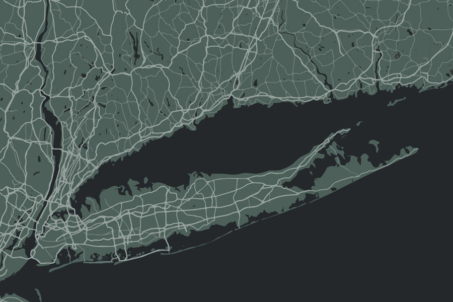
Long Island’s highways, parkways, expressways, turnpikes, and major local roads form the backbone of travel across Long Island. From commuters heading into New York City to beachgoers traveling toward Jones Beach, Fire Island, and the Hamptons, the Island’s road network shapes daily life across Nassau County and Suffolk County. Some roads are high-speed regional corridors, while others are scenic drives, historic routes, or commercial arteries lined with downtowns, shopping centers, restaurants, and local businesses.
Major Expressways
Long Island Expressway (I-495)
- Route: Runs east-west across Long Island from Queens through Nassau and Suffolk, ending in Riverhead.
- Use: Primary commuter and commercial route across the Island.
- Nickname: Commonly known as “The LIE.”
Seaford–Oyster Bay Expressway (NY-135)
- Route: North-south expressway through central Nassau County.
- Use: Connects the South Shore, central Nassau, the LIE, Northern State Parkway, and North Shore areas.
- Notable: Important limited-access alternative to local north-south roads.
Major Parkways
Northern State Parkway
- Route: Runs parallel to the Long Island Expressway through Nassau and western Suffolk.
- Use: Scenic commuter alternative to I-495.
- Note: Like most Long Island parkways, commercial trucks are prohibited.
Meadowbrook State Parkway
- Route: Runs north-south in Nassau County from the Northern State Parkway to Jones Beach.
- Use: Popular beach route and major connector to central Nassau destinations.
Sunken Meadow State Parkway
- Route: Runs north from the Northern State Parkway to Sunken Meadow State Park in Kings Park.
- Use: Provides North Shore access and a scenic route toward Smithtown Bay.
Bethpage State Parkway
- Route: Connects the Southern State Parkway in North Massapequa to Bethpage State Park.
- Use: Short but important parkway serving recreation, golf, and local Nassau County travel.
Southern State Parkway
- Route: Extends from Queens through Nassau into western Suffolk.
- Use: Major South Shore commuter route.
- Design: Known for winding curves, landscaped sections, and low stone overpasses.
Wantagh State Parkway
- Route: Connects the Northern State Parkway to Jones Beach.
- Use: Major beach access route running parallel to the Meadowbrook.
Sagtikos State Parkway / Robert Moses Causeway
- Route: Sagtikos links the Southern State Parkway to the Northern State Parkway; Robert Moses Causeway continues south toward Fire Island.
- Use: Access to Robert Moses State Park, Fire Island, and Captree State Park.
Ocean Parkway
- Route: Scenic coastal roadway between Jones Beach and Captree.
- Use: Beach access, fishing piers, state parks, and coastal views.
Major East-West Roads
Sunrise Highway (NY-27)
- Route: Extends from Queens to Montauk along the South Shore.
- Use: Major commuter and East End travel route.
- Notable: Main alternative to the LIE for many Hamptons trips.
Route 25 / Jericho Turnpike
- Route: Runs east-west from Queens through Nassau and Suffolk toward Orient Point.
- Use: Historic commercial corridor with downtowns, restaurants, shopping centers, and local businesses.
Hempstead Turnpike (NY-24)
- Route: Major east-west artery from Queens through central Nassau into Suffolk.
- Use: Busy commercial roadway serving shopping centers, restaurants, institutions, and neighborhoods.
Route 109 (NY-109)
- Route: Busy east-west roadway serving Babylon, West Babylon, and Farmingdale.
- Use: Commercial, industrial, and commuter route connecting South Shore communities with central Nassau and Suffolk corridors.
Montauk Highway (NY-27A)
- Route: Historic South Shore roadway running parallel to Sunrise Highway in many areas.
- Use: Scenic route through coastal communities, downtown districts, and East End destinations.
Route 25A / Northern Boulevard
- Route: North Shore route running parallel to Route 25 through Nassau and western Suffolk.
- Use: Scenic and historic corridor through waterfront villages and North Shore downtowns.
Old Country Road
- Route: Historic east-west arterial through central Nassau County, serving areas such as Mineola, Carle Place, Westbury, Hicksville, and Plainview.
- Use: Major commercial corridor with shopping centers, office buildings, restaurants, local businesses, and access to nearby neighborhoods.
- Notable: One of Nassau County’s most recognizable surface roads and an important alternative to nearby parkways and expressways.
Route 347 / Nesconset Highway
- Route: East-west Suffolk County corridor from Smithtown toward Port Jefferson Station.
- Use: Important commuter and retail corridor serving offices, shopping centers, and residential communities.
Major North-South Roads
Route 106 (NY-106)
- Route: North-south Nassau County route connecting Hicksville and Oyster Bay.
- Use: Serves central Nassau neighborhoods, business districts, and North Shore waterfront areas.
Route 110 (NY-110 / Broadhollow Road)
- Route: Major north-south road running from Amityville to Huntington.
- Use: One of Long Island’s busiest commercial corridors, serving Farmingdale, Melville, Huntington, offices, retail centers, and industrial parks.
Nicolls Road (CR-97)
- Route: North-south Suffolk County corridor linking Stony Brook, Holtsville, and Patchogue.
- Use: Major connector between Stony Brook University, the LIE, Sunrise Highway, and South Shore communities.
Route 112 (NY-112)
- Route: Runs from Patchogue to Port Jefferson Station.
- Use: Major Suffolk County commercial and commuter corridor with access to Sunrise Highway and the LIE.
Route 107 (NY-107)
- Route: North-south Nassau County corridor running through Hicksville, Jericho, Brookville, and Glen Cove.
- Use: Important commuter road with access to business districts, residential areas, and North Shore communities.
Deer Park Avenue / Route 231 (NY-231)
- Route: North-south Suffolk County road connecting Babylon Village, Deer Park, North Babylon, and Dix Hills.
- Use: Important commuter and commercial route linking the South Shore to central Suffolk.
William Floyd Parkway (CR-46)
- Route: Long north-south roadway in eastern Suffolk County.
- Use: Connects the South Shore to North Shore areas, with wooded stretches and access to parks, neighborhoods, and research facilities.
Route 111 (NY-111)
- Route: North-south Suffolk County route serving Islip, Brentwood, Hauppauge, and Smithtown.
- Use: Connects residential areas, industrial parks, and major parkways in central Suffolk.
Coastal, Connector & Gateway Roads
Bay Parkway
- Route: Short roadway within Jones Beach State Park extending west from the Wantagh State Parkway / Ocean Parkway interchange area.
- Use: Provides access to western Jones Beach areas, shoreline access points, and quieter West End sections of the barrier island.
- Notable: Part of the historic Jones Beach roadway network associated with Robert Moses and the Long Island parkway era.
Veterans Memorial Highway (NY-454)
- Route: Central Suffolk roadway serving Hauppauge, Bohemia, Ronkonkoma, and nearby communities.
- Use: Important connector to Long Island MacArthur Airport, office parks, and commercial districts.
Belt Parkway / Grand Central Parkway
- Use: Key New York City connector routes for drivers traveling between Long Island, Brooklyn, Queens, airports, bridges, and Manhattan-bound crossings.
- Notable: These routes are technically outside Nassau and Suffolk, but they are essential to how many drivers enter and leave Long Island.
Loop Parkway (NY-909C)
- Route: Short coastal connector linking the Meadowbrook State Parkway to Lido Boulevard near Point Lookout.
- Use: Access to Point Lookout, Lido Beach, Reynolds Channel, and nearby South Shore waterfront areas.
Cross Island Parkway
- Route: Western gateway parkway in Queens near the Nassau County line.
- Use: Connects Long Island traffic with the Whitestone Bridge, Throgs Neck Bridge, Belt Parkway, and Grand Central Parkway.
Long Island’s roadways are more than simple transportation routes – they are part of the region’s identity. The Long Island Expressway moves commuters and commerce across the Island, Ocean Parkway and Montauk Highway provide scenic coastal drives, and local corridors such as Route 110, Route 112, Nicolls Road, Hempstead Turnpike, and Jericho Turnpike connect downtowns, neighborhoods, business districts, schools, parks, beaches, and everyday destinations. Understanding these roads helps residents and visitors travel more confidently across one of the most active suburban regions in the country.
