
William Floyd Parkway
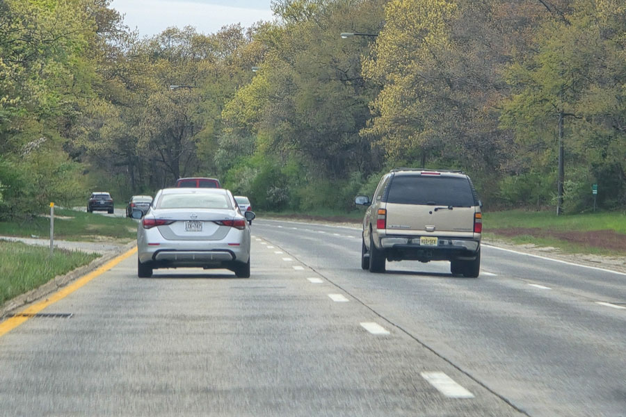
The William Floyd Parkway (Suffolk County Route 46) is a major north-south road in eastern Long Island, running between Smith Point County Park at the South Shore and NY 25A in the Wading River/Shoreham area on the North Shore. Despite its name, it functions more like a county arterial than a traditional limited-access parkway: commercial vehicles are permitted, and the route combines freeway-style interchanges with signalized intersections. It remains an important commuter corridor and one of Suffolk County’s main approach routes to Smith Point and the ocean beach.
Route Description
At its south end, William Floyd Parkway reaches the Smith Point County Park traffic circle near the beach facilities and the west end of the Smith Point Bridge. From there it crosses the Great South Bay and heads north through Shirley, Yaphank, and Ridge, providing major connections with NY 27 (Sunrise Highway), I-495 (Long Island Expressway), NY 25 (Middle Country Road), and CR 111. The route ends at NY 25A in the Shoreham-Wading River area near the shores of the Long Island Sound. Depending on the segment, drivers encounter a mix of divided highway stretches, wooded medians, and conventional intersections.
History
- The roadway is named for William Floyd, the Revolutionary-era statesman and Declaration of Independence signer associated with the Mastic area of Long Island.
- William Floyd Parkway was planned and built in stages during the mid-20th century as part of a larger north-south transportation corridor in eastern Suffolk County.
- The Smith Point Bridge, a signature crossing of the Great South Bay, opened in 1959 and expanded direct road access between mainland Brookhaven and the Smith Point beach area.
- Over time, the roadway evolved from a largely rural connector into a vital commuter and recreational route, with a mix of grade-separated interchanges and at-grade intersections rather than full expressway design throughout.
William Floyd Parkway / CR 46 Junctions
Major Intersections & Features
| Location | Road / Route | Notes |
|---|---|---|
| South terminus | Smith Point County Park traffic circle | South end of the route near beach access and Smith Point Bridge |
| Shirley | NY 27 (Sunrise Highway) | Major interchange for South Shore travel |
| Yaphank | I-495 (Long Island Expressway) | Key east-west commuter connection |
| Ridge | NY 25 (Middle Country Road) | Important central Brookhaven junction |
| Ridge / Brookhaven area | CR 111 | Regional connector toward Port Jefferson and Westhampton areas |
| North terminus | NY 25A (North Country Road) | Junction in the Shoreham–Wading River area |
Additional Notes
William Floyd Parkway links South Shore waterfront access with Suffolk County’s interior and the North Shore. Parts of the road have a parkway-like feel thanks to wooded stretches and broad medians, but drivers should expect standard traffic signals, turning movements, and local access points along much of the corridor. Because it serves both commuters and beach traffic, congestion can build quickly on summer weekends, holiday afternoons, and around major junctions such as Sunrise Highway, the Long Island Expressway, and the Smith Point approaches.
For visitors, William Floyd Parkway is best understood as both a transportation corridor and a gateway route. It connects the South Shore waterfront with inland Brookhaven communities and the North Shore, and it is one of the most direct drives to Smith Point County Park. Traffic patterns, construction activity, beach access procedures, parking availability, and seasonal operations can change, so it is wise to check current road and park conditions before heading out.
Are you ready for fall on Long Island? Check out these local seasonal guides:
🍎 Apple Picking | 🍂 Fall Festivals & Farm Activities | 👻 Haunted Houses | 🎃 Pumpkin Picking
