
Sunrise Highway (NY-27) on Long Island
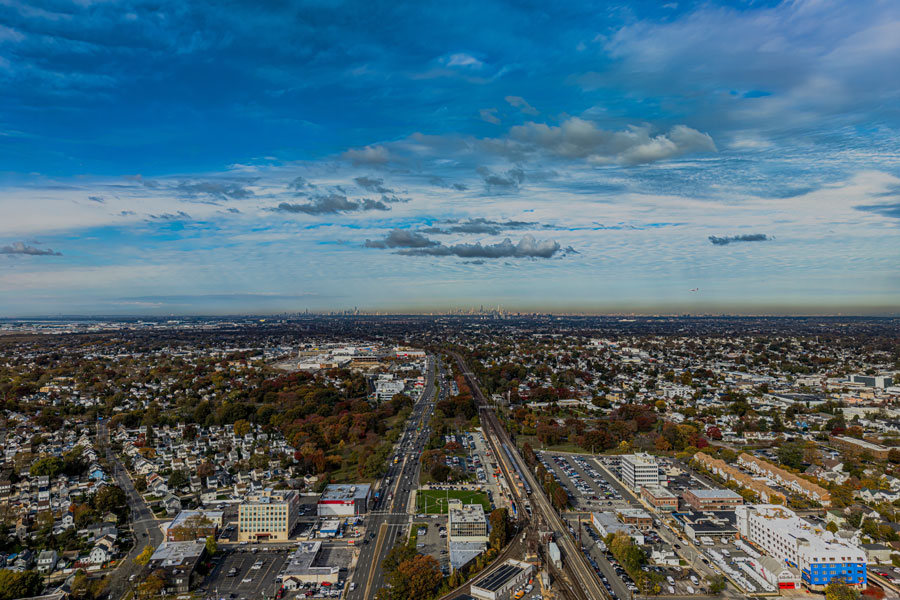
Sunrise Highway (NY-27) is one of Long Island’s primary east–west travel corridors. On Long Island, the name generally refers to the NY-27 route beginning near the Queens/Nassau line by the Cross Island Parkway and continuing east through Nassau and Suffolk Counties. Depending on the segment, the corridor functions as a limited-access highway, a divided arterial with service roads, or a more local surface route. It remains a vital commuter and commercial roadway, linking major South Shore communities, shopping districts, beach connections, and eastbound travel toward the Hamptons and the wider East End.
Route and Features
- Long Island western starting point: Near the Queens/Nassau border at the Cross Island Parkway and Belt Parkway connector area
- Eastward reach: Continues across much of Suffolk County toward the South Fork, with route naming and roadway character varying by segment farther east
- Counties served on Long Island: Nassau and Suffolk (NY-27 also continues west into Queens and Brooklyn)
- Character: Faster, more controlled-access travel through many western and central sections; more service roads, signals, and local access points in eastern sections
- Role: Major commuter, commercial, and seasonal travel route for the South Shore and East End
- Restrictions: Unlike most Long Island parkways, trucks and commercial vehicles are generally permitted where posted
Sunrise Highway (NY-27)
Major Connections and Interchanges
| Roadway / Connection | Area Served | Notes |
|---|---|---|
| Cross Island Parkway / Belt Parkway connector | Queens–Nassau border | Long Island western gateway for the Sunrise Highway corridor |
| Meadowbrook State Parkway | Hempstead area / Jones Beach access | Key north–south link to central Nassau and the South Shore beaches |
| Wantagh State Parkway | Levittown / Jones Beach access | Major connection for beach traffic and central Nassau travel |
| Seaford–Oyster Bay Expressway (NY-135) | Seaford / Massapequa / Syosset corridor | Important north–south route across Nassau County |
| Broadway / Route 110 (Broadhollow Road) | Amityville / Farmingdale business district | Busy commercial hub with retail, office, and industrial access |
| Robert Moses Causeway | West Islip / Fire Island access | Connection toward Robert Moses State Park and the Fire Island area |
| Heckscher State Parkway | Bay Shore / East Islip area | Access to Heckscher State Park and nearby South Shore communities |
| Nicolls Road (CR-97) | Patchogue / Stony Brook corridor | Major north–south artery serving central Suffolk County destinations |
| William Floyd Parkway (CR-46) | Shirley / Mastic area | Important connector toward Brookhaven Town communities and Smith Point access routes |
| Manorville Road / Brookhaven National Laboratory area | Manorville | Eastern Suffolk access point where the highway begins to feel less urban and more transitional |
| NY-24 / Flanders Road area | Riverhead / Flanders gateway | Key split point for East End travel patterns, with local routing and signage varying by direction |
Signage, exit numbering, lane patterns, and access arrangements can vary by segment, and eastern portions of the corridor include more surface-road conditions than the western expressway stretches. Check current navigation and traffic conditions before longer trips.
Notable Facts
- Sunrise Highway is widely used as the truck-friendly counterpart to the Southern State Parkway, giving drivers a practical east–west option that accommodates commercial traffic.
- The roadway changes character as you travel east, shifting from higher-speed divided highway segments to stretches with service roads, traffic signals, and more direct local access.
- It is a major route for reaching South Shore downtowns, beach parkways, Fire Island access routes, and the broader NY-27 corridor leading toward the Hamptons and Montauk.
- Many retail centers, auto dealerships, restaurants, and local business districts line the corridor, especially in Nassau County and western Suffolk.
- Travel times often increase sharply on summer Fridays, summer Sundays, holiday weekends, and peak beach days, so leaving early and checking live traffic updates can make a noticeable difference.
- For rail travelers, several LIRR stations sit near the Sunrise Highway corridor, making the route important for station access as well as through-travel.
Are you ready for fall on Long Island? Check out these local seasonal guides:
🍎 Apple Picking | 🍂 Fall Festivals & Farm Activities | 👻 Haunted Houses | 🎃 Pumpkin Picking
