
Wantagh State Parkway: Route, Exits & Jones Beach Access
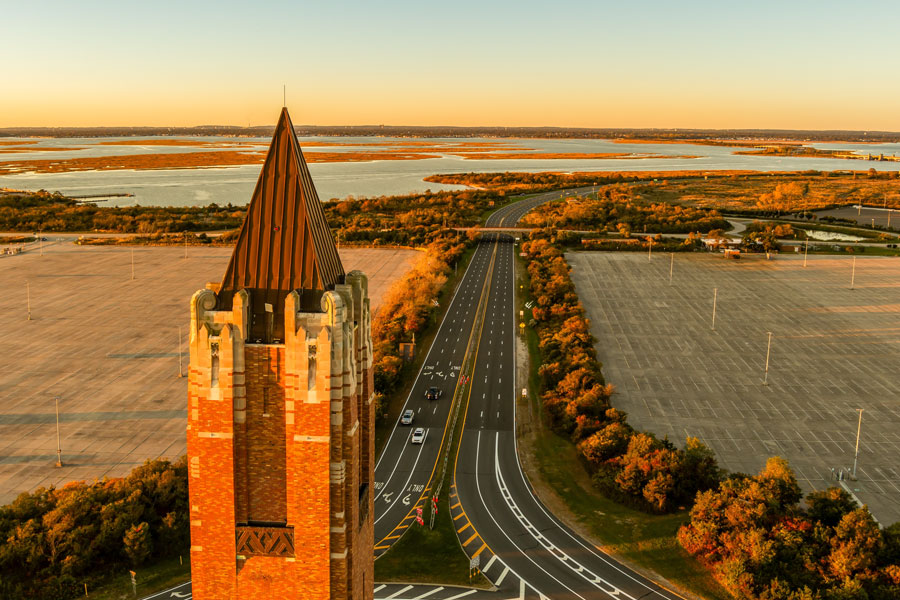
The Wantagh State Parkway (WSP) is a roughly 13-mile north-south parkway in Nassau County. It runs from the Northern State Parkway in the Westbury area south to Jones Beach State Park, where it connects with Ocean Parkway and Bay Parkway. Built during the Robert Moses parkway era, it was designed as a scenic, limited-access route from central Nassau to the South Shore beaches.
Like other classic Long Island parkways, the Wantagh State Parkway was built for passenger vehicles and is known for landscaped medians, stone-faced bridges, and beach-oriented design. It intersects several major east-west roads, including the Southern State Parkway and Sunrise Highway, making it one of the principal routes between central Nassau communities and the Jones Beach waterfront.
Route and Features
- Northern Terminus: Northern State Parkway, near Old Country Road in Westbury
- Southern Terminus: Jones Beach State Park – Ocean Parkway / Bay Parkway interchange
- Length: about 13 miles
- County: Nassau County
- Restrictions: Parkway rules apply; commercial trucks and other restricted or oversized vehicles should use alternate routes
Numbered Exits (north → south)
| Exit | Destination / Roadway | Notes |
|---|---|---|
| W1 | Northern State Parkway | Northern terminus in the Westbury area |
| W2E / W2W | Old Country Road (CR 25) East / West | Westbury |
| W3 | Hempstead Turnpike (NY 24) | Westbury / Hempstead area |
| W4E / W4W | Southern State Parkway East / West | Major east-west junction |
| W5 | Jerusalem Avenue (CR 105) | Wantagh / East Meadow area |
| W6 | Newbridge Road (NY 106) | Bellmore / North Wantagh area |
| W7 | Hicksville Road (NY 107) | Seaford / Massapequa area |
| W8 | Merrick Road (CR 27) | South Shore local access |
| W9 | Sunrise Highway (NY 27) | Major South Shore east-west route |
| W10 | Loop Parkway | Jones Beach approach and barrier-island connection |
| — | Ocean Parkway / Bay Parkway | Southern terminus at Jones Beach State Park |
Travel times can change sharply on summer weekends, beach days, and during concerts or special events at Jones Beach Theater. Drivers should also remember that Long Island parkways are not suitable for trucks, moving vans, trailers, or other tall vehicles because parkway restrictions and low-clearance bridges remain part of the system. Check current traffic and posted signs before heading south.
Vicinity of the north-south Parkway
Notable Facts
- The parkway was developed in the late 1920s and early 1930s as part of the larger Jones Beach parkway network, alongside the Meadowbrook State Parkway.
- Its original purpose was to provide a landscaped, automobile-oriented approach from inland Nassau County communities to the beaches and recreation areas of the South Shore.
- The route is closely tied to the legacy of Robert Moses and the broader Long Island State Park Commission parkway and recreation system.
- Today it remains one of the most direct north-south routes to Jones Beach State Park for many central and eastern Nassau communities.
- Historic design elements such as stone-faced bridges, medians, and controlled access still help define the character of the route, even though sections have been updated over time for modern traffic patterns.
