
Address and Jurisdiction Finder
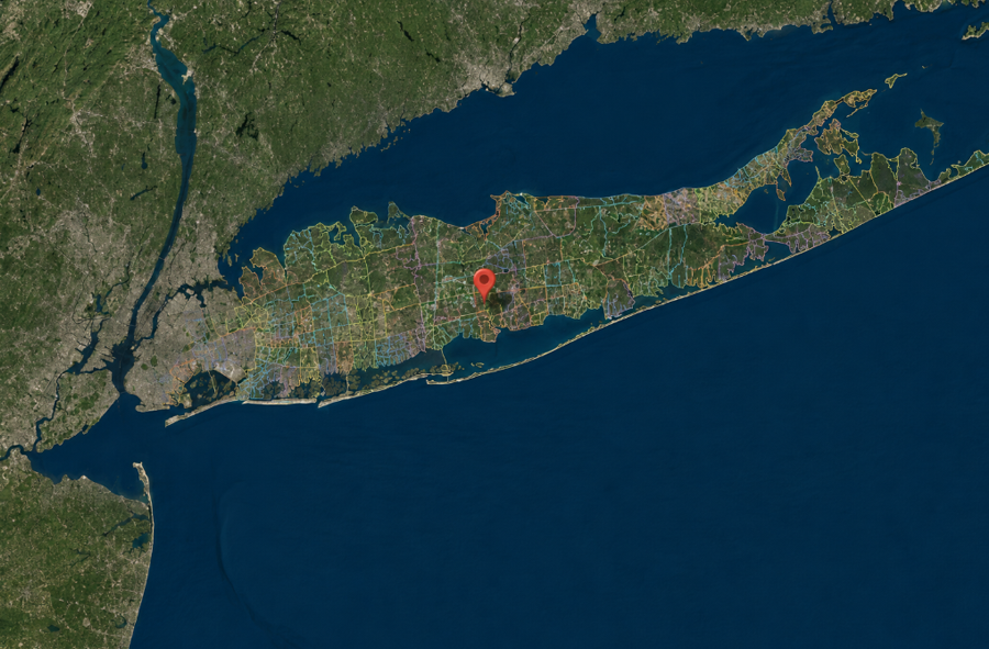
A Long Island mailing address does not always reveal the community, municipality, school district, fire district, water provider or other jurisdictions that serve the property. The name used by the U.S. Postal Service may differ from the hamlet or village where the address is physically located, while public services may be provided by several independent districts with their own boundaries.
The Long Island Address and Jurisdiction Finder brings that information together in one interactive tool for Nassau and Suffolk counties. Enter a complete street address to generate a geographic identity report, or click anywhere on the map to examine the jurisdictions associated with that location. The map can also be explored one layer at a time to see how community and service boundaries overlap.
In Short
Enter a Nassau or Suffolk County address into the finder below. The tool converts the address into a map point and checks that location against 1,110 embedded boundary polygons. Depending on the available data for that point, the report may identify its mailing community, ZIP code, hamlet or community area, incorporated village, town or city, county, school district, fire district, police jurisdiction, library district, water provider, sanitation coverage and several other special districts.
Why Long Island Addresses Can Be Confusing
Long Island contains several different kinds of geography occupying the same land. An address can be associated with a postal community, a hamlet or census-designated place, an incorporated village, a town, a county and numerous special service districts at the same time. Those boundaries were created for different purposes and do not necessarily follow one another.
For example, the community name appearing in an address is primarily used for mail delivery. It does not by itself establish whether the property is inside an incorporated village, which town governs it or which school and fire districts serve it. Even neighboring homes can sometimes fall within different service areas when a district boundary runs along or between local streets.
This is particularly important on Long Island because its two suburban counties contain two cities, 13 towns, dozens of incorporated villages, many more unincorporated communities and a dense network of special districts. Understanding the distinction between a town, village and hamlet helps explain why one property can have several correct location names, each describing something different.
How to Use the Address Finder
- Enter a complete street address in Nassau or Suffolk County, including the community or ZIP code.
- Select Find Address, or press Enter, to place the address on the map and generate its report.
- Review the matched community, municipal and service-area boundaries in the Address Report panel.
- Open Layers to display individual boundary categories on the map.
- Use Copy Share Link to preserve the selected location or Print Report to create a printable copy.
You can also click a point directly on the map. This is helpful when examining an undeveloped property, park, waterfront area or other location that may not have a conventional street address.
What the Address Report Can Identify
The finder checks every available boundary category when an address or point is selected, whether or not those layers are currently visible on the map. A report may include the following:
- Mailing community and ZIP code: The postal information associated with the geocoded address.
- Hamlet or community area: The local place or census geography containing the selected point.
- Incorporated village: A village government whose legal boundary contains the property, when applicable.
- Town or city: The primary municipal jurisdiction containing the location.
- County: Nassau County or Suffolk County.
- Ambulance district: The mapped emergency medical service area associated with the point.
- Fire district: The fire-service district or area identified by the boundary data.
- Garbage or sanitation district: The mapped refuse or sanitation service area, where available.
- Library district: The public-library service area containing the location.
- Park and parking districts: Special park or parking jurisdictions in communities where these districts exist.
- Police jurisdiction: The police service area or precinct represented in the source data.
- School district: The elementary, union free, central or high-school district boundary associated with the point.
- Sewer district: A mapped public sewer service area, where one is identified.
- Water district or provider: The district, authority or other mapped water-service provider.
Not every address will produce a named result in every category. Some services are organized differently from one municipality to another, some properties are outside a particular type of district, and the available source files do not represent every jurisdiction with equal completeness. When the tool does not find a matching polygon, it reports that no matching boundary was identified rather than claiming that no district or service exists.
Exploring the Boundary Layers
The map can be used independently of the address report. Select Layers to turn different boundary categories on or off and compare their geographic coverage. The available municipal and community layers include cities and towns, incorporated villages, and hamlet or community areas. Service layers include ambulance, fire, sanitation, library, park, parking, police, school, sewer and water boundaries.
Displaying the layers makes it easy to see why a single Long Island address may be described in several ways. A postal name may extend across municipal lines, a school district may serve portions of several communities, and the boundaries of a fire or water district may differ from both. Selecting an individual polygon displays the name and type of the mapped area.
Sharing and Printing a Location Report
After a location has been selected, the Copy Share Link button creates a direct link to that specific map point and its jurisdiction report. Anyone opening the link can view the same selected location without searching for it again. This can be useful when discussing a property with a buyer, tenant, real estate professional, attorney, contractor, family member or local organization.
The shared link opens the focused, standalone version of the finder and records the selected latitude and longitude rather than placing the typed street address in the URL. It may also preserve the map layers that were active when the link was created. Anyone who receives the link can still see the selected location, so it should be shared with the same care as any property-location information.
The Print Report option creates a simplified version intended for printing or saving as a PDF. Map controls are removed from the printed layout so the jurisdiction results are easier to read.
Data Sources, Privacy and Limitations
The application combines municipal, community and special-district boundary data from public geographic sources. Source information and the retrieval date for the service-area compilation are available through the Sources & Methodology button inside each generated report.
One address-geocoding request is used to convert an entered address into geographic coordinates. The point is then compared locally against the boundary information embedded in the map. The standalone application does not store the address entered into its search field. The finder does not request the visitor’s current location and will not display a browser location-permission prompt.
Boundaries and administrative arrangements can change, and some datasets may be more current or complete than others. Results should therefore be treated as a research and reference aid, not as a legal determination of residency, school enrollment, taxation, voting eligibility, emergency response or utility service. Before making a decision based on a result, confirm the address directly with the appropriate municipality, school district, service provider or government agency.
Key Facts & Details
| Feature | Details |
|---|---|
| Geographic coverage | Nassau County and Suffolk County |
| Embedded boundaries | 1,110 municipal, community and service-area polygons |
| Ways to select a location | Enter a complete address or click directly on the map |
| Community geography | Cities, towns, villages, hamlets and community areas |
| Service categories | Ambulance, fire, sanitation, library, park, parking, police, school, sewer and water |
| Shareable results | Direct link to the selected map point and report |
| Location permission | Not requested or used |
| Intended use | General research and geographic reference; official verification is recommended |
The Address and Jurisdiction Finder provides a new way to understand how a Long Island property fits into the region’s overlapping geography. For broader reference, visitors can explore the complete Long Island ZIP code map and directory, review the counties of Long Island, learn which towns are on Long Island, or continue to the individual LongIslandGuide.com pages for the cities, villages, hamlets and towns identified in a location report.
Are you ready for fall on Long Island? Check out these local seasonal guides:
🍎 Apple Picking 🍓 Strawberry Picking 🎃 Pumpkin Picking 👻 Haunted Houses 🍂 Farm Festivals
