
Census-Designated Place (CDP)
If you’ve explored community pages throughout Long Island Guide, you’ve probably noticed the phrase “census-designated place (CDP)” appearing frequently. While the term may sound like an official type of municipality, a Census-Designated Place is actually a geographic area identified by the United States Census Bureau solely for statistical purposes. CDPs allow the Census Bureau to collect and publish population, housing, and demographic information for recognizable communities that do not have their own incorporated municipal government.
What Is a Census-Designated Place?
A Census-Designated Place (CDP) is a populated community that the U.S. Census Bureau recognizes as a distinct place for collecting and reporting census data. Although a CDP has defined geographic boundaries for statistical purposes, it is not a city, village, town, or any other form of local government.
CDPs make it possible to publish separate population counts, housing statistics, economic data, and demographic information for communities that residents commonly recognize by name. Without CDP designations, many well-known communities would simply be included within the larger towns or counties that govern them.
Why Does the Census Bureau Create CDPs?
The Census Bureau establishes CDPs to improve the accuracy and usefulness of census data. Many communities have a distinct identity, history, ZIP code, school district, or business district even though they are not incorporated municipalities. Creating a Census-Designated Place allows these communities to receive their own statistical profile during each decennial census and other Census Bureau surveys.
The designation does not create a government, change property ownership, establish municipal services, or alter legal boundaries. It exists solely to improve demographic reporting and statistical analysis.
Why Are Census-Designated Places So Common on Long Island?
Although Census-Designated Places exist throughout the United States, Long Island has an unusually high concentration of them. This is largely because Nassau and Suffolk counties contain numerous well-established communities that have long been recognized by residents but were never incorporated as separate municipalities.
Instead of creating hundreds of small cities or villages, Long Island developed around larger town governments that encompass dozens of distinct neighborhoods and communities. The Census Bureau uses CDPs to collect and publish separate statistics for these communities, allowing places such as Levittown, Ronkonkoma, Medford, North Bellport, and North Bay Shore to have their own published census data despite not being incorporated municipalities.
Because of this unique governmental structure, Long Island residents encounter the term “Census-Designated Place (CDP)” far more often than people in many other parts of the country.
How Are CDP Boundaries Determined?
The U.S. Census Bureau works with state and local officials to define CDP boundaries based on how communities are commonly recognized. Factors such as development patterns, neighborhoods, local identity, and population distribution are considered when establishing or revising these boundaries. Because they exist for statistical reporting rather than legal purposes, CDP boundaries may not always align perfectly with ZIP codes, school districts, postal addresses, or locally recognized neighborhood boundaries.
Can Census-Designated Place Boundaries Change?
Yes. Since CDPs are statistical areas rather than incorporated municipalities, the Census Bureau may revise their boundaries between census cycles to reflect changes in development, population growth, or community identity. As a result, the reported land area, population, or demographic characteristics of a CDP may change over time.
An Unusual Example: No Name, Colorado
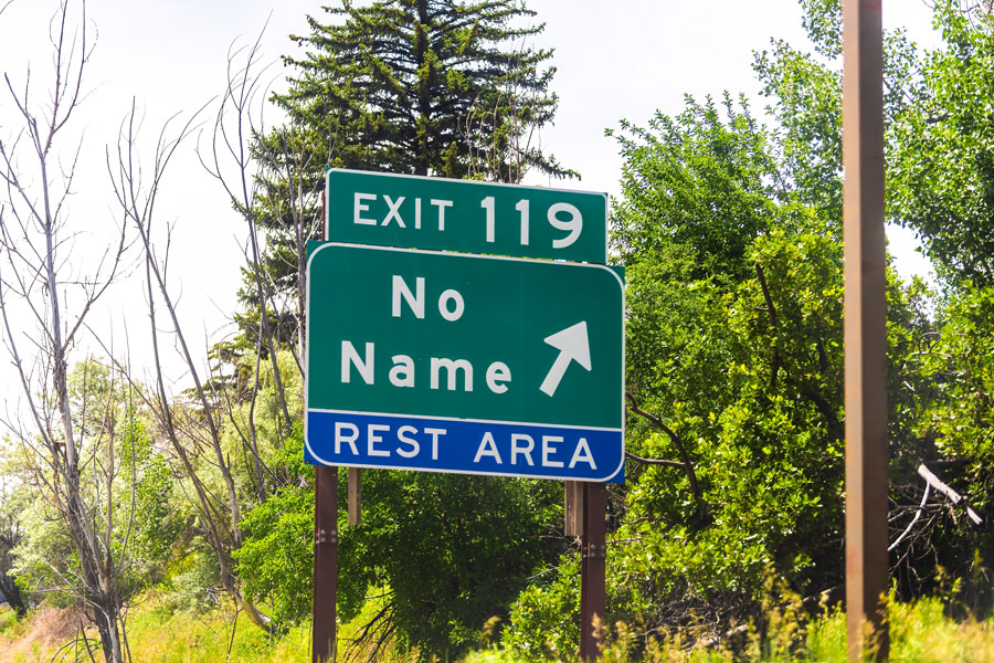
One of the nation’s most unusual Census-Designated Places is No Name, Colorado. Despite its unconventional name, No Name is officially recognized by the U.S. Census Bureau as a CDP. The community demonstrates that a Census-Designated Place is simply a statistical designation for a recognizable populated area and not a form of incorporated local government.
Why Long Island Guide References CDPs
Long Island Guide uses official U.S. Census Bureau classifications whenever applicable to provide readers with accurate and consistent community information. When a community is identified as a Census-Designated Place, the designation reflects the Census Bureau’s official statistical classification and helps readers understand why separate population and demographic data are available for that location.
| Key Facts & Details | Information |
|---|---|
| Definition | A geographic area established by the U.S. Census Bureau for statistical reporting. |
| Purpose | To collect and publish separate population, housing, and demographic data for recognizable communities. |
| Local Government | None. A CDP is not an incorporated municipality. |
| Who Creates CDPs? | The U.S. Census Bureau, working with state and local officials. |
| Can Boundaries Change? | Yes. CDP boundaries may be revised between census cycles to reflect community changes. |
| Why So Common on Long Island? | Long Island’s unique governmental structure includes many recognizable communities that benefit from separate Census reporting despite lacking incorporated municipal governments. |
Census-Designated Places help the U.S. Census Bureau accurately measure and report information about communities that residents recognize as distinct places. While they do not represent a form of local government, CDPs play an important role in demographic reporting, planning, and research. Their widespread use across Nassau and Suffolk counties reflects Long Island’s distinctive pattern of community development and explains why the term appears so frequently throughout Long Island Guide.
Are you ready for fall on Long Island? Check out these local seasonal guides:
🍎 Apple Picking 🍓 Strawberry Picking 🎃 Pumpkin Picking 👻 Haunted Houses 🍂 Farm Festivals
