
Shirley, New York
Shirley is a hamlet and census-designated place (CDP) in the Town of Brookhaven, Suffolk County, on Long Island‘s South Shore. Largely residential, Shirley offers convenient access to major roadways, the Long Island Rail Road, protected wetlands along the Carmans River, and the ocean beach at Smith Point County Park. Its location makes it a practical base for both everyday living and exploring the outdoor attractions of southeastern Brookhaven.
History & Development
Shirley expanded significantly after World War II as suburban development moved eastward across Long Island. The hamlet’s name is commonly linked to developer Walter T. Shirley, whose land development activity helped shape the area in the early 20th century. Over time, Shirley grew from a sparsely settled section of Brookhaven into an established community with neighborhoods, schools, shopping areas, and local services.
Community & Lifestyle
Today, Shirley is known mainly as a residential community with a mix of longtime neighborhoods, postwar homes, and newer housing. Much of the hamlet is served by the William Floyd School District, and residents are close to libraries, youth programs, everyday shopping, and local parks. Visitors also benefit from Shirley’s position between inland community amenities and the shoreline destinations farther south.
Parks, Nature & Waterfront Access
One of Shirley’s biggest advantages is its proximity to well-known outdoor destinations. Wertheim National Wildlife Refuge, which protects habitat along the Carmans River, offers opportunities for birdwatching, walking, photography, and enjoying coastal wetlands and woodlands. To the south, Smith Point County Park is a major regional draw with an ocean beach, fishing access, seasonal camping, and gateway access to the eastern end of Fire Island. Visitors often use Shirley as a convenient jumping-off point for these natural areas, though park hours, beach access, and seasonal services can vary, so it is wise to check ahead before visiting.
Transportation & Access
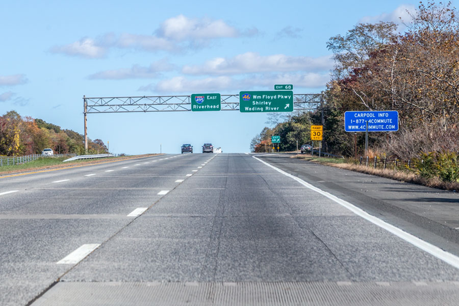
Shirley is well positioned for regional travel. Major routes include Sunrise Highway (NY 27), Montauk Highway (County Road 80), and William Floyd Parkway, which provides a direct north-south connection between the Long Island Expressway and Smith Point. Rail service is available at the Mastic–Shirley station on the Long Island Rail Road’s Montauk Branch; schedules, service patterns, and station details may change, especially outside peak periods, so riders should confirm current information before traveling.
Local Economy & Nearby Services
While Shirley is largely residential, it has active commercial corridors with restaurants, convenience services, and everyday shopping, especially along Montauk Highway and near William Floyd Parkway. The wider area is also influenced by major employers and transportation assets in Brookhaven, including Brookhaven Calabro Airport and Brookhaven National Laboratory, both of which help support jobs and business activity across this part of Suffolk County.
Shirley, New York
Snapshot
| Category | Details |
|---|---|
| Location | South Shore area of Long Island, in the Town of Brookhaven, Suffolk County |
| Population | About 27,800 residents (2020 census) |
| School District | Mostly within the William Floyd School District |
| Major Roads | Sunrise Highway (NY 27), Montauk Highway (CR 80), William Floyd Parkway |
| LIRR Station | Mastic–Shirley Station (Montauk Branch) |
| Nearby Attractions | Smith Point County Park, Wertheim National Wildlife Refuge, Fire Island access via Smith Point |
| Community Character | Residential, suburban, and close to parks, marshland, and South Shore recreation |
Shirley, New York, is best known for its convenient location between neighborhood amenities and some of Brookhaven’s best-known outdoor destinations. Whether you are heading to the beach, exploring the refuge, or using the rail line for a day trip, Shirley serves as a practical South Shore base. Because transportation schedules, park rules, beach fees, and seasonal facilities may change, checking current information before you go is recommended.
Are you ready for fall on Long Island? Check out these local seasonal guides:
🍎 Apple Picking | 🍂 Fall Festivals & Farm Activities | 👻 Haunted Houses | 🎃 Pumpkin Picking
