
Robert Moses Causeway
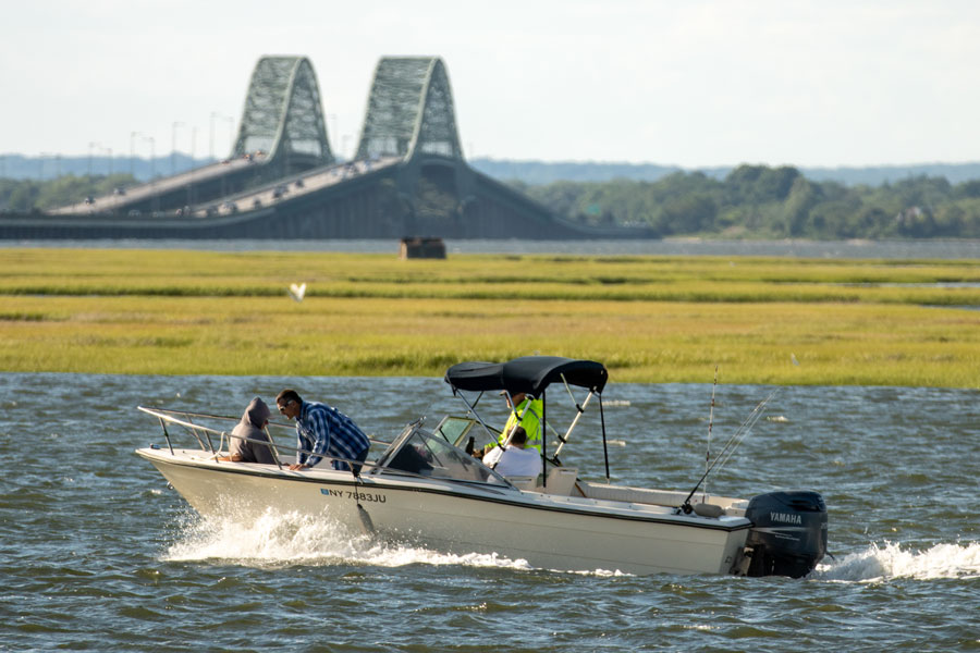
The Robert Moses Causeway is a major north-south parkway in western Suffolk County that connects mainland Long Island with Captree State Park, the Fire Island Inlet area, and Robert Moses State Park on the western end of Fire Island. Extending about 8 miles, it runs from Robert Moses State Park north across a series of bridges and causeway spans to the Southern State Parkway in West Islip, where the route continues as the Sagtikos State Parkway.
Built in the mid-20th century and named for New York public works planner Robert Moses, the causeway operates as a parkway, so commercial trucks and other non-parkway traffic are generally prohibited. The drive is known for wide-open views of the Great South Bay, Fire Island Inlet, and the nearby Atlantic Ocean, and it remains one of the main gateways to Long Island’s South Shore beaches, boating, and fishing destinations.
Route and Features
- Southern Terminus: Robert Moses State Park, western Fire Island
- Northern Terminus: Southern State Parkway, West Islip (continues north as the Sagtikos State Parkway)
- Length: About 8 miles
- County: Suffolk
- Character: Elevated causeway and bridge route crossing barrier-island and bay landscapes
- Primary Access: Robert Moses State Park, Captree State Park, Ocean Parkway, and Fire Island Inlet-area recreation
- Restrictions: Parkway rules apply; commercial trucks and similar non-parkway traffic are prohibited
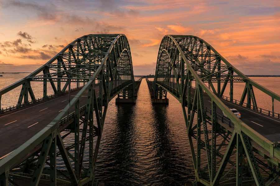
Robert Moses Causeway Exits
Major Interchanges & Access Points (south → north)
| Junction / Exit | Destination / Notes |
|---|---|
| Robert Moses State Park | Southern terminus; access to ocean beaches, park fields, and nearby Fire Island Lighthouse facilities |
| Ocean Parkway | East-west connection along Jones Beach Island toward other South Shore beach destinations |
| Fire Island Inlet Bridge | Signature span over Fire Island Inlet with broad bay and ocean views |
| Captree State Park / Ocean Parkway area | Access to Captree marinas, party boats, fishing piers, and nearby Overlook Beach |
| Great South Bay Bridges | Series of spans connecting Captree Island with the mainland South Shore |
| Montauk Highway (NY-27A) | Local access for West Islip, Bay Shore, and nearby waterfront communities |
| Sunrise Highway (NY-27) | Major east-west South Shore corridor |
| Southern State Parkway | Northern terminus; roadway continues as the Sagtikos State Parkway toward central and northern Long Island |
Notable Facts
- The Fire Island Inlet Bridge is the most recognizable span on the route and offers some of the causeway’s broadest water views.
- The causeway provides the primary direct automobile route to Robert Moses State Park and also serves Fire Island-area recreation and Great South Bay boating access.
- It forms the southern link in a continuous parkway chain that can carry drivers north toward the Long Island Sound via the Southern State Parkway, Sagtikos State Parkway, and Sunken Meadow State Parkway.
- Summer weekends, beach-weather holidays, and popular fishing periods can bring heavy traffic, so travel times may be longer than usual.
Visitor Planning Tips
- Beach parking fees, field access, and seasonal operations at Robert Moses State Park and Captree State Park can change, so check ahead before visiting.
- Marine weather, wind, fog, and summer congestion can affect driving conditions on the bridges and approaches.
- The causeway is designed primarily for motor-vehicle travel; use designated park, marina, and beach facilities for walking, fishing, and other recreation.
Are you ready for fall on Long Island? Check out these local seasonal guides:
🍎 Apple Picking | 🍂 Fall Festivals & Farm Activities | 👻 Haunted Houses | 🎃 Pumpkin Picking
