
Sagtikos State Parkway
The Sagtikos State Parkway is a northsouth limited-access parkway in western Suffolk County that links the Southern State Parkway with the Northern State Parkway and continues north as the Sunken Meadow State Parkway toward Long Island Sound. Built in the mid-20th century as part of Long Islands parkway network, it remains one of the main cross-island connectors for drivers moving between the South Shore and North Shore.
Like other Long Island parkways, the Sagtikos is intended for passenger vehicles. Commercial trucks, tractor-trailers, and other oversized vehicles are generally prohibited, and drivers should always follow posted parkway restrictions and clearance warnings.
Route and Features
- Southern Terminus: Southern State Parkway (West Islip area); southbound connections lead toward the Robert Moses Causeway and the ocean-side park and beach corridor.
- Northern Terminus: Transition to the Sunken Meadow State Parkway at the Northern State Parkway interchange in the Commack area.
- County: Suffolk County
- Character: Limited-access parkway with wooded medians, older overpasses, and several closely spaced interchanges.
- Restrictions: Passenger vehicles only; commercial trucks, tractor-trailers, and many oversized vehicles are prohibited.
Major Interchanges & Access Points (south north)
Interchange names, local ramp movements, and exit references can vary by direction and signage. Use posted signs and current navigation when planning a trip.
| Exit / Junction | Destination / Roadway | Notes |
|---|---|---|
| Southern Terminus | Southern State Parkway / Robert Moses Causeway | Major parkway link for trips toward the South Shore and barrier beach corridor |
| NY-27A | Montauk Highway (West Islip / Bay Shore) | Local South Shore access |
| NY-27 | Sunrise Highway | Major east-west connection |
| Pine Aire Drive / Bay Shore Road | Local access near Brentwood and Bay Shore; ramp patterns are limited | |
| CR-13 | Crooked Hill Road | Access for Brentwood and Suffolk County Community College Grant Campus area |
| I-495 | Long Island Expressway (Exit 53 area) | Key regional east-west link |
| CR-67 | Motor Parkway | Hauppauge / Brentwood business corridor |
| Vanderbilt Parkway / Townline Road | Local access in the Dix Hills / Commack area; movements may vary | |
| NY-25 | Jericho Turnpike | Commack / Smithtown access |
| Northern Terminus | Northern State Parkway / Sunken Meadow State Parkway | Northbound continuation toward Sunken Meadow State Park and Long Island Sound |
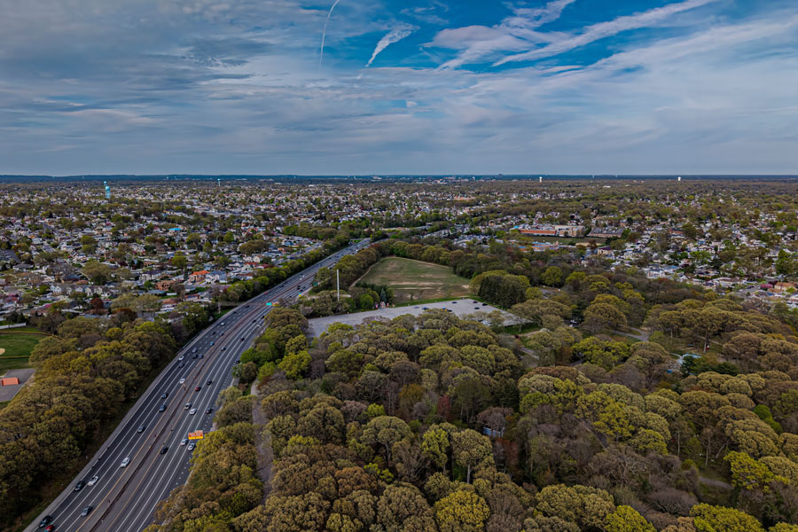
Vicinity of the Sagtikos State Parkway
Notable Facts
- The Sagtikos forms one of Long Islands main northsouth parkway links, tying together the Southern State, Northern State, and Sunken Meadow parkway corridors.
- It is an important connection for drivers transferring between the Long Island Expressway and Long Islands state parkway system.
- Older parkway geometry, short merge areas, and heavy commuter traffic can make driving feel tighter here than on newer expressways, especially near Sunrise Highway and the LIE.
- There are no standard service plazas on the parkway itself, so plan fuel, food, and restroom stops off-route.
Traveler Tips
- Rush hours, summer beach traffic, incidents, and storm cleanup can all affect travel times on this corridor.
- Check 511NY or a current navigation app before you go for live traffic, construction, and closure information.
- If you are driving a rental truck, moving van, or towing equipment, confirm that your vehicle is allowed before using any Long Island parkway.
