
Cross Island Parkway
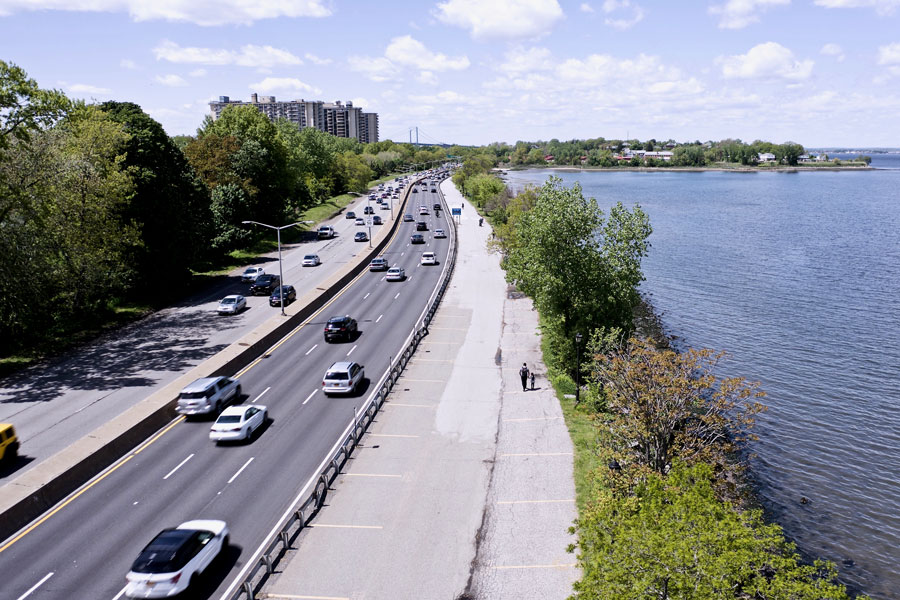
The Cross Island Parkway is a major north–south parkway in Queens and an important part of New York City’s Belt Parkway system. Running about 10.6 miles along the eastern edge of Queens, it links the Belt Parkway and Southern State Parkway split at the Queens–Nassau border with the Bronx–Whitestone Bridge approach via the Whitestone Expressway (I-678). It also provides a key connection to the Throgs Neck Bridge corridor by way of the Clearview Expressway (I-295). For Long Island drivers, the Cross Island Parkway remains one of the main routes to the Bronx, Westchester, Connecticut, and the rest of New England, while also tying into Long Island’s broader network of parkways and expressways.
History
- Construction: Planned and built in the late 1930s under the leadership of Robert Moses as the eastern leg of the Belt Parkway system.
- Opening: The parkway opened in stages around 1939 and 1940, alongside other major Belt system improvements.
- Purpose: Like other New York parkways of its era, it was designed primarily for passenger vehicles and intended to move traffic efficiently around eastern Queens rather than through local commercial streets.
- Modernization: Over time, the road has seen resurfacing, interchange updates, and changing traffic management, while nearby bridge crossings have shifted to cashless tolling. Roadway details and traffic patterns may change with construction projects.
Route and Significance
- Northern Terminus: At the Whitestone Expressway (I-678) near the Bronx–Whitestone Bridge approaches in Whitestone, with nearby access to the Throgs Neck Bridge via the Clearview Expressway (I-295).
- Southern Terminus: At the Belt Parkway / Southern State Parkway interchange at the Queens–Nassau border, near Cambria Heights and Elmont.
- Length: Approximately 10.6 miles.
- Restrictions: As with other New York parkways, low clearances and parkway rules restrict trucks, commercial vehicles, and other non-permitted traffic. Follow posted signs for current vehicle restrictions.
The parkway provides important connections for Long Island motorists heading to:
- Bronx–Whitestone & Throgs Neck Bridge corridors → the Bronx, Westchester, Connecticut, and New England.
- Southern State Parkway → Long Island destinations in Nassau and Suffolk counties.
- Belt Parkway system → Other key roads in Brooklyn and Queens.
Cross Island Parkway Junctions
Major Exits and Connections
Exit layouts, lane assignments, and ramp access can change during construction or traffic operations. Use current posted signage and check conditions ahead of time before a trip.
| Exit | Direction | Destination / Notes |
|---|---|---|
| 25A | Southbound | Southern State Parkway / Belt Parkway connection |
| 25B | Southbound | Linden Boulevard |
| 26A | Northbound | Belmont Park / UBS Arena area |
| 26B | Both | Hempstead Turnpike (NY 24) – West |
| 26C | Both | Hempstead Turnpike (NY 24) – East |
| 26D | Northbound | Secondary Belmont Park access |
| 27 | Northbound | Jericho Turnpike (NY 25) / Braddock Avenue |
| 28A | Both | Hillside Avenue (NY 25B) |
| 28B | Both | Union Turnpike |
| 29E / 29W | Both | Grand Central Parkway (East / West) |
| 30E / 30W | Both | Long Island Expressway (I-495) East / West |
| 31E / 31W | Both | Northern Boulevard (NY 25A) East / West |
| 32 | Both | Bell Boulevard |
| 33 | Both | Clearview Expressway (I-295) / Throgs Neck Bridge |
| 34 | Southbound | Utopia Parkway / 160 Street |
| 35 | Southbound | 14 Avenue / Francis Lewis Boulevard |
| 36N / 36S | Both | Whitestone Expressway (I-678) / Bronx–Whitestone Bridge approaches |
Notable Facts
- It is one of the original parkways developed as part of the broader Belt Parkway system under Robert Moses.
- For many Long Island drivers, it is a primary route to the Bronx–Whitestone and Throgs Neck bridge corridors.
- Its more scenic stretches run near Alley Pond Park and along the waterfront edge of Little Neck Bay in northeastern Queens.
Travel note: Congestion is common during rush hours and around the Grand Central Parkway, Long Island Expressway, Clearview Expressway, and bridge approaches. Construction activity, incidents, and major events in the Belmont Park / UBS Arena area can also affect travel times. For current road conditions, closures, and travel alerts, check 511NY before leaving.
The Cross Island Parkway remains a critical link in the Belt Parkway system and one of the most important north–south roadways for Long Island drivers. With direct connections to the Bronx–Whitestone Bridge corridor, nearby access to the Throgs Neck Bridge, and a seamless link to the Southern State Parkway, it continues to serve commuters, travelers, and visitors moving between eastern Queens, Nassau, and the greater New York region.
Are you ready for fall on Long Island? Check out these local seasonal guides:
🍎 Apple Picking | 🍂 Fall Festivals & Farm Activities | 👻 Haunted Houses | 🎃 Pumpkin Picking
