
Grand Central Parkway
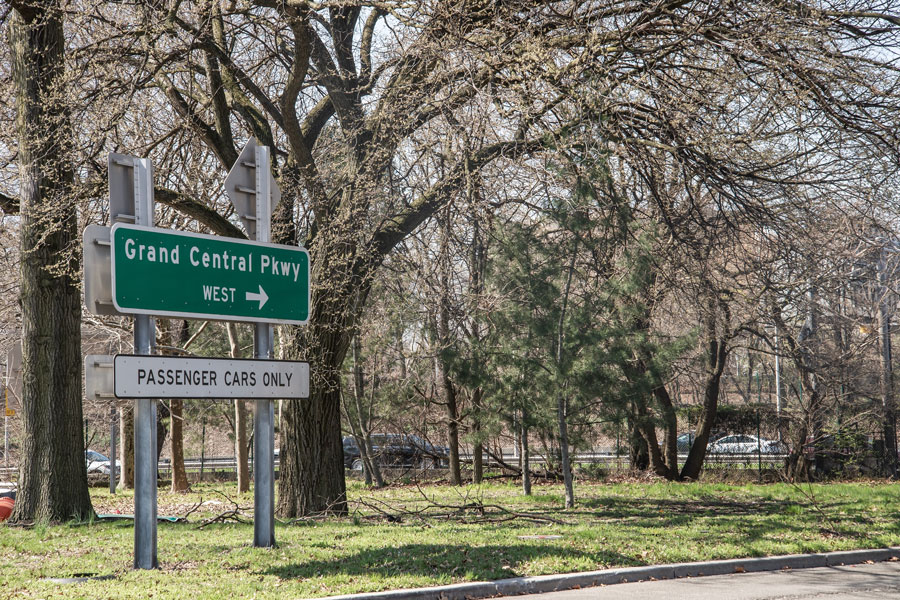
The Grand Central Parkway (GCP) is one of New York City’s most important east–west parkways, running across Queens from the Robert F. Kennedy Bridge approaches in Astoria to the Nassau County line, where it continues as the Northern State Parkway. At roughly 14.6 miles, it is a major link for drivers traveling between New York City and Long Island, with direct access to LaGuardia Airport, connections toward John F. Kennedy International Airport (JFK) via the Van Wyck Expressway, and convenient approaches to Citi Field, Flushing Meadows–Corona Park, and other Queens destinations.
History
- Construction: Planned in the late 1920s and built largely in the 1930s under Robert Moses as part of New York’s expanding parkway system.
- Opening: Different sections opened in stages during the 1930s as the route was extended and connected to other regional roadways.
- Design: The road was conceived as a landscaped parkway with curving alignments, planted medians, and passenger-vehicle restrictions that still shape how it functions today.
- Modernization: Over time, the GCP has seen interchange updates, airport-access changes, and other traffic improvements, especially around LaGuardia Airport and the Kew Gardens area.
Route and Significance
- Western End: Connects with the Robert F. Kennedy Bridge approaches in Astoria, Queens.
- Eastern End: Continues as the Northern State Parkway at the Queens–Nassau border.
- Length: Approximately 14.6 miles.
- Restrictions: As a parkway, it is intended for passenger vehicles; commercial trucks, tractor-trailers, and other oversized vehicles are generally prohibited. Always follow posted signs and clearance warnings.
The Grand Central Parkway remains especially important for travelers heading to:
- LaGuardia Airport – one of the main highway approaches to the airport, with ramps and local connections that may change as roadwork and terminal traffic patterns evolve.
- JFK Airport – reached indirectly via the Van Wyck Expressway (I-678).
- Long Island – continues into the Northern State Parkway for travel deeper into Nassau and Suffolk Counties.
- Manhattan and the Bronx – accessible by way of the Robert F. Kennedy Bridge connection.
- Queens Attractions – including Citi Field, Flushing Meadows–Corona Park, and the USTA Billie Jean King National Tennis Center.
Grand Central Parkway Junctions
Major Connections (West to East)
The parkway’s interchanges are among the busiest in Queens. Posted lane assignments, airport access patterns, and local ramp configurations can change, so drivers should use current roadway signs and navigation for turn-by-turn guidance.
| Connection | Typical Destinations |
|---|---|
| Robert F. Kennedy Bridge (I-278) | Manhattan, the Bronx, and regional connections west of Queens |
| Hoyt Avenue / 31st Street | Astoria local access |
| Brooklyn–Queens Expressway (I-278) | Brooklyn, Staten Island, and regional expressway connections |
| Northern Boulevard (NY 25A) | Woodside, Jackson Heights, Flushing, and local Queens destinations |
| Astoria Boulevard / 82nd Street | East Elmhurst and airport-area access |
| LaGuardia Airport access roads | Terminal approaches, airport parking, and rental car facilities; check current airport signage before traveling |
| 94th Street / Ditmars Boulevard | East Elmhurst and additional LaGuardia-area access |
| 111th Street | Corona and Flushing Meadows–Corona Park |
| Citi Field / Flushing Meadows area connections | Citi Field, park facilities, and nearby local roads |
| Van Wyck Expressway (I-678) | JFK Airport, Kew Gardens, Whitestone, and southern Queens |
| Long Island Expressway (I-495) | Midtown Tunnel, central Queens, and Long Island |
| Jewel Avenue | Forest Hills and nearby residential neighborhoods |
| Union Turnpike | Kew Gardens, Forest Hills, and nearby civic destinations |
| Jackie Robinson Parkway | Brooklyn and southwestern Queens connections |
| Francis Lewis Boulevard | Fresh Meadows and eastern Queens local access |
| Cross Island Parkway | Whitestone and Throgs Neck bridge routes, southern Queens, and Nassau County approaches |
| Northern State Parkway continuation | Nassau County, Suffolk County, and the broader Long Island parkway network |
Notable Facts
- The route runs alongside Flushing Meadows–Corona Park, home to major sports venues and the grounds of the 1939 and 1964 World’s Fairs.
- It is one of the most important highway approaches to LaGuardia Airport and an important connector to JFK Airport via the Van Wyck.
- Congestion can be significant, especially near LaGuardia Airport, the Van Wyck interchange, and the Kew Gardens area.
- Some eastern stretches still reflect the parkway’s original scenic character, with landscaped medians and a more traditional parkway feel.
- Because it is a parkway, the GCP is not suitable for large commercial vehicles or drivers who need truck-legal routing.
The Grand Central Parkway is more than a commuter road: it is a key transportation link between Manhattan, Queens, and Long Island. Whether you are heading to LaGuardia Airport, connecting to the Van Wyck Expressway, Cross Island Parkway, or Long Island Expressway, or continuing east onto the Northern State, it remains one of the region’s most heavily used roadways. Before driving, check current traffic, incidents, and closures through 511NY, and verify current terminal access directly with LaGuardia Airport or JFK Airport when airport travel is involved.
Are you ready for fall on Long Island? Check out these local seasonal guides:
🍎 Apple Picking | 🍂 Fall Festivals & Farm Activities | 👻 Haunted Houses | 🎃 Pumpkin Picking
