
Nesconset Highway (NY-347)
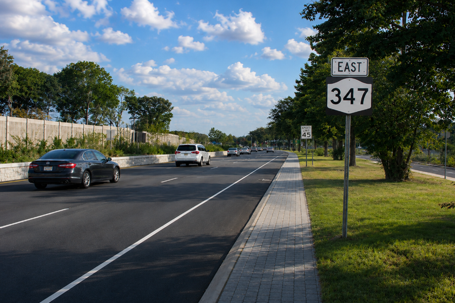
New York State Route 347 (NY-347), widely known as the Nesconset Highway, is a major east-west state route in north-central Suffolk County, Long Island. Running for roughly 15 miles from the Smithtown–Hauppauge area east to Port Jefferson Station, it generally parallels NY-25 (Jericho Turnpike) and serves as a higher-capacity commercial and commuter corridor.
Developed during Long Island’s suburban growth era, NY-347 was intended to ease pressure on older east-west roads while improving access to business districts, shopping areas, and institutional destinations. Today the route is defined by wide medians, multiple signalized intersections, and a mix of retail centers, offices, medical uses, and neighborhood connections.
For drivers and visitors, Route 347 functions less like an uninterrupted expressway and more like a broad arterial roadway. Travel times can vary considerably during rush hours, holiday shopping periods, and construction phases, so checking traffic conditions ahead of time is a smart idea.
Route and Features
- Western Terminus: NY-25 (Jericho Turnpike) in the Smithtown-Hauppauge area
- Eastern Terminus: NY-25A in Port Jefferson Station
- Length: about 15 miles
- County: Suffolk
- Character: Multi-lane divided arterial with heavy commercial development and frequent traffic signals
- Restrictions: Open to passenger and commercial vehicles (not a parkway)
Major Intersections & Interchanges (west → east)
| Junction | Destination / Notes |
|---|---|
| NY-25 | Smithtown / Hauppauge area — western terminus |
| Sunken Meadow State Parkway | North to Sunken Meadow State Park; south via the Sagtikos / Sunken Meadow parkway system toward central Long Island parkways |
| NY-111 | Hauppauge — local link toward the LIE corridor, Islip, and nearby business districts |
| NY-454 (Veterans Memorial Highway) | Hauppauge / Islandia / Long Island MacArthur Airport area |
| CR-97 (Nicolls Road) | Stony Brook University and the Stony Brook area / Lake Ronkonkoma / Patchogue corridor |
| CR-83 (Patchogue-Mount Sinai Road) | Selden / Farmingville / Mount Sinai |
| NY-25A | Port Jefferson Station — eastern terminus, with onward access toward Port Jefferson |
Notable Facts
- Parallel corridor to Jericho Turnpike (NY-25): NY-347 shares much of the east-west travel demand in north-central Suffolk and is often used for trips headed to retail, office, and medical destinations.
- Heavily traveled roadway: Traffic is typically busy for much of the day, especially near Lake Grove, the Stony Brook-area junctions, and major shopping centers.
- Commercial landmark corridor: Smith Haven Mall and surrounding retail clusters help make Route 347 one of Suffolk County’s best-known shopping corridors.
- Long-running modernization work: NYSDOT has advanced safety and streetscape improvements along Route 347, including redesigned intersections, landscaped medians, sidewalks, and bicycle accommodations on parts of the corridor.
- Regional connector: The route provides important links to Stony Brook University, the Lake Grove retail district, Hauppauge employment centers, the Port Jefferson ferry terminal area via connecting roads, and Long Island MacArthur Airport via NY-454 and other connecting highways.
Vicinity of the East-West Route
Driving Notes for Visitors
- Expect frequent traffic signals, turn lanes, and busy commercial entrances along Nesconset Highway (NY-347) rather than uninterrupted highway-style driving.
- Retail activity is especially concentrated around Lake Grove and the Smith Haven Mall corridor, where shopping traffic can create delays during weekends, holidays, and peak travel periods.
- Access to destinations such as Stony Brook, Lake Grove, and Port Jefferson typically requires short connecting roads after leaving NY-347.
- Construction projects, lane shifts, and seasonal traffic throughout central and eastern Suffolk County can affect travel times, especially near intersections with Nicolls Road, Veterans Memorial Highway (NY-454), and the Long Island Expressway.
