
Massapequa Creek
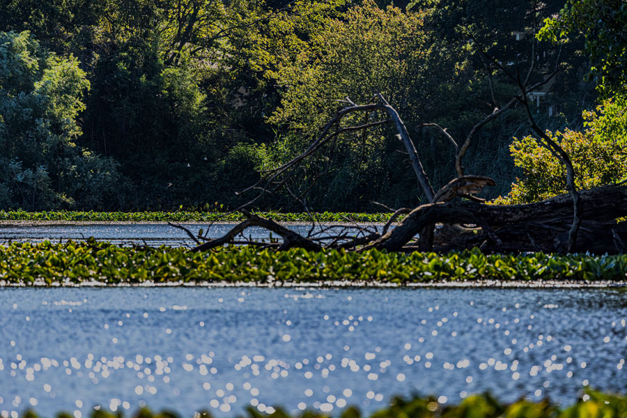
Massapequa Creek, historically also called the Massapequa River, is a groundwater-fed stream flowing through the Town of Oyster Bay in Nassau County on the South Shore of Long Island, New York. The creek begins in the Farmingdale and South Farmingdale area, flows south through Massapequa Preserve, Massapequa Park and Massapequa, and ultimately reaches Massapequa Cove and South Oyster Bay. USGS maintains a long-term monitoring station identified as Massapequa Creek at Massapequa, New York.
The waterway is closely associated with the 423-acre Peter J. Schmitt Massapequa Preserve, where freshwater swamps, marshes, ponds, streams and wooded habitat create one of the largest protected natural corridors in southern Nassau County. Nassau County describes the preserve as its largest single acquisition of former New York City watershed property.
Geography
Massapequa Creek runs generally north to south through southeastern Nassau County.
Its headwaters extend into the South Farmingdale area near Farmingdale and East Farmingdale, where several small tributaries collect groundwater and stormwater before joining the main creek.
The stream then passes beneath the Southern State Parkway and enters the wooded corridor associated with Massapequa Preserve.
From there, the creek continues through Massapequa Park and Massapequa, passing through ponds, wetlands and impoundments before eventually reaching Massapequa Cove and South Oyster Bay.
The entire watershed lies within the larger South Shore Estuary Reserve drainage system. New York State maintains a dedicated Massapequa Creek Watershed Management Plan for the Town of Oyster Bay.
Massapequa Creek or Massapequa River?
The waterway has been referred to by both names over time.
Modern federal, state and county agencies consistently use Massapequa Creek. The U.S. Geological Survey operates a monitoring site under that name, while New York State DEC uses Massapequa Creek when describing both Massapequa Reservoir and local watershed conditions.
The name Massapequa River, however, appears in historical descriptions and continues to be used colloquially in some local references. Historical accounts of early settlement near Merrick Road refer to the Massapequa River, demonstrating that the older name has deep roots in the community.
For modern geographic purposes, Massapequa Creek is the more accurate name.
Massapequa Preserve
Massapequa Preserve contains the most recognizable and natural stretch of the creek.
Nassau County describes the preserve as a 423-acre property containing freshwater swamps, marshes, streams, lakes and sandy-bog habitat. The area supports unusual Long Island plants including orchids, sundews and bladderworts.
The preserve stretches through a narrow north-south greenbelt surrounded by suburban development, making the creek corridor an important wildlife and recreation area within Massapequa and Massapequa Park.
Trails follow much of the waterway, creating opportunities for hiking, walking, bicycling and birdwatching. The preserve is also included among notable Long Island hiking trails.
Groundwater-Fed Stream
Like many rivers and creeks on Long Island, Massapequa Creek depends heavily on groundwater.
Long Island’s sandy glacial soils allow rainfall to seep into the underground aquifer system. Groundwater then gradually moves toward low areas and stream channels, helping maintain flow in waterways such as Massapequa Creek even between major rainstorms.
This relationship also means that groundwater quality and land use within the watershed can affect the creek.
Stormwater runoff, road drainage, fertilizers, wastewater and other contaminants can enter the watershed directly or indirectly, which is why watershed management efforts extend well beyond the immediate stream banks.
Massapequa Reservoir
Massapequa Reservoir is one of the major freshwater impoundments along the creek.
The reservoir lies near Sunrise Highway and the Long Island Rail Road between Massapequa and Massapequa Park. DEC specifically notes that Massapequa Creek passes beneath Sunrise Highway near the reservoir.
The reservoir is a popular freshwater fishing location. New York State stocks both brown trout and rainbow trout during the spring, while largemouth bass, bluegill, black crappie, white perch and common carp also occur there.
Dense aquatic vegetation can develop during warmer months, making some portions of the reservoir more difficult to fish.
Massapequa Lake
Farther downstream is Massapequa Lake, another prominent impoundment within the creek system.
The lake lies south of Sunrise Highway and north of Merrick Road, surrounded by parkland and residential neighborhoods. Water from the creek enters the lake after passing through upstream wetlands and the reservoir.
DEC identifies Massapequa Lake as another freshwater fishing location supporting species such as largemouth bass and common carp. Large carp exceeding 10 pounds are regularly reported.
From the southern end of the lake, the creek continues beneath Merrick Road toward the tidal waters closer to South Oyster Bay.
From Freshwater Creek to Coastal Waterway
Massapequa Creek changes significantly as it approaches the South Shore.
Upstream portions are freshwater and pass through wooded preserves, ponds and wetlands. South of Merrick Road, the waterway becomes increasingly channelized and enters the developed waterfront environment of southern Massapequa.
The lower channel leads into Massapequa Cove, which opens into South Oyster Bay.
This transition creates a direct hydrologic connection between freshwater areas several miles inland and the tidal estuary behind Long Island’s Atlantic barrier beaches.
Massapequa Cove
Massapequa Cove lies at the southern end of the creek system and forms the tidal transition between Massapequa Creek and South Oyster Bay.
The cove is located along the north side of South Oyster Bay between the residential waterfront areas near Biltmore Beach and Alhambra Beach.
Here, the character of the waterway changes from freshwater stream to tidal coastal channel.
Residential canals, docks and boating facilities become more prominent, and the water is influenced increasingly by tides moving through South Oyster Bay.
South Oyster Bay
South Oyster Bay is the final coastal waterbody receiving water from Massapequa Creek.
The bay forms part of the broad estuarine system behind the South Shore barrier islands and is connected with the neighboring Hempstead Bays system.
Water originating as groundwater and runoff in the Farmingdale and Massapequa watershed eventually enters South Oyster Bay through Massapequa Creek and Massapequa Cove.
This connection demonstrates how inland land use and water quality can ultimately affect Long Island’s coastal bays.
Farmingdale and the Headwaters
The northern watershed extends into the Farmingdale area.
Small tributaries begin near developed neighborhoods, roads and commercial areas before flowing south toward the preserve.
The watershed therefore crosses a wide variety of landscapes, including residential neighborhoods, transportation corridors, wooded preserves, ponds, wetlands and waterfront communities.
That contrast makes Massapequa Creek particularly representative of waterways in suburban Nassau County, where natural drainage systems often survive within narrow green corridors surrounded by development.
Massapequa Park
Massapequa Park lies directly alongside much of the creek and preserve system.
The village is bordered by wooded portions of the preserve, while the creek passes through or beside several lakes and ponds associated with the community.
The creek corridor provides Massapequa Park residents with unusually extensive natural open space compared with many communities in Nassau County.
Walking and bicycling paths running through the preserve also create a north-south recreation corridor connecting neighborhoods with wooded areas and waterways.
Massapequa
Massapequa occupies much of the lower watershed.
The community developed around Merrick Road, Sunrise Highway and the Long Island Rail Road, all of which cross or pass close to the creek.
Historical settlement in the area was also closely tied to the waterway. The Historical Society of the Massapequas notes that early settler Thomas Jones established a home near what was then described as the Massapequa River near present-day Merrick Road.
The lower creek ultimately enters the residential waterfront neighborhoods south of Merrick Road before reaching South Oyster Bay.
Watershed Management
Massapequa Creek has been the subject of extensive watershed planning because of the combination of dense suburban development and sensitive freshwater habitat surrounding it.
The New York State Department of State maintains the Massapequa Creek Watershed Management Plan, prepared for the Town of Oyster Bay. The plan addresses water quality, stormwater runoff, stream restoration and protection of natural resources throughout the watershed.
The Town of Oyster Bay also identifies Massapequa Creek among local waterbodies protected by its illicit-discharge prevention programs, alongside South Oyster Bay and other coastal waters.
Protecting the creek consequently involves both preserving natural areas and controlling pollutants entering storm drains and groundwater.
Fishing
Fishing is one of the most popular recreational activities associated with Massapequa Creek and its ponds.
Massapequa Reservoir receives significant seasonal trout stockings from DEC. Spring 2026 stocking schedules included brown trout and rainbow trout released during March and April.
Warm-water species include largemouth bass, bluegill, pumpkinseed, black crappie, white perch and common carp.
Massapequa Lake also supports freshwater fishing, while anglers farther downstream transition into the saltwater fishing environment of Massapequa Cove and South Oyster Bay.
Additional locations can be explored through Long Island fishing and where to fish.
Hiking and Bicycling
The creek’s long preserved corridor makes it particularly important for recreation.
Trails through Massapequa Preserve follow portions of the stream and connect wooded areas, wetlands, ponds and lakes.
The terrain is generally easy and is popular for walking, running and bicycling. The preserve is specifically identified in the Long Island hiking trails guide as a family-friendly and birdwatching destination.
The presence of such an extensive trail corridor within suburban Nassau County makes Massapequa Creek one of the more accessible natural waterways in western Long Island.
Wildlife and Habitat
Massapequa Creek and the surrounding preserve provide habitat for fish, amphibians, turtles, birds and small mammals.
Nassau County emphasizes the ecological diversity of the preserve’s freshwater swamps, marshes, stream habitat, lake and sandy bogs. Rare and unusual plant species also occur within the property.
Wetlands along the creek provide important feeding and breeding areas while also storing stormwater and filtering runoff before it reaches downstream waters.
The combination of water, forest and wetland habitat makes the preserve particularly useful for birdwatching and nature observation.
Roads and Transportation Crossings
Because Massapequa Creek runs through a densely developed part of Nassau County, several major transportation routes cross the waterway.
The creek passes beneath the Southern State Parkway, the Long Island Rail Road Babylon Branch, Sunrise Highway and Merrick Road.
These crossings illustrate the contrast between the preserved creek corridor and the suburban transportation network surrounding it.
Road and drainage infrastructure also contribute stormwater to the watershed, making runoff management an important component of creek protection.
Massapequa Creek within Long Island’s Waterway System
Massapequa Creek is one of several small groundwater-fed waterways carrying freshwater from inland Long Island toward the South Shore.
Unlike larger waterways such as the Carmans River, Connetquot River and Peconic River, Massapequa Creek flows through one of the most densely developed areas of Nassau County.
Its survival within Massapequa Preserve creates a continuous natural corridor extending from the Farmingdale area south toward Massapequa and South Oyster Bay.
The creek therefore links inland groundwater, freshwater ponds, wetlands, suburban communities and tidal bay waters within Long Island’s broader bays, harbors, inlets and waterways system. The waterways index currently lists the feature among Long Island’s rivers and significant waterways.
Massapequa Creek
Key Facts & Details
| Feature | Details |
|---|---|
| Waterway | Massapequa Creek within Long Island’s bays, harbors, inlets and waterways system |
| Historic Name | Massapequa River |
| Location | South Shore of Long Island |
| County | Nassau County |
| State | New York |
| Island | Long Island |
| Town | Town of Oyster Bay |
| Headwaters Area | Farmingdale and South Farmingdale |
| Primary Communities | Massapequa Park and Massapequa |
| Major Preserve | Massapequa Preserve |
| Preserve Size | Approximately 423 acres |
| Waterway Type | Groundwater-fed freshwater creek transitioning to a tidal coastal waterway |
| Major Upstream Impoundment | Massapequa Reservoir |
| Major Downstream Impoundment | Massapequa Lake |
| Tidal Outlet | Massapequa Cove |
| Receiving Bay | South Oyster Bay |
| Major Habitats | Freshwater stream, ponds, wetlands, wooded preserve and tidal shoreline |
| Major Roads Crossed | Southern State Parkway, Sunrise Highway and Merrick Road |
| Rail Crossing | Long Island Rail Road Babylon Branch |
| Popular Activities | Fishing, hiking, bicycling and birdwatching |
| Fishing Resource | Long Island fishing |
| Hiking Resource | Long Island hiking trails |
| Comparable Long Island Waterways | Carmans River, Connetquot River and Peconic River |
| Known For | Massapequa Preserve, freshwater fishing, ponds, wetlands and its connection to South Oyster Bay |
| Related Waterways Guide | Bays, Harbors, Inlets & Waterways of Long Island |
Massapequa Creek is one of the most important natural waterways in southeastern Nassau County, flowing from the Farmingdale area through the forests, wetlands and ponds of Massapequa Preserve before passing through Massapequa Park and Massapequa on its way to South Oyster Bay. Its combination of freshwater habitat, trout fishing, wooded trails and direct connection with the South Shore estuary makes it an unusually valuable natural corridor within one of the most suburbanized portions of Long Island.
Are you ready for fall on Long Island? Check out these local seasonal guides:
🍎 Apple Picking 🍓 Strawberry Picking 🎃 Pumpkin Picking 👻 Haunted Houses 🍂 Farm Festivals
