
Carmans River in Brookhaven
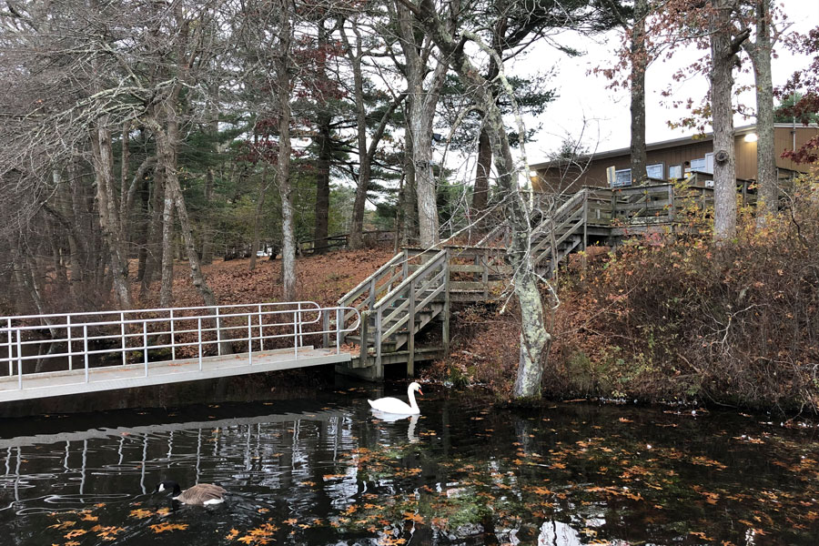
Carmans River is a groundwater-fed river flowing through the Town of Brookhaven in Suffolk County on Long Island, New York. Beginning near Middle Island, the river flows generally south through Yaphank, Southaven County Park and the protected wetlands of Wertheim National Wildlife Refuge before emptying into Bellport Bay and the larger Great South Bay estuary. New York environmental records describe the river as extending approximately 10 miles from Middle Island to Bellport Bay.
Carmans River is one of Long Island’s most significant freshwater and tidal river systems. Its upper reaches pass through the Long Island Pine Barrens, while the lower river gradually changes from freshwater habitat to a tidal estuary influenced by Great South Bay. The river passes through large areas of preserved land, including Southaven County Park and the 2,550-acre Wertheim National Wildlife Refuge, where the U.S. Fish and Wildlife Service describes Carmans River as a New York State-designated scenic river and one of the largest rivers on Long Island.
Geography
Carmans River runs north to south through central Brookhaven, beginning near Middle Island and eventually reaching the South Shore near Shirley and Bellport Bay.
The river’s headwaters are associated with the Pine Barrens landscape near Middle Island. In July 2026, the Town of Brookhaven announced the preservation of another 5.5 acres along the Carmans River headwaters on Yaphank-Middle Island Road, adjoining more than 450 acres of existing protected open space around Cathedral Pines County Park.
From Middle Island, the river flows south through Yaphank, where impoundments along the river form the Upper and Lower Yaphank lakes. It then continues through Southaven County Park and beneath Sunrise Highway before entering the broad wetlands surrounding Wertheim National Wildlife Refuge.
The lower river becomes increasingly tidal before eventually emptying into Bellport Bay, part of Great South Bay.
A Groundwater-Fed Long Island River
Unlike major continental rivers supplied by extensive tributary networks and mountain runoff, Carmans River is primarily fed by groundwater stored beneath Long Island.
A New York State biological assessment describes the Carmans as approximately 95 percent groundwater generated. The same study identifies about the first eight miles as freshwater, with the final two miles becoming tidal as the river approaches Bellport Bay.
This close relationship between groundwater and surface water means the health of the river is directly connected with the condition of Long Island’s underground aquifer system.
Water entering the ground throughout the surrounding watershed can eventually emerge through springs and groundwater seepage into the river. Development, wastewater, fertilizers and other activities within that watershed can consequently affect the river even when they occur some distance from its banks.
Middle Island and the Headwaters
The northern portion of Carmans River begins near Middle Island, within the wooded landscape of central Suffolk County.
The headwaters lie within an area heavily associated with the Long Island Pine Barrens, an extensive ecosystem of pine-oak forest, sandy soils, wetlands and groundwater recharge areas.
The importance of this landscape has resulted in significant public acquisition of land surrounding the river. The Town of Brookhaven’s 2026 headwaters acquisition was specifically intended to protect sensitive habitat and water quality while furthering the goals of the Carmans River Conservation and Management Plan.
Nearby Cathedral Pines County Park protects another large area of forest surrounding the river’s upper watershed.
Yaphank
Yaphank is one of the communities most closely associated with Carmans River.
The river passes directly through the hamlet, where dams created two prominent impoundments historically known as Upper Yaphank Lake and Lower Yaphank Lake, also called Upper Mill Pond and Lower Mill Pond.
The U.S. Geological Survey has monitored Carmans River at Yaphank for decades. Its long-running stream gauge near the Long Island Rail Road bridge has records extending back to 1942, making it an important location for studying groundwater and streamflow conditions in central Suffolk County.
Lower Yaphank Lake has also been the focus of restoration efforts. The Town of Brookhaven drained the lake as part of a project addressing accumulated sediment and invasive vegetation, work that had been recommended in the Carmans River Conservation and Management Plan.
Upper and Lower Yaphank Lakes
Two historic mill ponds interrupt the otherwise flowing character of the river in Yaphank.
Upper Yaphank Lake lies north of the central hamlet, while Lower Yaphank Lake, historically known as Lily Lake, lies farther downstream. Brookhaven identifies Lower Yaphank Lake as part of the Carmans River system and notes its history as a recreational boating and fishing destination.
The dams associated with these lakes are reminders of the river’s historical use for water-powered mills.
They also influence the modern ecology of the river by altering water depth, flow, temperature and aquatic vegetation.
Southaven County Park
Southaven County Park protects a major section of Carmans River south of Yaphank.
The 1,356-acre county park contains pine-oak forest surrounding the river and offers camping, picnicking, boating and freshwater fishing. Suffolk County specifically identifies Carmans River as flowing through the park.
The park is also an important recreational access point for canoeing and kayaking. Suffolk County includes the Carmans River at Southaven among its paddling locations.
Trails through the surrounding Pine Barrens provide opportunities for hiking, wildlife viewing and exploring the central Long Island forest environment. Southaven County Park is also included among the major routes in the Long Island hiking trails network.
The Long Island Pine Barrens
Much of the upper Carmans River watershed lies within or beside the Long Island Pine Barrens.
The Pine Barrens are especially important because their sandy soils allow precipitation to infiltrate into the groundwater system that ultimately feeds rivers such as the Carmans.
Preserving forest around the watershed therefore protects more than scenery. It helps preserve groundwater recharge areas, wetlands, wildlife habitat and water quality.
New York State also maintains the Carmans River Pine Barrens State Forest, a 24.8-acre undeveloped preserve between the river and the Long Island Expressway. The property contains Pine Barrens habitat and is open for hiking, hunting and wildlife viewing under applicable DEC access requirements.
Freshwater and Tidal Sections
Carmans River changes character substantially as it travels south.
For approximately its first eight miles, the river is predominantly freshwater. The lower two miles become increasingly influenced by tides from Bellport Bay and Great South Bay.
The transition creates a range of habitats along a relatively short river.
Upstream areas contain freshwater streams, ponds and forested wetlands. Farther downstream, freshwater begins mixing with salt water, creating brackish marshes before the river finally reaches the saltier waters of the bay.
This freshwater-to-estuary transition helps explain the river’s unusually diverse fish and wildlife habitat.
Wertheim National Wildlife Refuge
The lower Carmans River passes through Wertheim National Wildlife Refuge near Shirley.
Established in 1947, the refuge protects approximately 2,550 acres along Long Island’s South Shore. The U.S. Fish and Wildlife Service describes the refuge as being bisected by Carmans River and containing oak-pine woodlands, grasslands, freshwater wetlands, brackish wetlands and saltwater wetlands.
These habitats support white-tailed deer, osprey, muskrat, foxes, turtles, frogs, fish and numerous migratory birds.
The refuge also protects one of Long Island’s largest continuous wetland landscapes, making the lower Carmans River markedly less developed than many other South Shore waterways.
Visitors can explore trails and several overlooks facing the river. Fish and Wildlife Service materials identify four Carmans River overlooks as particularly productive locations for observing wildlife.
Bellport Bay and Great South Bay
After passing through the wetlands surrounding Wertheim National Wildlife Refuge, Carmans River empties into Bellport Bay, the eastern portion of Great South Bay.
This places the river within the larger estuarine system behind Fire Island.
Freshwater discharged by Carmans River mixes with salt water entering Great South Bay from the Atlantic Ocean through the surrounding South Shore inlet system.
The river mouth lies near the mainland communities of Shirley, Brookhaven and Bellport, directly across the bay from the protected barrier island of Fire Island National Seashore.
A New York State Scenic River
Carmans River is recognized by New York State for its scenic and ecological value.
The U.S. Fish and Wildlife Service identifies Carmans River as a New York State-designated scenic river, emphasizing its importance as one of the island’s major natural waterways.
The designation reflects the river’s combination of undeveloped shoreline, Pine Barrens forest, wetlands, wildlife habitat and recreational importance.
Unlike many waterways surrounded almost continuously by suburban development, substantial portions of the Carmans remain protected by county, state, federal and Town-owned conservation land.
Carmans River Conservation and Management Plan
Protecting the Carmans River watershed has been a major planning priority in the Town of Brookhaven.
In 2013, the Brookhaven Town Board unanimously approved the Carmans River Conservation and Management Plan, containing 19 categories of recommendations intended to preserve and restore the river and guide future land use within its watershed. The Town said implementation of the plan could protect more than 1,600 acres within the critical watershed.
Recommendations have addressed open-space acquisition, wastewater treatment, nitrogen pollution, development standards, habitat protection and restoration.
Brookhaven subsequently adopted additional measures implementing recommendations from the plan, including stricter standards intended to reduce nitrogen entering the river from wastewater systems. Excess nitrogen can contribute to algae growth, invasive aquatic vegetation and reduced dissolved oxygen.
Open-Space Preservation
Land preservation has become one of the principal tools used to protect Carmans River.
The river corridor contains large blocks of preserved land belonging to Suffolk County, the Town of Brookhaven, New York State and the federal government.
In 2023, DEC acquired another 2.5-acre riverfront parcel in Yaphank within the Pine Barrens Core Preservation Area. The acquisition was completed with the Town of Brookhaven and was intended to restore the property to a more natural condition while protecting the watershed.
Three years later, Brookhaven announced the acquisition of another 5.5 acres near the river’s Middle Island headwaters.
Taken together with Southaven County Park, Wertheim National Wildlife Refuge and surrounding Pine Barrens preserves, these acquisitions help create a substantial conservation corridor around the river.
Fishing
Fishing is one of the traditional recreational uses of Carmans River.
Freshwater portions of the river support trout and other freshwater fish, while the tidal lower river contains species associated with brackish and saltwater environments.
At Wertheim National Wildlife Refuge, the U.S. Fish and Wildlife Service lists species including striped bass, weakfish, brown trout, brook trout, rainbow trout, carp, largemouth bass and white perch. Fishing from a boat is permitted in portions of the Carmans River within the refuge, while bank fishing is permitted at a designated DEC access area between Sunrise Highway and Montauk Highway.
Southaven County Park also permits freshwater fishing, subject to New York State licensing requirements and a Suffolk County fishing permit specific to Southaven.
Canoeing and Kayaking
The Carmans River is also one of central Suffolk County’s established kayaking and canoeing waterways.
Southaven County Park provides access to the scenic upper river, where paddlers travel through Pine Barrens forest rather than heavily developed shoreline. Suffolk County specifically lists the Carmans River at Southaven among its paddling opportunities.
Farther downstream, the river becomes broader and increasingly tidal as it approaches Wertheim National Wildlife Refuge.
Paddlers should understand local access restrictions and changing conditions. Portions of the refuge shoreline are protected, and regulations govern where boats may land.
Hiking and Nature Observation
The extensive protected lands surrounding Carmans River create numerous opportunities for hiking and nature observation.
Southaven County Park contains woodland trails along the river and through surrounding Pine Barrens forest. Farther south, Wertheim National Wildlife Refuge contains trails, observation areas and river overlooks.
The combination of protected forest, wetlands and open water also makes the corridor particularly useful for birdwatching.
Ospreys are especially associated with the lower river. Fish and Wildlife Service seasonal information notes that osprey return to the Carmans River area in early spring to rebuild their nests.
Wildlife
Carmans River supports wildlife ranging from freshwater fish and amphibians in its upper reaches to shorebirds and estuarine species near its mouth.
The mix of habitats includes pine-oak forest, freshwater wetlands, ponds, flowing river, brackish marsh and salt marsh.
At Wertheim National Wildlife Refuge, these environments support mammals, reptiles, amphibians and a substantial variety of resident and migratory birds.
The refuge lies along the Atlantic Flyway, making the lower river an important stopover and feeding area for migratory birds traveling along the East Coast.
Carmans River and Long Island’s Groundwater
The Carmans River also provides an important window into Long Island’s groundwater system.
Because most river flow originates underground, changes in aquifer levels can affect the amount of water flowing through the river.
USGS continues to monitor hydrologic conditions in the Carmans watershed and has studied both surface-water quality and groundwater movement as part of broader efforts to understand central Long Island’s water resources.
This relationship makes preservation of the surrounding watershed important not only for wildlife but also for understanding the larger underground water system on which Long Island depends.
Historical Use of the River
Carmans River has also played a role in the human history of Brookhaven.
Its flowing water powered mills, while its ponds and surrounding forests supported fishing, hunting and other activities.
The river was historically known as the Connecticut River. Brookhaven’s Longwood Estate history notes that the estate once extended from the Connecticut River, now known as Carmans River, across thousands of acres of central Brookhaven.
The modern name is associated with the Carman family, whose activities along the river included milling and sporting interests.
The dams and mill ponds remaining around Yaphank are among the most visible reminders of this earlier period.
Carmans River within Long Island’s Waterway System
Carmans River is an important freshwater counterpart to Long Island’s better-known coastal bays and tidal waterways.
While nearby rivers such as the Connetquot River and Peconic River also depend heavily on groundwater, Carmans River is distinguished by the unusually large amount of protected land surrounding its course.
From the Pine Barrens near Middle Island through Yaphank, Southaven County Park and Wertheim National Wildlife Refuge, the river forms a continuous environmental corridor leading toward Bellport Bay and Great South Bay.
Its freshwater headwaters, historic mill ponds, tidal wetlands and protected river mouth make Carmans River one of the most diverse waterways in Long Island’s larger bays, harbors, inlets and waterways system.
Carmans River
Key Facts & Details
| Feature | Details |
|---|---|
| Waterway | Carmans River within Long Island’s bays, harbors, inlets and waterways system |
| Location | Central and South Shore Long Island |
| County | Suffolk County |
| State | New York |
| Island | Long Island |
| Town | Town of Brookhaven |
| Approximate Length | About 10 miles from Middle Island to Bellport Bay |
| Headwaters | Near Middle Island and the Long Island Pine Barrens |
| Primary Inland Community | Yaphank |
| Lower-River Community | Shirley |
| Nearby South Shore Communities | Brookhaven and Bellport |
| River Type | Groundwater-fed freshwater river transitioning to a tidal estuary |
| Freshwater Section | Approximately the first eight miles |
| Tidal Section | Approximately the final two miles approaching Bellport Bay |
| River Mouth | Bellport Bay within Great South Bay |
| Major Upper-River Watershed | Long Island Pine Barrens |
| Major Lakes | Upper Yaphank Lake and Lower Yaphank Lake in Yaphank |
| Major County Park | Southaven County Park near Yaphank |
| Major Wildlife Refuge | Wertheim National Wildlife Refuge near Shirley |
| State Recognition | New York State-designated scenic river |
| Major Habitats | Pine Barrens forest, freshwater wetlands, ponds, river channels, brackish marsh and tidal wetlands |
| Popular Activities | Fishing, kayaking, hiking and birdwatching |
| Fishing Resource | Long Island fishing |
| Hiking Resource | Long Island hiking trails |
| Connected Coastal Waterbody | Bellport Bay and Great South Bay |
| Comparable Long Island Rivers | Connetquot River and Peconic River |
| Known For | Groundwater-fed flow, Pine Barrens scenery, protected wetlands, fishing and wildlife habitat |
| Related Waterways Guide | Bays, Harbors, Inlets & Waterways of Long Island |
Carmans River is one of the most environmentally significant rivers in the Town of Brookhaven, flowing from the Pine Barrens near Middle Island through Yaphank, Southaven County Park and the wetlands of Wertheim National Wildlife Refuge before reaching Bellport Bay and Great South Bay. Its combination of groundwater-fed freshwater, historic mill ponds, tidal estuary, protected forest and extensive wetlands gives the river an unusually diverse character and makes it an important part of Long Island’s natural landscape.
Are you ready for fall on Long Island? Check out these local seasonal guides:
🍎 Apple Picking 🍓 Strawberry Picking 🎃 Pumpkin Picking 👻 Haunted Houses 🍂 Farm Festivals
