
Where Are Long Island’s Major Industrial Areas?
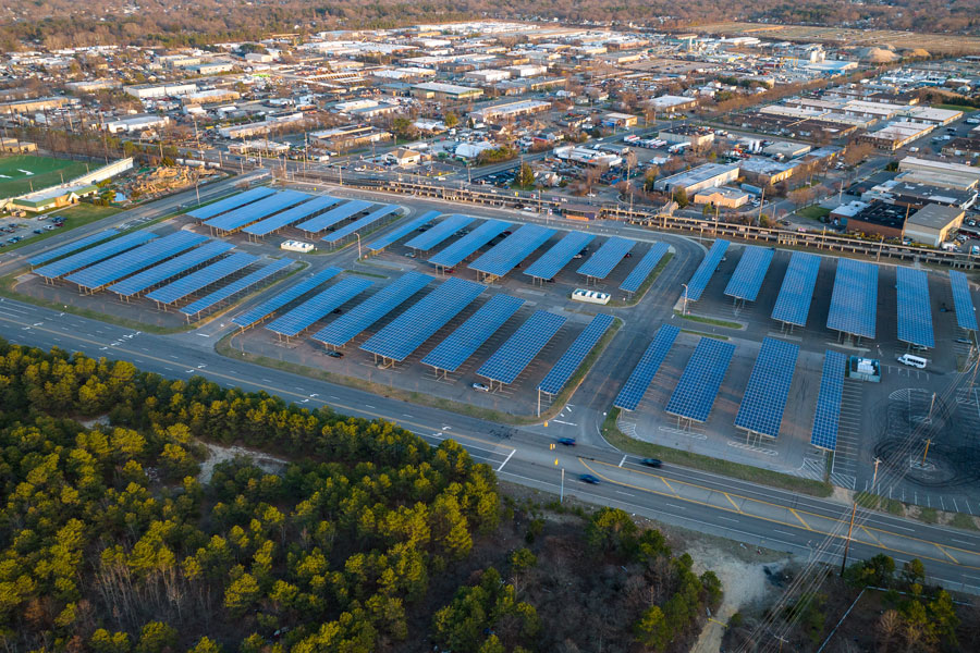
Long Island’s largest concentrations of industrial development are found in Hauppauge, Melville and East Farmingdale along the Route 110 corridor, Deer Park and Brentwood, the Bohemia–Ronkonkoma area surrounding Long Island MacArthur Airport, and the growing Medford–Yaphank corridor. Nassau County also contains longstanding industrial districts in communities including Bethpage, Hicksville, Plainview, Westbury, New Hyde Park and Farmingdale.
Although Long Island is best known for its suburban communities, downtowns and residential neighborhoods, industry occupies a significant portion of the region’s commercial landscape. Manufacturing plants, warehouses, distribution centers, laboratories, aerospace facilities, technology companies, food producers, construction suppliers and other industrial businesses are concentrated in several large employment corridors extending from western Nassau County through Suffolk County and into the East End.
These areas did not develop randomly. Most are located near major highways, airports, rail lines or other transportation infrastructure. Route 110, the Long Island Expressway, Veterans Memorial Highway, Sunrise Highway, Long Island MacArthur Airport and Republic Airport have all helped shape where Long Island’s industrial economy developed.
Where Is Long Island’s Largest Industrial Area?
The Long Island Innovation Park at Hauppauge, historically known as the Hauppauge Industrial Park, is Long Island’s best-known concentration of industrial and business activity. Located near the Long Island Expressway in Hauppauge, the sprawling business district extends through portions of the towns of Smithtown and Islip.
The park contains approximately 1,300 companies employing about 55,000 people and produces more than $13 billion in annual economic output. Its businesses span manufacturing, aerospace and defense, technology, medical products, pharmaceuticals, food production, distribution, professional services and other industries. That diversity reflects the broader economic mix examined in What Industries Are Largest on Long Island?
Unlike an old-fashioned industrial district dominated by smokestacks and heavy factories, Hauppauge developed primarily as a suburban industrial and business park. Low-rise factories, laboratories, warehouses, offices and flex buildings occupy large blocks along roads including Motor Parkway, Adams Avenue, Marcus Boulevard, Oser Avenue and Wireless Boulevard.
The Route 110 Industrial Corridor
Another of Long Island’s largest employment concentrations follows Route 110 through Farmingdale, East Farmingdale and Melville. The corridor crosses the Nassau County–Suffolk County line and developed into an unusual combination of manufacturing, warehousing, research facilities, corporate offices, retail development and aviation-related businesses.
Historical regional planning data identified the Route 110 corridor as Long Island’s largest combined industrial concentration, with East Farmingdale and Melville forming its core. East Farmingdale alone contained approximately 900 acres being used for industrial purposes in the regional study, while Melville contained another approximately 600 acres.
Transportation played a major role in that development. Route 110 connects the Southern State Parkway and Long Island Expressway and passes directly beside Republic Airport. The corridor also provides relatively convenient access to the Northern State Parkway and the Long Island Rail Road.
Melville gradually developed a particularly strong corporate-office component, while East Farmingdale retained substantial industrial, warehouse and commercial space. The result is a corridor where traditional industrial buildings can sit relatively close to major corporate campuses, hotels, retailers and restaurants.
Farmingdale and Republic Airport
The greater Farmingdale area contains one of Long Island’s oldest and most important industrial concentrations. Industrial properties extend through East Farmingdale and toward the Route 110 corridor, while Republic Airport anchors a significant aviation component.
Long Island’s aviation and defense industries were once among the most important components of the regional economy, and the Farmingdale–Bethpage area was at the center of that history. Although the region’s industrial base has diversified considerably, aviation businesses, manufacturers, warehouses, automotive businesses and other industrial users continue to occupy large portions of the area.
Bethpage, Hicksville and Plainview
Central Nassau County contains another major belt of industrial development running through Bethpage, Hicksville and Plainview. These districts developed alongside Long Island’s postwar aerospace and manufacturing economy and benefited from access to the Long Island Expressway, Northern State Parkway and major north-south roads.
Bethpage is particularly significant in Long Island industrial history because of the enormous former Grumman aerospace complex. Grumman manufactured military aircraft and components for the Apollo Lunar Module in Bethpage, making the community one of the best-known centers of Long Island’s former aerospace industry.
Regional planning data historically identified approximately 600 acres in Bethpage, 300 acres in Hicksville and 300 acres in Plainview as being used for industrial purposes. While land uses have evolved and some former industrial properties have been redeveloped, the central Nassau corridor remains an important concentration of commercial and industrial activity.
Westbury, Carle Place and New Cassel
Westbury, Carle Place and New Cassel form another important Nassau County commercial-industrial district. Industrial buildings, wholesalers, warehouses, automotive businesses and service companies are mixed with some of Long Island’s largest retail developments.
The area benefits from its central location and access to the Northern State Parkway, Meadowbrook State Parkway, Long Island Expressway and Long Island Rail Road. Nassau County has also studied the New Cassel industrial area as part of broader planning and redevelopment initiatives.
Deer Park, Brentwood and North Bay Shore
A broad industrial belt developed through Deer Park, Brentwood and North Bay Shore in western Suffolk County. Regional planners historically identified this combined area as one of Long Island’s largest industrial concentrations.
Industrial development here includes manufacturing buildings, warehouses, distribution facilities, building suppliers, automotive businesses and smaller flex-space operations. The area benefits from proximity to the Long Island Expressway, Southern State Parkway, Sagtikos State Parkway and major freight routes.
Historical regional data identified approximately 500 acres of industrial use in Deer Park, 300 acres in North Bay Shore and another 200 acres in Brentwood. Together with neighboring industrial properties, the district forms a substantial employment corridor between the Route 110 and Hauppauge areas.
Bohemia, Ronkonkoma and Long Island MacArthur Airport
One of Long Island’s largest industrial and business concentrations surrounds Long Island MacArthur Airport. Industrial development extends through Bohemia, Ronkonkoma and neighboring communities, particularly along Veterans Memorial Highway.
The district contains manufacturing companies, aerospace businesses, warehouses, distributors, offices and transportation-related operations. Its location provides an unusual combination of highway, airport and rail access, with the Long Island Expressway nearby and the Ronkonkoma station on the Long Island Rail Road serving as one of the region’s major transportation hubs.
Regional planners have historically referred to this concentration as the Veterans Highway Corridor or MacArthur Airport Area. Ronkonkoma alone was identified as having approximately 2,000 acres zoned for industrial use, much of it associated with Long Island MacArthur Airport, while Bohemia contained a substantial concentration of developed industrial property.
Holbrook and the Sunrise Highway Corridor
Holbrook contains another notable concentration of industrial property east of the MacArthur Airport district. Industrial development is particularly visible around Veterans Memorial Highway, Lincoln Avenue and areas approaching Sunrise Highway.
A Suffolk County planning study identified Holbrook as the largest industrial concentration within the portion of the Sunrise Highway corridor it examined, documenting more than 916,000 square feet of industrial space in 25 buildings at the time of the study. Nearby Bayport also contained more than 600,000 square feet of industrial space.
Medford and Yaphank
The Medford–Yaphank corridor has emerged as one of the most important areas for future industrial development on Long Island. Unlike western Long Island, where industrial districts are largely built out, central Suffolk County still contains comparatively large parcels capable of supporting warehouses, manufacturing facilities and other employment uses.
The Town of Brookhaven reported in 2026 that it contains approximately 6,300 acres of industrially zoned land, including more than 2,500 acres in the Medford–Yaphank corridor. The town also reports more than eight industrial parks and substantial additional land available for industrial development.
The corridor’s access to the Long Island Expressway is a major advantage. The nearby Brookhaven Rail Terminal has also added freight-rail infrastructure to an area long dominated by truck transportation. As industrial land closer to New York City becomes increasingly scarce, Medford and Yaphank have become increasingly important to Long Island’s warehouse, distribution and industrial economy.
Calverton Enterprise Park
Farther east, Calverton contains one of Long Island’s largest potential industrial redevelopment sites. The Enterprise Park at Calverton, commonly known as EPCAL, occupies the former Naval Weapons Industrial Reserve Plant once operated in connection with Grumman.
The Town of Riverhead took control of the former federal property in 1998 and has pursued redevelopment of the approximately 2,900-acre site in Calverton. The property includes enormous former runways and large tracts intended for aviation, industrial, commercial and other economic-development uses.
Because so much of Long Island’s established industrial territory is already developed, EPCAL in Calverton represents something unusual: a very large contiguous property with an industrial and aviation history that remains capable of accommodating substantial new development.
Why Are So Many Industrial Areas Near Airports?
The relationship between Long Island industry and aviation dates back generations. During the 20th century, companies including Grumman, Republic Aviation, Fairchild and other manufacturers made Long Island a major center of American aircraft production and defense manufacturing.
That history left a geographic imprint that remains visible today. Republic Airport sits within the Farmingdale–Route 110 industrial corridor. Long Island MacArthur Airport is surrounded by industrial development in Bohemia and Ronkonkoma. The former naval and Grumman property at Calverton became EPCAL. Brookhaven Calabro Airport in Shirley is surrounded by additional land designated for research, aviation and industrial development.
Why Is Suffolk County More Industrial Than Nassau County?
Both Nassau County and Suffolk County have important industrial districts, but Suffolk has considerably more available land. Nassau developed earlier and more densely, leaving its industrial areas concentrated in established corridors such as Bethpage, Hicksville, Plainview, Westbury and the Nassau side of the Farmingdale area.
Suffolk County’s later suburban development allowed much larger industrial parks to emerge. Hauppauge, the Route 110 corridor, Deer Park–Brentwood, the MacArthur Airport area and Medford–Yaphank each developed into major employment centers, while eastern Suffolk retained additional large tracts suitable for future development.
What Types of Industry Operate on Long Island?
Modern Long Island industry is much broader than traditional manufacturing. Industrial districts contain aerospace and defense contractors, pharmaceutical and biotechnology companies, electronics manufacturers, food producers, medical-device companies, construction suppliers, printing businesses, wholesalers, transportation companies, warehouses, fulfillment centers and research-and-development operations. The broader regional mix is examined in What Industries Are Largest on Long Island?
Many buildings are classified as “flex” space, combining offices with laboratories, light manufacturing, storage or distribution under one roof. This mixture helps explain why some Long Island industrial districts can resemble suburban office parks rather than conventional factory districts.
Is Manufacturing Still Important on Long Island?
Yes. Long Island no longer has the enormous aircraft-production industry that employed tens of thousands of workers during the height of the region’s aerospace era, but manufacturing remains an important component of the economy. Suffolk County describes its modern manufacturing sector as a diversified ecosystem that includes aerospace, defense, pharmaceuticals, food production and other advanced industries.
The scale of the Hauppauge business district demonstrates how substantial that economy remains. The Long Island Innovation Park at Hauppauge alone contains approximately 1,300 companies, supports about 55,000 jobs and generates more than $13 billion in annual economic output. The region’s larger corporate presence is explored further in What Companies Are Headquartered on Long Island? and Who Are Long Island’s Biggest Employers?
Where Could Long Island’s Industrial Economy Grow Next?
Future industrial growth is increasingly constrained by Long Island’s limited supply of undeveloped land. That makes existing industrial corridors and the remaining large development sites especially important. Industrial space, transportation infrastructure, labor availability and proximity to the New York metropolitan market also contribute to the broader question of whether Long Island is a good place to start a business.
The Medford–Yaphank area is particularly significant because the Town of Brookhaven still contains thousands of acres of industrially zoned property. The MacArthur Airport district is also receiving major transportation investment, while Calverton remains one of the largest potential redevelopment sites on the East End. At the same time, older districts in East Farmingdale, Hauppauge and elsewhere are increasingly being examined for modernization, redevelopment and more intensive use of existing property.
Key Facts & Details
| Largest major industrial concentrations | Hauppauge; Route 110/Melville–East Farmingdale; Deer Park–Brentwood–North Bay Shore; MacArthur Airport/Bohemia–Ronkonkoma; and Medford–Yaphank |
| Long Island Innovation Park at Hauppauge | Approximately 1,300 companies and 55,000 employees |
| Hauppauge economic output | More than $13 billion annually |
| Route 110 corridor | Major industrial and corporate corridor centered on Melville and East Farmingdale |
| MacArthur Airport industrial area | Concentrated primarily in Bohemia and Ronkonkoma along Veterans Memorial Highway |
| Brookhaven industrial zoning | Approximately 6,300 acres reported by the Town of Brookhaven in 2026 |
| Medford–Yaphank corridor | More than 2,500 industrially zoned acres reported by the Town of Brookhaven in 2026 |
| EPCAL | Approximately 2,900-acre former naval and Grumman property in Calverton targeted for economic redevelopment by the Town of Riverhead |
| Major Nassau County industrial communities | Bethpage, Hicksville, Plainview, Farmingdale, East Farmingdale, Westbury, Carle Place, New Cassel and surrounding areas |
| Major Suffolk County industrial communities | Hauppauge, Melville, East Farmingdale, Deer Park, Brentwood, North Bay Shore, Bohemia, Ronkonkoma, Holbrook, Medford, Yaphank and Calverton |
| Major transportation corridors | Long Island Expressway, Route 110, Veterans Memorial Highway and Sunrise Highway |
| Important aviation centers | Republic Airport, Long Island MacArthur Airport, Brookhaven Calabro Airport in Shirley and the former aviation facilities at Calverton |
| Common modern industries | Aerospace, defense, pharmaceuticals, biotechnology, electronics, food production, medical products, warehousing, distribution, construction supply and research and development |
Long Island’s industrial economy is not concentrated in a single factory district but spread among a series of major employment corridors that developed around highways, airports and available land. From the enormous business concentration in Hauppauge and the historic Route 110 corridor to the MacArthur Airport district and expanding industrial territory around Medford and Yaphank, these areas remain an important but often overlooked part of the Long Island economy. They also preserve a connection to the region’s manufacturing and aerospace history while providing the warehouses, laboratories, production facilities and technology-oriented workplaces supporting Long Island’s modern economy.
Are you ready for fall on Long Island? Check out these local seasonal guides:
🍎 Apple Picking 🍓 Strawberry Picking 🎃 Pumpkin Picking 👻 Haunted Houses 🍂 Farm Festivals
