
Holbrook, New York
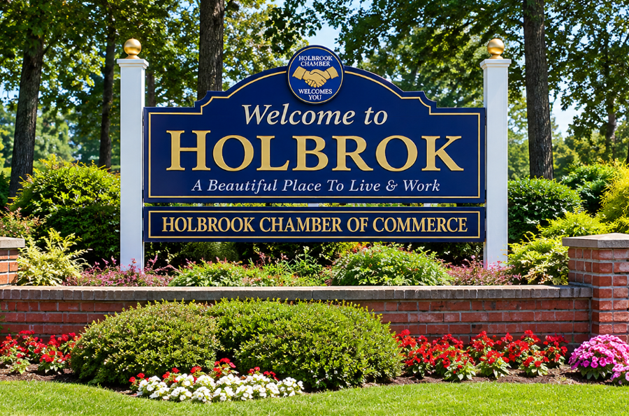
Holbrook, New York, is a suburban hamlet and census-designated place located primarily in the Town of Islip, with a smaller portion extending into the Town of Brookhaven, in central Suffolk County on Long Island. Home to 26,487 residents at the 2020 Census, Holbrook is an established suburban community characterized by residential neighborhoods, schools, parks, local businesses, and convenient access to some of Long Island’s most important transportation corridors.
Holbrook’s central location places it between the Long Island Expressway (I-495) and Sunrise Highway (NY 27), with Patchogue-Holbrook Road providing an important north-south connection through the area. Nearby Ronkonkoma provides access to one of the busiest Long Island Rail Road stations in Suffolk County, while communities along the South Shore are only a short drive away.
History of Holbrook
The area that became Holbrook was once part of a much more rural central Long Island landscape of farms, forests, and pine barrens. Much of present-day Holbrook lies within the Town of Islip, whose colonial history dates to the late seventeenth century. For generations, development in this inland portion of Suffolk County remained limited compared with older settlements along Long Island’s shorelines.
Holbrook gradually developed its own community institutions, including local schools that existed well before the large-scale suburban expansion that transformed central Suffolk County after World War II. During the 1920s, children in the Holbrook community attended Union Avenue School, part of an educational history that would eventually lead to the creation of the much larger Sachem school system.
The decades following World War II brought substantial change. New homes, schools, roads, shopping areas, and public facilities were built as Suffolk County’s population expanded rapidly. Improved highway access made previously rural areas increasingly practical for commuters and families seeking suburban housing farther east on Long Island.
Holbrook became part of this broader transformation, developing into the predominantly residential suburban community seen today. Its location near major highways, the Ronkonkoma transportation hub, and growing commercial corridors helped establish the hamlet as a convenient place to live within central Suffolk County.
Location and Geography
Holbrook occupies approximately 6.9 square miles in central Suffolk County. Most of the hamlet lies within the Town of Islip, while a smaller portion extends into the neighboring Town of Brookhaven. The community is inland, between Long Island’s North and South shores, and consists primarily of developed residential neighborhoods interspersed with commercial corridors, schools, parks, and remaining wooded areas.
Nearby communities include Ronkonkoma and Lake Ronkonkoma to the north, Holtsville and Farmingville to the east, and Bohemia to the west. The Patchogue area and other South Shore communities are located a short distance to the south.
According to the 2020 Census, Holbrook had a population density of approximately 3,848 residents per square mile. Despite its suburban development, the hamlet’s location also places residents close to several larger natural and recreational areas in central Suffolk County.
Transportation
Transportation access is one of Holbrook’s defining characteristics. The Long Island Expressway (I-495) runs just north of much of the community, while Sunrise Highway (NY 27) is readily accessible to the south. Patchogue-Holbrook Road provides a major north-south route between these highways and connects Holbrook with communities toward the South Shore.
Other important roads serving the area include Portion Road, Broadway Avenue, Union Avenue, and nearby Veterans Memorial Highway. Together, these roads provide connections to shopping areas, schools, employment centers, and neighboring communities throughout Islip and Brookhaven.
Holbrook does not have its own Long Island Rail Road station, but the nearby Ronkonkoma station provides rail service toward New York City and other destinations. The station’s location just north of Holbrook makes rail commuting practical for many residents.
Transportation is also reflected in local commuting patterns. U.S. Census Bureau estimates for 2020 through 2024 place the mean travel time to work for Holbrook workers at approximately 34 minutes.
Shopping and Commerce
Holbrook’s commercial activity is concentrated primarily along Portion Road, Patchogue-Holbrook Road, and other major local corridors. These areas contain shopping centers, restaurants, supermarkets, professional offices, healthcare providers, automotive businesses, and a variety of neighborhood services.
The community does not have a traditional walkable downtown comparable with some older Long Island villages. Instead, its commercial development reflects the suburban pattern found throughout central Suffolk County, with shopping plazas and businesses positioned along major roads. Residents also have convenient access to larger retail and dining areas in Ronkonkoma, Patchogue, and surrounding communities.
Parks and Recreation
Holbrook Country Club is one of the community’s principal recreational facilities. Operated by the Town of Islip, the large recreational complex on Patchogue-Holbrook Road includes an 18-hole golf course and driving range along with athletic fields, basketball and tennis courts, handball courts, a playground, pro shop, gazebo, and other facilities.
Residents also have access to neighborhood parks, playgrounds, athletic fields, and recreation programs throughout the surrounding area. Holbrook’s central location places larger natural areas within a relatively short drive, including Connetquot River State Park Preserve, where thousands of acres of protected land support hiking, fishing, wildlife observation, and other outdoor recreation.
Nearby Lake Ronkonkoma provides another recognizable recreational destination north of the hamlet, while parks and waterfront areas along the South Shore expand the range of outdoor activities available within a short drive. Hours, permits, fees, and seasonal restrictions vary among individual facilities.
Sachem Public Library
Sachem Public Library, located on Holbrook Road, is one of Holbrook’s major civic and community institutions. Its history predates the current building and traces back to a small library collection established in 1914 and the formation of the Lake Ronkonkoma Free Library in 1916.
Following decades of population growth, voters approved the creation of a new school district public library in 1961. Land was acquired on Holbrook Road, and the present library’s predecessor building opened in Holbrook in 1966. The facility was subsequently expanded and renovated as the population and demand for library services increased.
Today, the library serves as much more than a place to borrow books, offering public programs, educational resources, events, technology, meeting spaces, exhibits, and activities for children, teens, adults, and families throughout the Sachem community.
Education
Holbrook is served primarily by the Sachem Central School District, a large public school system spanning portions of several communities in central Suffolk County. The district includes elementary schools, middle schools, and two high schools and has long played a major role in the identity of Holbrook and neighboring communities.
The modern Sachem district was formed in 1955 when residents of the Farmingville-Holtsville, Holbrook, and Lake Ronkonkoma school districts voted to create a centralized district in response to rapid population growth in the Towns of Brookhaven and Islip. The district expanded rapidly during the suburban growth that followed, adding numerous schools from the 1950s through the 1970s.
Schools physically located in Holbrook include Grundy Avenue Elementary School, Merrimac Elementary School, and Seneca Middle School, among others serving the broader Sachem community. Exact school assignments depend on residential address and district attendance boundaries.
Community Character
Holbrook is predominantly residential, with neighborhoods consisting largely of detached single-family homes. Much of the community’s present-day appearance reflects the major suburban expansion of central Suffolk County during the decades following World War II, although housing and development span several periods.
Census data illustrate the community’s strongly residential character. During the 2020-2024 American Community Survey period, approximately 80 percent of occupied housing units were owner-occupied. The Census Bureau reported 8,922 households, with an average of approximately three people per household.
Unlike communities centered around a historic downtown or waterfront, Holbrook’s identity is closely tied to its neighborhoods, schools, parks, civic institutions, and transportation connections. This gives the hamlet a practical suburban character while placing residents within easy reach of employment, shopping, recreation, and transportation elsewhere in central Suffolk County.
Economy and Employment
Holbrook’s local economy is supported by retail, restaurants, healthcare, education, construction, professional services, and numerous small and locally oriented businesses. Commercial activity along the hamlet’s major roads serves both local residents and people traveling between surrounding communities.
The community’s location between the Long Island Expressway and Sunrise Highway also provides residents with access to employment centers elsewhere in Suffolk County and Nassau County. Nearby rail service at Ronkonkoma extends commuting options west toward New York City.
Holbrook, New York
Key Facts and Details
| Location | Central Suffolk County, Long Island, New York |
|---|---|
| Municipalities | Primarily Town of Islip, with a smaller portion in the Town of Brookhaven |
| Community Type | Hamlet and Census-Designated Place |
| Population | 26,487 (2020 Census) |
| Land Area | 6.88 square miles |
| Population Density | 3,848 residents per square mile (2020) |
| Median Household Income | $144,760 (2020-2024 Census estimate, 2024 dollars) |
| Owner-Occupied Housing | 79.6% (2020-2024 Census estimate) |
| Mean Travel Time to Work | 34.1 minutes (2020-2024 Census estimate) |
| ZIP Code | 11741 |
| School District | Sachem Central School District |
| Primary Roadways | Long Island Expressway (I-495), Sunrise Highway (NY 27), Patchogue-Holbrook Road, Portion Road |
| Rail Access | Nearby Ronkonkoma LIRR station |
| Nearby Communities | Ronkonkoma, Holtsville, Bohemia, Farmingville, and Patchogue |
| Notable Amenities | Sachem Public Library, Holbrook Country Club, neighborhood shopping corridors, parks, and access to central Suffolk recreational areas |
Holbrook combines the residential character of an established central Suffolk County suburb with unusually convenient access to major highways, nearby rail service, schools, shopping, parks, and community facilities. Its position between the Long Island Expressway and Sunrise Highway, together with its proximity to Ronkonkoma and the South Shore, continues to make Holbrook a well-connected residential community within the broader Long Island region.
Explore seasonal activities on Long Island:
🍎 Apple Picking | 🍂 Fall Festivals | 🦃 Thanksgiving Dinner & Activities | 🎄 Holiday Lights & Christmas