
Nature Preserves
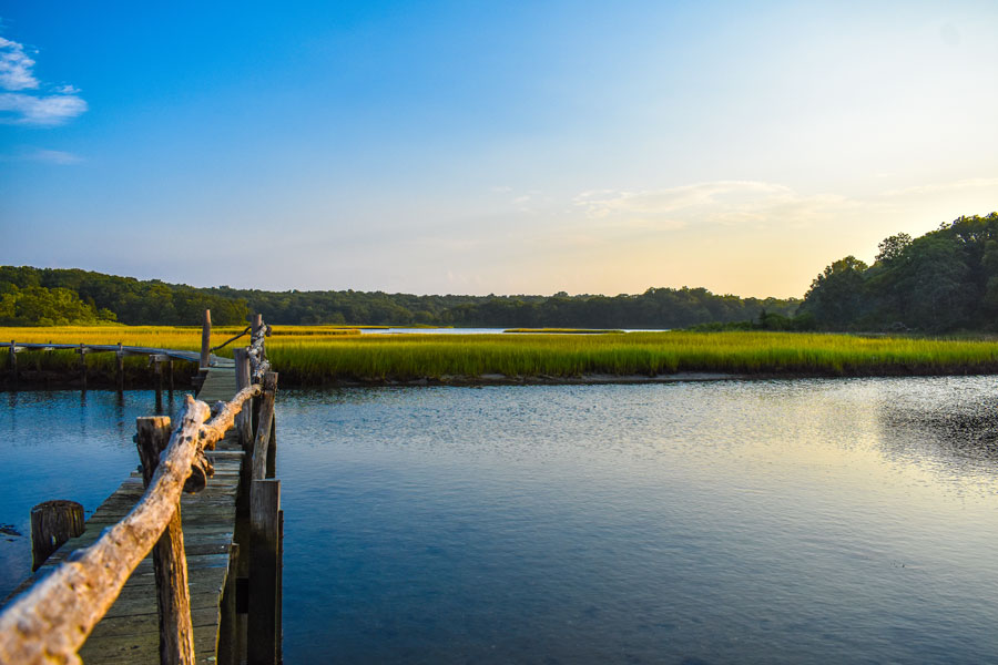
Long Island contains an unusually broad network of protected landscapes, from tidal marshes and coastal forests to the Long Island Pine Barrens, freshwater ponds, wildlife refuges, bird sanctuaries, and historic estates preserved for public enjoyment. These natural areas are spread across Nassau County and Suffolk County, including preserves on the North Shore, along the South Shore, throughout the East End, and within the island’s extensive pine barrens.
This directory brings together 46 nature preserves, wildlife refuges, sanctuaries, state park preserves, forests, greenbelts, and protected natural areas across Long Island. Use the interactive map to locate each site, then browse the directory for the community, county, classification, and general public-access status. Preserve names in the directory link to their official managing organizations.
Interactive Map of Long Island Nature Preserves
The map is a geographic companion to the directory. Select a marker to identify a preserve, review its location, visit the managing organization’s website, or request driving directions. Markers generally represent a documented entrance, visitor center, trailhead, street address, or verified location within the protected property. Some preserves cover large areas and may have more than one access point.
Nature Preserves Across Long Island
Long Island’s protected lands reflect the island’s varied geography. North Shore preserves often contain wooded hills, glacial terrain, freshwater ponds, steep ravines, rocky beaches, and habitat overlooking the Long Island Sound. Well-known examples include Caumsett State Historic Park Preserve, Target Rock National Wildlife Refuge, and several preserves managed throughout northern Nassau and Suffolk counties that protect woodland, meadow, freshwater, and shoreline habitats.
South Shore preserves are frequently associated with tidal wetlands, bays, creeks, maritime grasslands, and habitat behind the barrier beaches. Wertheim National Wildlife Refuge, Seatuck National Wildlife Refuge, Marine Nature Study Area, Cow Meadow Park and Preserve, and Norman J. Levy Park and Preserve protect important marsh ecosystems connected to the Great South Bay, South Oyster Bay, and other South Shore waterways.
Farther east, protected lands become larger and more interconnected. Rocky Point Pine Barrens State Forest, Otis Pike Preserve, Dwarf Pine Plains Preserve, David A. Sarnoff Preserve, and Long Pond Greenbelt protect significant portions of the Long Island Pine Barrens, groundwater recharge areas, rare plant communities, and extensive trail systems. Additional preserves throughout the East End, the Peconic Bays, Hamptons, and Shelter Island protect coastal wetlands, beaches, forests, and estuarine habitats.
What Counts as a Nature Preserve?
The terms used for protected land are not interchangeable. A nature preserve is generally managed to protect habitat, scenery, ecological resources, or open space. A wildlife refuge places particular emphasis on habitat for birds, mammals, fish, and other wildlife. A nature sanctuary often combines habitat protection with passive public use, while a state park preserve is a New York State designation that generally gives natural-resource protection greater priority than intensive recreation.
State forests and pine barrens preserves can cover much larger tracts and may permit hiking, hunting, horseback riding, mountain biking, or other activities in designated areas. County and municipal preserves vary widely, ranging from compact neighborhood sanctuaries to extensive wetland complexes. The classification in this directory follows the terminology commonly used for each protected property.
Hiking, Wildlife Watching, and Passive Recreation
Many Long Island preserves are best suited to passive recreation. Common activities include hiking, walking, birdwatching, nature photography, environmental education, and seasonal wildlife observation. Larger properties may also offer bridle paths, bicycle routes, fishing access, paddling opportunities, interpretive centers, historic buildings, or organized educational programs.
Facilities differ considerably. Some locations have marked trail systems, parking lots, restrooms, visitor centers, maps, and staffed programs. Others may consist of an unpaved trailhead, roadside pull-off, boardwalk, or small neighborhood entrance. Visitors should review current information before traveling, especially when planning a longer hike or visiting a preserve with limited parking.
Public Access and Preserve Rules
Most locations in this directory provide some form of public access, but access does not mean every section is open at all times. Seasonal closures, habitat restoration, hunting seasons, nesting areas, storm damage, trail maintenance, permit requirements, and private-property boundaries can affect where visitors may go. Conscience Point National Wildlife Refuge is included because of its conservation importance, but general public access is restricted.
Preserve rules commonly prohibit littering, fires, motorized vehicles, plant removal, wildlife disturbance, and off-trail activity in sensitive areas. Dog policies vary and may require leashes or prohibit pets entirely. Bicycles, horses, fishing, hunting, drones, picnicking, and organized group activities may also be regulated differently at each property. Posted signs should always take precedence over general directory information.
Planning a Visit
Review the preserve’s information before departure and confirm the entrance location, operating hours, parking rules, trail conditions, and permitted activities. Bring appropriate footwear, water, insect protection, and sun protection. Ticks are common throughout Long Island’s wooded and grassy areas, so visitors should remain on marked trails when required and perform a tick check after returning.
Weather and seasonal conditions can quickly change trail surfaces. Coastal preserves may flood during high tides or storms, while pine barrens and woodland trails can become sandy, muddy, icy, or obstructed. Visitors should carry out all trash, avoid disturbing plants and animals, and leave natural and historic features as they were found.
Long Island Nature Preserve Directory
The preserve name links to an official agency or managing organization when one was identified. Community and county names link to related LongIslandGuide.com pages. Public-access information is general and should be verified before visiting.
How This Directory Was Compiled
This directory was assembled through a manual review of federal, New York State, county, municipal, nonprofit, and preserve-management sources. Properties were included when they had an identifiable Long Island location and functioned primarily as protected natural land, a wildlife refuge, a sanctuary, a state park preserve, a state forest, a greenbelt, or a comparable conservation property. Ordinary recreation parks without a meaningful preserve or conservation function were not included.
Map locations were developed using documented addresses, preserve names, visitor centers, trailheads, and verified geographic coordinates. Because many preserves encompass hundreds or even thousands of acres, map markers should be viewed as general reference points rather than exact representations of preserve boundaries or every available entrance. Visitors should confirm access points and current conditions before traveling.
Protecting Long Island’s Natural Landscape
Long Island’s preserves protect far more than scenic places to walk. They safeguard drinking-water recharge areas, wetlands, forests, coastal habitat, rare ecological communities, migratory bird corridors, and open space within one of the nation’s most densely populated regions. Together with Long Island’s parks, beaches, Pine Barrens, Long Island Sound, Great South Bay, and countless other natural areas, these preserves give residents and visitors an opportunity to experience the landscapes that continue to define Long Island.
Are you ready for fall on Long Island? Check out these local seasonal guides:
🍎 Apple Picking 🍓 Strawberry Picking 🎃 Pumpkin Picking 👻 Haunted Houses 🍂 Farm Festivals
