
Carlls River in Babylon, Long Island
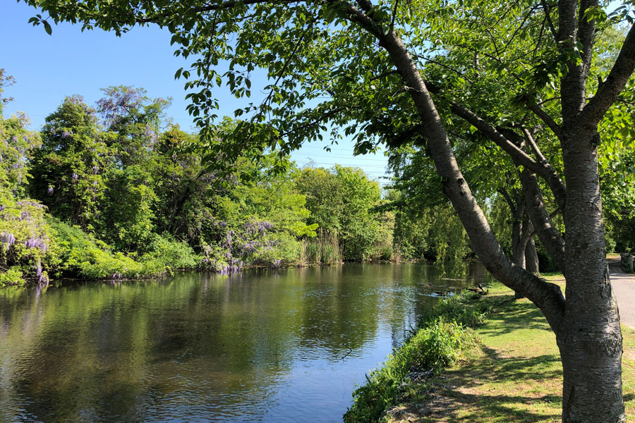
Carlls River is a groundwater-fed stream flowing south through the Town of Babylon in Suffolk County on the South Shore of Long Island, New York. The river passes through or near Deer Park, North Babylon, West Babylon and Babylon before reaching Great South Bay. Along the way, its waters pass through a distinctive chain of lakes and ponds that includes Geiger Lake, Belmont Lake, Southards Pond and Argyle Lake. The Town of Babylon identifies this sequence as part of the Carlls River system, while New York State Parks describes the river as extending south from Belmont Lake toward Great South Bay.
The river is one of Suffolk County’s principal watershed valleys and is notable for combining freshwater stream habitat, parkland, stocked trout waters, suburban neighborhoods and a direct connection to the Great South Bay estuary. Suffolk County has identified Carlls River as one of the county’s five main watershed river valleys, alongside the Nissequogue, Connetquot, Carmans and Peconic rivers.
Geography
Carlls River runs generally north to south through the western portion of the Town of Babylon.
The river is formed from groundwater and small underground-fed streams in the northern part of the watershed. Town of Babylon descriptions trace the system south through Geiger Lake, then Belmont Lake in North Babylon, Southards Pond and Argyle Lake in Babylon before it ultimately reaches Great South Bay.
The river corridor passes through a heavily suburbanized section of western Suffolk County, but several important sections remain protected by parks and other open space. These include Geiger Memorial Park, Belmont Lake State Park, Southards Pond and parkland surrounding Argyle Lake.
This combination allows Carlls River to function as a continuous natural corridor through communities that otherwise contain dense residential, commercial and transportation development.
Name and Spelling
The waterway is generally known as Carlls River, although variations including Carll River, Carll’s River and Carlls Creek appear in government and historical sources.
The U.S. Geological Survey operates its long-term monitoring station under the name Carlls River at Babylon, NY, while New York State Parks refers to the waterway through Belmont Lake State Park as Carlls Creek. The Town of Babylon uses both Carll River and Carlls River in different contexts.
For consistency, Carlls River is the best title for the waterway as a whole.
Groundwater-Fed River
Like many streams on Long Island, Carlls River depends heavily on groundwater.
Long Island’s sandy glacial soils allow precipitation to infiltrate into the underground aquifer system. Groundwater then moves gradually toward low points in the landscape, emerging into ponds, wetlands and stream channels.
The Town of Babylon describes the Carll River as being formed from underground streams north of Geiger Lake.
Because groundwater contributes significantly to river flow, activities throughout the surrounding watershed can influence water quality. Nutrients from wastewater systems, lawn fertilizers and stormwater runoff can eventually reach the river and, farther downstream, Great South Bay.
Geiger Lake and Geiger Memorial Park
Geiger Lake is one of the northernmost prominent surface-water features within the Carlls River system.
The lake is located within Geiger Memorial Park near the boundary between Deer Park and Wyandanch. The Town of Babylon formally dedicated Geiger Memorial Park in 1957 and specifically identifies Geiger Lake as part of the Carll River.
Water from Geiger Lake continues south toward Belmont Lake.
The park also contains the Carlls River Botanical Garden, connecting the river corridor with recreational and horticultural use.
North Babylon
North Babylon is closely associated with Carlls River because the river and Belmont Lake form important natural features along the community’s western side.
Town of Babylon geographic descriptions identify the Carll River as part of the boundary between North Babylon and neighboring communities and note its passage through Geiger Lake and Belmont Lake.
The presence of Belmont Lake State Park gives North Babylon one of the largest continuous recreational landscapes along the river.
The current LongIslandGuide page for North Babylon also highlights Belmont Lake State Park and Geiger Lake Memorial Park among the area’s important recreation destinations.
Belmont Lake State Park
Belmont Lake State Park protects one of the most important sections of the Carlls River corridor.
New York State Parks describes the 463-acre park as being bisected by Carlls Creek and Belmont Lake. The park was established in 1926 on property formerly owned by August Belmont and later became the headquarters of the Long Island State Park Region.
The park’s focal point is Belmont Lake, a spring-fed freshwater lake surrounded by trails, woodlands and recreational areas.
Carlls River flows through the lake before continuing south toward Southards Pond and Babylon.
Belmont Lake
Belmont Lake is one of the largest and most recognizable impoundments along Carlls River.
New York State Parks describes the lake as spring-fed and surrounded by a significant wetland complex. The lake supports trout fishing during spring and bass fishing during warmer months. It also provides habitat for permanent and migratory waterfowl, including osprey, mergansers, teal, great blue herons and egrets.
The lake is stocked annually with trout by the New York State Department of Environmental Conservation. DEC’s 2026 stocking schedule included both brown trout and rainbow trout.
Non-motorized boating is permitted under park rules, and kayaks and canoes can be launched from the park boat dock when it is operating.
Trails Along the River
One of the distinctive recreational features of Carlls River is the trail corridor following portions of the waterway.
New York State Parks describes a trail following Carlls Creek south from Belmont Lake toward Great South Bay, with hiking and bicycling opportunities through the river corridor. The Belmont Lake park trail system totals approximately 7.6 miles.
The river therefore connects naturally with hiking, walking and bicycling in addition to its better-known fishing opportunities.
Portions of the route pass through wooded sections that feel considerably removed from the dense suburban neighborhoods surrounding them.
Southards Pond
Southards Pond is another major freshwater feature along Carlls River, located south of Sunrise Highway in Babylon.
New York DEC identifies the 19-acre pond as part of the Carll’s River system. The pond has a maximum depth of about five feet and nearly a mile of shoreline.
Public footpaths provide access around much of the pond, and fishing is one of its principal recreational uses.
DEC stocks Southards Pond with both brown and rainbow trout. Its 2026 schedule included hundreds of trout released during March.
From Southards Pond, Carlls River continues south toward Argyle Lake in the heart of Babylon Village.
Argyle Lake
Argyle Lake is perhaps the most recognizable urban feature along Carlls River.
Located in the center of Babylon, the lake is formed by a dam across the river. New York DEC describes Argyle Lake as approximately 25 acres with a maximum depth of about four feet.
The lake is surrounded by Babylon Village parkland and lies immediately north of Montauk Highway.
Its relatively open shoreline, decorative waterfalls and central location make it one of Babylon’s best-known scenic landmarks.
Argyle Lake is also stocked annually with trout. DEC’s 2026 program included both brown trout and rainbow trout.
Babylon Village
The lower freshwater portion of Carlls River passes directly through Babylon.
The village developed around several waterways leading toward Great South Bay, with Carlls River and Argyle Lake forming particularly visible landscape features.
South of Argyle Lake, the river continues through the lower village toward increasingly tidal coastal waters.
Babylon’s location between Carlls River and nearby Sampawams Creek also shaped local geography. Town descriptions identify the land between the two waterways as historically associated with Sumpwams Neck.
From Freshwater River to Great South Bay
Carlls River changes character as it travels south.
Its upper portions include freshwater springs, lakes and ponds. Farther downstream, the river gradually enters the tidal environment associated with the Babylon waterfront.
The Town of Babylon identifies the river as continuing from Argyle Lake south to Great South Bay.
This means water originating from groundwater in the northern watershed ultimately becomes part of Long Island’s larger South Shore estuary.
The river therefore creates a direct hydrologic connection between inland Suffolk County and the salt marshes, tidal creeks and open waters of Great South Bay.
Great South Bay
Great South Bay is the ultimate receiving waterbody for Carlls River.
The bay stretches along the South Shore behind Fire Island and receives freshwater and stormwater from numerous streams and watersheds across Suffolk County.
Because Carlls River flows directly into Great South Bay, water quality throughout the river watershed can ultimately influence the coastal estuary.
The Town of Babylon specifically connects its stormwater, watershed and environmental programs with protecting Great South Bay from pollution and erosion.
Fishing
Fishing is one of the most important recreational uses of Carlls River.
DEC manages portions of the river as stocked trout water. Current state trout-stream classifications identify approximately 0.8 mile between Argyle Lake and Southards Pond and approximately 1.7 miles between Southards Pond and Belmont Lake as stocked trout reaches.
For spring 2026, DEC scheduled hundreds of rainbow and brown trout for Carlls River itself, in addition to separate stockings at Belmont Lake, Southards Pond and Argyle Lake.
This sequence makes the Carlls River corridor one of the more concentrated freshwater fishing areas in western Suffolk County.
Kayaking and Boating
Portions of the Carlls River system also support kayaking and non-motorized boating.
At Belmont Lake State Park, hard-bottomed kayaks and canoes may be launched from the boat dock when it is open, and seasonal kayak rentals are available. Paddleboards are not permitted on Belmont Lake under current park rules.
Southards Pond and Argyle Lake prohibit boats, making them primarily shoreline recreation and fishing destinations.
Conditions and access therefore vary substantially from one section of the river system to another.
Wildlife and Birdwatching
Carlls River’s combination of freshwater, wetlands, wooded banks and open lakes creates valuable habitat within a heavily developed part of Suffolk County.
Belmont Lake State Park supports permanent and migratory waterfowl, including osprey, herons, egrets and several species of ducks.
Smaller wetlands and wooded sections along the river provide additional habitat for birds, turtles, fish and other wildlife.
The river corridor is consequently well suited to birdwatching and nature observation, particularly around Belmont Lake and other protected park areas.
Carlls River Watershed
The river is surrounded by a much larger drainage area known as the Carlls River Watershed.
Water entering the watershed through rainfall, groundwater recharge and stormwater runoff ultimately moves toward the river and Great South Bay.
Suffolk County has identified wastewater pollution and flood resilience as major issues within this watershed, especially in low-lying portions of North Babylon and West Babylon.
Because much of the area was historically developed using individual septic systems rather than sewers, nitrogen from wastewater has been an important water-quality concern.
Carlls River Watershed Sewer Project
One of the largest current environmental infrastructure projects associated with the river is the Carlls River Watershed Sewer Project.
Suffolk County’s Coastal Resiliency Initiative includes construction of a new sewer collection system serving portions of North Babylon and West Babylon. The project is designed to reduce pollution from onsite wastewater systems while improving resilience to coastal flooding and future storms.
New York State has described the larger coastal sewer initiative as an effort to reduce nitrogen loading, improve water quality and strengthen coastal resiliency following Hurricane Sandy.
The Town of Babylon maintains a dedicated Carlls River Sewer Extension Project page for residents affected by the work.
Flooding and Storm Resilience
Flooding is another important issue within the Carlls River watershed.
The river crosses low-lying portions of Babylon where heavy rainfall can increase freshwater flow while coastal storms can simultaneously raise water levels from Great South Bay.
Suffolk County’s current watershed infrastructure program is intended partly to reduce the environmental and public-safety problems associated with wastewater systems failing during high groundwater and flooding events.
Stormwater-management projects have also focused on controlling runoff and reducing flooding within Babylon Village and nearby communities.
Water Quality
The close connection between Carlls River and Great South Bay makes upstream water quality particularly important.
Storm drains can carry fertilizers, lawn chemicals, oil, litter and other pollutants into the river. Town educational materials specifically note that pollutants entering Carlls River and Belmont Lake can ultimately reach Great South Bay and Long Island’s groundwater system.
Environmental programs within the Town of Babylon include stormwater treatment, wetland restoration and watershed planning intended to reduce pollutants entering local waterways.
Wastewater improvements in the Carlls River watershed represent another major effort to reduce nitrogen entering the river and bay.
Roads and Transportation
Carlls River crosses several major transportation corridors as it flows south.
The river and its associated lakes lie near or beneath routes including the Southern State Parkway, Sunrise Highway, Montauk Highway and the Long Island Rail Road corridor in Babylon.
This creates a strong contrast between the river’s natural stream and pond habitats and the dense suburban infrastructure surrounding them.
The preserved portions around Belmont Lake and Southards Pond consequently serve as especially important green corridors within western Suffolk County.
Carlls River within Long Island’s Waterway System
Carlls River is one of several major groundwater-fed river systems draining Long Island toward its surrounding bays.
Suffolk County identifies the Carlls, Nissequogue, Connetquot, Carmans and Peconic rivers as five of its principal watershed river valleys.
Compared with the longer Carmans River, Connetquot River and Peconic River, Carlls River flows through a much more heavily developed suburban landscape.
Yet its sequence of Geiger Lake, Belmont Lake State Park, Southards Pond and Argyle Lake preserves a surprisingly continuous natural and recreational corridor from inland Babylon south toward Great South Bay.
That combination of groundwater-fed flow, freshwater fishing, parkland, suburban history and coastal connection makes Carlls River an important component of Long Island’s larger bays, harbors, inlets and waterways system.
Carlls River in Babylon
Key Facts & Details
| Feature | Details |
|---|---|
| Waterway | Carlls River within Long Island’s bays, harbors, inlets and waterways system |
| Location | South Shore of Long Island |
| County | Suffolk County |
| State | New York |
| Island | Long Island |
| Town | Town of Babylon |
| Primary Communities | Deer Park, North Babylon, West Babylon and Babylon |
| Waterway Type | Groundwater-fed freshwater river transitioning toward a tidal South Shore estuary |
| Northern River Feature | Geiger Lake near Deer Park and Wyandanch |
| Major State Park | Belmont Lake State Park |
| Major Lakes & Ponds | Geiger Lake, Belmont Lake, Southards Pond and Argyle Lake |
| Major Inland Park Community | North Babylon |
| Lower River Community | Babylon |
| Receiving Waterbody | Great South Bay |
| USGS Monitoring Site | Carlls River at Babylon, station 01308500 |
| State Fishery Management | Stocked trout reaches between Belmont Lake, Southards Pond and Argyle Lake |
| Major Habitats | Freshwater stream, spring-fed lakes, ponds, wetlands, wooded parkland and lower tidal habitat |
| Popular Activities | Fishing, hiking, bicycling, kayaking at Belmont Lake and birdwatching |
| Fishing Resource | Long Island fishing |
| Major Environmental Project | Carlls River Watershed Sewer Project serving portions of North Babylon and West Babylon |
| Environmental Concerns | Nitrogen pollution, stormwater runoff, flooding and downstream effects on Great South Bay |
| Comparable Long Island Rivers | Carmans River, Connetquot River and Peconic River |
| Known For | Belmont Lake State Park, trout fishing, interconnected lakes and ponds, and its connection to Great South Bay |
| Related Waterways Guide | Bays, Harbors, Inlets & Waterways of Long Island |
Carlls River forms one of the most distinctive freshwater corridors in the Town of Babylon, carrying groundwater south through Geiger Lake, Belmont Lake State Park, Southards Pond and Argyle Lake before reaching Great South Bay. Flowing through North Babylon, West Babylon and Babylon, the river combines trout fishing, wetlands, wooded parkland and suburban history while also serving as an important watershed whose health is directly connected with the ecological condition of Long Island’s South Shore.
Are you ready for fall on Long Island? Check out these local seasonal guides:
🍎 Apple Picking 🍓 Strawberry Picking 🎃 Pumpkin Picking 👻 Haunted Houses 🍂 Farm Festivals
