
Southold Bay
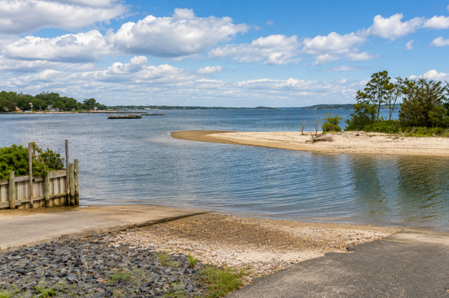
Southold Bay is a sheltered coastal bay along the North Fork of Long Island, located off the hamlet of Southold in Suffolk County, New York. The bay forms a broad bight at the western end of Shelter Island Sound and is part of the larger Peconic Bay estuarine system that separates Long Island’s North Fork from Shelter Island and the South Fork. Maritime guides describe Southold as being at the head of Southold Bay, with the bay extending westward from the vicinity of Jennings Point on Shelter Island.
The shoreline around Southold Bay includes residential waterfronts, beaches, creeks, wetlands and small boat facilities, giving the bay a considerably more protected character than the open waters farther east. Local waterfront destinations include Goose Creek Beach and Founders Landing, while nearby communities include Southold, Peconic, Cutchogue and, farther east, Greenport. The Town of Southold specifically identifies Goose Creek as overlooking Southold Bay.
Geography
Southold Bay lies along the southern shoreline of the North Fork within the Town of Southold. It occupies the transition between the western Peconic Bays and Shelter Island Sound, creating a sheltered indentation along the mainland shoreline immediately south of the hamlet of Southold.
The bay is not an isolated body of water. Instead, it forms part of the interconnected bays, harbors, inlets and waterways that make up the Peconic Estuary. New York State’s waterfront planning documents describe Southold’s southern shoreline as part of the broader Peconic Estuary, which extends throughout the waters between the North and South Forks.
Southold Bay opens eastward toward Shelter Island Sound and lies north of the western side of Shelter Island. Its protected setting, combined with adjacent creeks and shallow-water areas, contributes to its traditional use for boating, fishing, shellfishing and waterfront recreation.
Southold and the Waterfront
The historic hamlet of Southold sits directly north of the bay and gives the waterbody its name.
Southold is one of the oldest English settlements on Long Island and has retained a strong connection to the surrounding agricultural and maritime landscape. The community’s southern shoreline includes waterfront neighborhoods, small beaches, docks and access points overlooking Southold Bay.
The bay is an important part of Southold’s geographic identity because the community sits between two very different coastal environments. Long Island Sound lies a short distance to the north, while Southold Bay and the Peconic waters lie to the south.
This narrow North Fork geography means residents and visitors can move between the Sound shoreline and the Peconic shoreline within only a few miles.
Shelter Island Sound
Southold Bay forms the western bight of Shelter Island Sound, the protected waterway separating the eastern North Fork from Shelter Island.
A nautical description of the area identifies Southold Bay as the bight at the western end of Shelter Island Sound, extending westward from Jennings Point. The same source notes shallow areas extending offshore in portions of the bay, an important consideration for navigation.
Farther east, Shelter Island Sound continues toward Greenport, Dering Harbor and the waterways leading toward Gardiners Bay.
This location places Southold Bay near the center of one of the most interconnected boating regions on the East End.
The Peconic Bay System
Southold Bay is part of the larger Peconic Estuary, which includes Great Peconic Bay, Little Peconic Bay, Shelter Island Sound and numerous smaller bays, coves, creeks and harbors.
These waterways extend between the North Fork and South Fork and create a broad system of protected coastal waters before eventually reaching Gardiners Bay farther east.
New York environmental planning documents specifically map Southold Bay within the Peconic watershed and alongside Little Peconic Bay and Shelter Island Sound.
Because there are few hard geographic boundaries between some sections of the Peconic system, names such as Southold Bay often identify locally recognized portions of a much larger connected estuary.
Jennings Point and the Eastern Bay
Jennings Point, on the northwestern side of Shelter Island, helps define the eastern side of Southold Bay.
New York shellfish regulations use lines involving Jennings Point and nearby mainland points when defining management areas in Shelter Island Sound, Southold Bay and adjacent waters. One regulatory area includes Shelter Island Sound West, Southold Bay and Hashamomuck Pond, illustrating how closely these waters are connected for environmental management purposes.
From Southold Bay, vessels traveling east enter the broader waters of Shelter Island Sound, where routes continue toward Greenport and around either side of Shelter Island.
Goose Creek
Goose Creek is one of the better-known protected waterways and public waterfront areas along Southold Bay.
The Town of Southold operates Goose Creek Beach on North Bayview Road in Southold. The Town specifically describes the property as overlooking Southold Bay and lists amenities including a guarded beach, playground and restrooms.
The surrounding creek and wetland environment adds another layer to the bay’s geography, with sheltered waters extending inland from the broader open bay.
Goose Creek also provides an example of the intimate scale of the Southold Bay shoreline, where small creeks, residential areas, wetlands and public beaches are closely interwoven.
Founders Landing
Founders Landing is another important waterfront destination associated with the Southold Bay shoreline.
The Town of Southold lists Founders Landing among its local beach and waterfront properties, providing access to the Peconic-side shoreline near the hamlet of Southold. Town directions identify the property as being reached from Route 25 in Southold.
The site contributes to the public recreational character of the bay and gives residents access to the protected waters south of the North Fork.
Together, Founders Landing and Goose Creek illustrate the close relationship between the community of Southold and the bay immediately offshore.
Beaches and Waterfront Recreation
Southold Bay’s protected shoreline supports swimming, boating, paddling, fishing and other forms of waterfront recreation.
Unlike the exposed beaches along Long Island Sound or the Atlantic Ocean, beaches along the Peconic side of the North Fork generally face calmer estuarine waters.
Goose Creek Beach is one of the public recreation areas directly overlooking Southold Bay. Town beaches may require resident or seasonal parking permits, and access rules can vary, particularly during the summer season.
Visitors looking more broadly around the island can also explore Long Island beaches and the surrounding waterfront communities of the North Fork.
Boating and Sailing
The protected waters of Southold Bay are well suited to recreational boating and sailing.
Boaters can travel east into Shelter Island Sound and toward Greenport or continue through the Peconic system toward Great Peconic Bay.
The Southold Yacht Club is associated with the local Peconic waterfront and reflects the area’s longstanding recreational sailing culture. The club is included among Long Island yacht clubs.
The North Fork also contains numerous marinas serving sailboats, powerboats and fishing vessels throughout the Peconic waterways.
Navigators should be aware that portions of Southold Bay are shallow. Maritime guidance notes shoal areas along both the northeastern and southwestern portions of the bay.
Fishing
Fishing is another traditional use of Southold Bay and the surrounding Peconic waters.
The bay’s protected waters, adjacent creeks and connection with Shelter Island Sound create varied habitat for marine species. Recreational anglers fish from boats and shoreline locations throughout the region, while nearby communities support charter and recreational fishing activity.
The broader North Fork provides access to a range of environments, from shallow estuarine waters within Southold Bay to deeper portions of Shelter Island Sound, Gardiners Bay and Long Island Sound.
Additional fishing options include where to fish on Long Island, fishing piers and fishing charters.
Shellfishing
Shellfishing is an important part of the Southold Bay environment and the broader Peconic Estuary.
The New York State Department of Environmental Conservation specifically identifies Southold Bay in its shellfish closure regulations and maintains classifications governing where shellfish may and may not be harvested. Some localized areas near boat basins and other shoreline features are designated uncertified or otherwise restricted.
DEC also maintains a public shellfish mapper showing year-round closures, seasonal closures, conditional harvesting areas, aquaculture sites and water-quality sampling locations.
Because temporary closures can occur following heavy rainfall or other water-quality events, anyone planning to harvest shellfish should check current regulations before entering the water.
Kayaking and Paddleboarding
The relatively sheltered shoreline of Southold Bay provides opportunities for kayaking and paddleboarding.
Protected areas around Goose Creek and other nearshore sections can offer calmer conditions than more exposed portions of the Peconic system, although wind, tides and boat traffic can still change conditions quickly.
Paddlers can explore the bay’s shoreline, nearby creeks and shallow-water environments while looking across toward Shelter Island and the broader Shelter Island Sound.
Coastal Wetlands and Habitat
Southold Bay is part of the larger Peconic Estuary ecosystem, which includes tidal wetlands, shallow bays, creeks, beaches and underwater habitat.
The Town of Southold’s waterfront planning program addresses natural and developed resources throughout the Peconic Estuary as well as Gardiners Bay and Long Island Sound.
These estuarine environments provide habitat for shellfish, finfish and coastal birds while also supporting boating, fishing and other recreational uses.
The mixture of protected shoreline and open water also makes the Southold Bay area attractive for birdwatching and nature observation.
Nearby Peconic Communities
Southold Bay sits within a closely connected group of North Fork communities.
Southold is located directly along the bay, while Peconic and Cutchogue lie farther west along the North Fork.
To the east, Greenport serves as the major maritime village near Shelter Island Sound, with ferry service, marinas and an active waterfront.
Across the water, Shelter Island forms much of the southern side of Shelter Island Sound and separates portions of the Peconic system from the waters leading toward Gardiners Bay.
The close spacing of these communities reflects the compact geography of the East End, where local bays and harbors often directly shape the character of neighboring villages and hamlets.
Southold Bay within Long Island’s Waterway System
Southold Bay occupies an important transition point within Long Island’s East End waterways.
To the west are the broader waters of the Peconic Bays, including Great Peconic Bay. To the east, the bay opens into Shelter Island Sound, which continues toward Greenport, Shelter Island and ultimately Gardiners Bay.
North of the narrow North Fork lies Long Island Sound, giving Southold an unusual position between two major coastal systems.
Southold Bay is therefore much more than a small local indentation. It is a named part of the Peconic Estuary and an important geographic link between the western Peconic Bays and Shelter Island Sound. New York State environmental and shellfish management documents continue to recognize Southold Bay as a distinct waterbody.
Southold Bay
Key Facts & Details
Southold Bay is a distinctive part of the Peconic Bay estuary and one of the waterways most closely associated with the historic North Fork community of Southold. Its sheltered shoreline, public waterfront areas, shellfish waters and direct connection with Shelter Island Sound make it an important recreational and ecological link between the western Peconic Bays and the maritime communities surrounding Shelter Island.
Are you ready for fall on Long Island? Check out these local seasonal guides:
🍎 Apple Picking | 🍂 Fall Festivals & Farm Activities | 👻 Haunted Houses | 🎃 Pumpkin Picking
