
Shinnecock Harbor
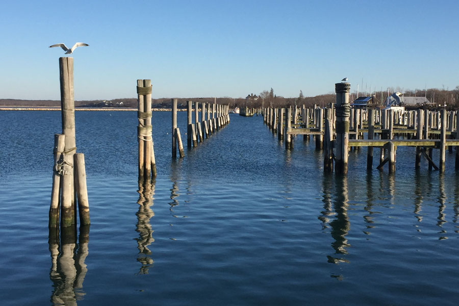
Shinnecock Harbor is the working maritime and commercial fishing area surrounding Shinnecock Inlet and the eastern portion of Shinnecock Bay on the South Fork of Long Island, New York. Located primarily in Hampton Bays within the Town of Southampton, Suffolk County, the harbor area connects protected bay waters with the Atlantic Ocean through Shinnecock Inlet.
The name Shinnecock Harbor is commonly used for the concentrated marine facilities, docks and commercial fishing activity near the inlet, while Shinnecock Bay is the formally mapped name for the much larger surrounding waterbody. The U.S. Army Corps of Engineers describes Shinnecock Inlet as providing access to Shinnecock Bay, which serves as a critical harbor of refuge and one of Long Island’s major commercial fishing centers.
Geography
Shinnecock Harbor lies along the southern edge of Shinnecock Bay near Hampton Bays, where the bay meets the Atlantic through Shinnecock Inlet.
The surrounding geography is part of Long Island’s extensive barrier-island and back-barrier lagoon system. Shinnecock Bay lies east of Moriches Bay and west of Mecox Bay and includes open water, salt marshes, dredged islands, tidal flats, creeks and barrier beaches. NOAA identifies the Shinnecock Bay habitat complex as approximately 9,000 acres.
To the north and west are Hampton Bays and the waterways connected with Shinnecock Canal. To the east are Shinnecock Hills and Southampton. The barrier beach separating the harbor area from the Atlantic includes stretches of Dune Road and oceanfront shoreline on either side of the inlet.
Shinnecock Inlet
Shinnecock Inlet is the defining geographic feature of Shinnecock Harbor.
The inlet provides a direct navigable connection between the Atlantic Ocean and Shinnecock Bay. The federal navigation project includes two rock jetties, an entrance channel approximately 200 feet wide and 10 feet deep, an inner channel leading to the Long Island Intracoastal Waterway and a sand deposition basin used as part of continuing navigation maintenance.
Because the inlet opens directly onto the Atlantic, it is particularly important to commercial fishing vessels, charter boats and recreational boaters operating from the harbor.
The U.S. Army Corps of Engineers reports that the inlet is regularly used by approximately 30 to 40 commercial fishing and deep-sea charter vessels and describes it as second only to Montauk among New York commercial fishing centers.
Shinnecock Bay
Shinnecock Bay forms the protected body of water immediately north of the harbor and inlet.
The bay extends across a broad portion of the Town of Southampton and includes tidal creeks, salt marshes, shoals and islands. NOAA describes the bay as part of a barrier beach and back-barrier lagoon system extending along Long Island’s South Shore.
Communities bordering or closely associated with the bay include Hampton Bays, East Quogue, Quogue, Shinnecock Hills and Southampton.
The bay’s protected waters make the harbor practical for commercial vessels and recreational boats seeking refuge from Atlantic conditions.
Shinnecock Canal
Shinnecock Canal lies north of the harbor area and connects Shinnecock Bay with the Peconic waterways.
The Town of Southampton describes the canal as a major connecting waterway for vessels traveling between the Atlantic Ocean and Great Peconic Bay. It also forms part of the Long Island Intracoastal Waterway and contains Long Island’s only operating navigation lock system.
This connection gives vessels based around Shinnecock Harbor access not only to the Atlantic but also to the protected waters north of the South Fork, including Great Peconic Bay and the wider Peconic estuary.
Without the canal, vessels traveling from the south side of the island toward the Peconic waters would otherwise need to travel around Montauk Point.
Hampton Bays
Hampton Bays is the community most closely associated with Shinnecock Harbor.
The hamlet occupies land between several major waterways, including Shinnecock Bay, Tiana Bay and the Peconic system. Its location beside Shinnecock Inlet has supported a longstanding fishing and maritime economy.
Commercial docks, seafood operations, charter vessels and recreational marine facilities are concentrated near the inlet and bay shoreline, making this portion of Hampton Bays one of the most active working waterfronts on the South Fork.
The surrounding community also provides access to beaches, restaurants, marinas and other marine-related businesses.
Commercial Fishing
Commercial fishing is one of the defining activities of Shinnecock Harbor.
The U.S. Army Corps of Engineers describes Shinnecock Inlet as a major New York commercial fishing center, with millions of pounds of fish historically landed annually through the harbor. Species landed through the area have included bluefish, monkfish and skate among dozens of others.
Fishing vessels operating from Shinnecock Harbor can reach Atlantic fishing grounds almost immediately after passing through the inlet.
This direct access distinguishes the harbor from many protected Long Island marinas that require lengthy travel through bays or channels before reaching open ocean.
The harbor also supports deep-sea charter fishing vessels serving recreational anglers.
Recreational Fishing
Fishing is equally important recreationally.
Anglers can fish within Shinnecock Bay, along nearby shorelines or travel through Shinnecock Inlet into the Atlantic.
The New York State Department of Environmental Conservation maintains Shinnecock Reef, an 850-acre artificial reef approximately two nautical miles south of Shinnecock Inlet. The reef contains rock, concrete and steel materials placed to create habitat for marine species and recreational fishing opportunities.
Nearby fishing opportunities also include where to fish on Long Island, fishing piers and fishing charters.
Boating
Shinnecock Harbor is one of the most strategically located boating areas on Long Island.
From the harbor, vessels can enter the Atlantic through Shinnecock Inlet, travel inland through Shinnecock Bay or continue north through Shinnecock Canal toward the Peconic waterways.
DEC lists a municipal hard-surface boat launch on Shinnecock Bay in Southampton, providing additional recreational access to the water.
The surrounding Hampton Bays area also contains numerous marinas and boat facilities serving recreational and commercial vessels.
Navigation around Shinnecock Inlet requires caution because shoaling and shifting bottom conditions can affect channel depths. The Army Corps performs hydrographic surveys and periodic dredging to maintain federal navigation channels.
Harbor of Refuge
The protected waters inside Shinnecock Inlet serve an important safety function.
The U.S. Army Corps of Engineers identifies Shinnecock Bay as a Critical Harbor of Refuge, giving commercial and recreational vessels a protected destination when Atlantic conditions deteriorate.
This role is particularly significant along the South Fork because relatively few navigable inlets provide direct refuge from the Atlantic.
The combination of the inlet, sheltered bay and connection to the Intracoastal Waterway makes the Shinnecock Harbor area an important part of Long Island’s marine transportation network.
Shinnecock Indian Nation
The Shinnecock Indian Nation has deep historical and cultural ties to the lands and waters surrounding Shinnecock Bay.
The Nation’s territory is located along the eastern side of the bay near Shinnecock Hills and Southampton.
The Shinnecock Nation states that its people have occupied their ancestral homelands in and around Southampton since time immemorial. The Nation received federal recognition in 2010.
Fishing, shellfishing and access to the surrounding coastal environment remain deeply connected to the history of the Shinnecock people.
Shellfishing
Shellfishing has long been an important use of Shinnecock Bay and its surrounding tidal waters.
New York State maintains detailed sanitary classifications governing shellfish harvesting throughout Shinnecock Bay, Tiana Bay, Ramspasture Bay and their tributary creeks and canals.
Certain creeks, boat basins and shoreline areas are permanently or seasonally closed to shellfish harvesting, while other areas may be temporarily closed following heavy rainfall or other water-quality events.
Anyone harvesting shellfish should check current DEC classifications before entering the water.
Salt Marshes and Wildlife
The wider Shinnecock Bay environment contains extensive salt marshes, tidal flats and shallow estuarine habitat.
NOAA identifies the bay as regionally significant habitat for fish, shellfish, migratory waterfowl, shorebirds, nesting waterbirds, raptors and rare plants.
Large numbers of ducks use Shinnecock Bay during winter and migration periods, while marsh islands support nesting colonies of terns, gulls and wading birds.
The inlet and nearby Atlantic waters also attract marine mammals. Harbor seals and gray seals use the Shinnecock Inlet area during colder months, while dolphins and several whale species occur offshore. Juvenile sea turtles also use the bay during summer.
The variety of habitats makes the surrounding area valuable for birdwatching and wildlife observation.
Kayaking and Paddleboarding
Protected portions of Shinnecock Bay offer opportunities for kayaking and paddleboarding.
Paddlers can explore quieter shoreline areas, tidal creeks and marshes away from the heavily trafficked inlet.
The immediate Shinnecock Harbor and inlet area is much more exposed to commercial vessel traffic, strong currents and ocean conditions, making sheltered parts of the bay generally more appropriate for small paddlecraft.
Beaches and Barrier Shore
The barrier beach south of Shinnecock Bay separates the harbor from the Atlantic Ocean.
The shoreline includes Shinnecock East County Park near the eastern side of the inlet, along with beaches extending west toward Tiana Beach and beyond.
These Atlantic-facing beaches contrast sharply with the protected bay waters just north of the dunes.
The inlet’s rock jetties interrupt the otherwise continuous barrier shoreline and provide the navigational entrance connecting Shinnecock Bay with the ocean.
Shinnecock Harbor within the South Shore Waterway System
Shinnecock Harbor occupies an unusually important position within Long Island’s bays, harbors, inlets and waterways system.
To the west, the South Shore lagoon system extends toward Quogue, Tiana Bay and eventually Moriches Bay. To the north, Shinnecock Canal connects the bay with Great Peconic Bay. To the south, Shinnecock Inlet provides direct access to the Atlantic Ocean.
This combination of protected harbor waters, Atlantic access and an inland connection to the Peconic system makes Shinnecock one of Long Island’s most versatile maritime locations.
Shinnecock Harbor
Key Facts & Details
Shinnecock Harbor is one of the most active working waterfronts on the South Fork, combining the protected waters of Shinnecock Bay with direct access to the Atlantic Ocean through Shinnecock Inlet. Its commercial fishing docks, charter fleet, connection to Shinnecock Canal and role as a harbor of refuge make it an important part of the maritime landscape surrounding Hampton Bays and eastern Long Island.
Are you ready for fall on Long Island? Check out these local seasonal guides:
🍎 Apple Picking 🍓 Strawberry Picking 🎃 Pumpkin Picking 👻 Haunted Houses 🍂 Farm Festivals
