
Patchogue, New York
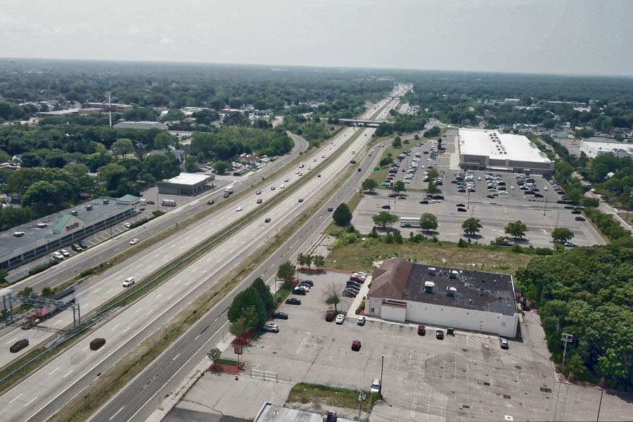
Patchogue is an incorporated village in the Town of Brookhaven, Suffolk County, on Long Island’s South Shore. Located along the Great South Bay roughly 60 miles east of Manhattan, Patchogue has developed into one of central Suffolk County’s most active downtown and waterfront communities.
The village is known for its walkable Main Street, Patchogue Theatre for the Performing Arts, restaurants, breweries, arts organizations, waterfront parks and seasonal ferry connections to Fire Island National Seashore. Patchogue also has a deeper industrial and maritime history than its modern downtown might suggest, having grown from a collection of water-powered mills into a manufacturing center, summer resort, railroad destination and important South Shore port before reinventing itself during the late 20th and early 21st centuries.
The 2020 Census counted 12,408 residents within approximately 2.26 square miles of land, giving Patchogue a population density of roughly 5,490 people per square mile. The Census Bureau estimated the village population at 12,486 in 2025.
History of Patchogue
Patchogue’s development is closely tied to the streams, creeks and protected waters that flow toward the Great South Bay. Historical accounts describe settlement taking shape during the 18th century, when waterways including the Patchogue River, Swan River and Tuthills Creek provided the water power needed for mills and early manufacturing.
The origin of the name Patchogue is generally traced to an Indigenous place name, although historical spellings and interpretations vary. Long before incorporation, the community had become an established center of settlement and commerce on the South Shore.
Water power played an unusually important role in Patchogue’s early economy. Gristmills, sawmills, paper mills, textile operations and other manufacturers developed along the village’s streams. By the 19th century, Patchogue was sufficiently associated with its numerous mills to earn the nickname “Milltown.”
Mills, Factories and the Lace Industry
Patchogue eventually became one of Long Island’s more important manufacturing communities. Its industries produced a remarkable range of goods, including lumber, paper, cotton products, twine, textiles, crinoline and lace. The combination of water power, access to the bay and later railroad transportation helped support an industrial economy that was unusual for a community now primarily associated with restaurants, entertainment and waterfront recreation.
The Patchogue Lace Mill became one of the community’s best-known industrial operations. The mill complex developed on a site that had previously supported other manufacturing activities, including paper and textile production. Lace finishing and manufacturing expanded during the late 19th and early 20th centuries, and skilled workers were brought from the English lace-making center of Nottingham to work in Patchogue.
At its height, the lace operation became a major local employer and helped establish Patchogue as a significant textile-manufacturing center. During World War II, the mill also produced materials for the war effort. Like many northern manufacturing operations, however, Patchogue’s mills faced growing competition from lower-cost production elsewhere. The lace mill ultimately closed during the 1950s, part of a broader decline in the industrial economy that had supported the village for generations.
The Railroad and Patchogue’s Resort Era
Railroad service reached Patchogue in 1869, connecting the village more directly with western Long Island and New York City. The arrival of the railroad changed both the local economy and the way visitors reached the South Shore. Patchogue became an important railroad destination and developed into a popular summer resort community during the late 19th and early 20th centuries.
Hotels, boarding houses, restaurants, boat facilities and recreational businesses served summer visitors who came to enjoy the bay, fishing, boating and a comparatively rural escape from New York City. The village’s location on the Great South Bay also supported commercial fishing, shellfishing, boatbuilding and maritime trade.
The Patchogue River became particularly important to this maritime economy. In 1890, the U.S. Army Corps of Engineers dredged the river, improving navigation and helping establish Patchogue as a deep-water South Shore port. The village served as a United States port of entry into the early 20th century, reflecting the scale of the commercial activity once centered around its waterfront.
Incorporation and the Growth of the Village
Patchogue was officially incorporated as a village in 1893, creating a municipal government within the larger Town of Brookhaven. Like other incorporated villages on Long Island, Patchogue remained geographically part of its town while gaining an additional level of local government responsible for village services, planning and community development.
By the early 20th century, Patchogue had become one of the leading commercial centers in Suffolk County. Main Street served residents from a much larger surrounding area, while local industries, rail transportation and maritime businesses provided employment. The village was sometimes promoted as the “Queen City of the South Shore,” a name reflecting its regional importance during this period.
Patchogue Theatre and the Entertainment District
The Patchogue Theatre for the Performing Arts opened on East Main Street in 1923, during the height of Patchogue’s growth as a regional commercial and entertainment center. The theater presented movies, vaudeville and live performances and became one of the village’s most recognizable landmarks.
Like many large downtown theaters, the building struggled as entertainment habits changed. It was eventually converted for movie use and later stood vacant. The Village of Patchogue acquired the theater during the 1990s, and an extensive restoration returned it to use as a live performance venue. Much of the original architectural character had survived beneath later alterations, allowing important decorative features, the stage and other elements to be incorporated into the restoration.
Today, Patchogue Theatre presents concerts, comedy, theatrical productions and other live entertainment throughout the year. Its restoration also became an important early component of the larger effort to bring activity back to Main Street.
Downtown Decline and Revitalization
Patchogue’s downtown declined significantly during the decades following World War II. Manufacturing jobs disappeared, automobile travel changed vacation patterns, suburban shopping centers drew customers away from traditional Main Streets, and several prominent properties became vacant or deteriorated.
By the late 20th century, village officials, business owners and community organizations had begun a long-term effort to reverse that decline. Infrastructure improvements proved particularly important. Expansion of sewer service and upgrades to the village wastewater-treatment system created capacity for restaurants, housing and other uses that would have been difficult to support with conventional septic systems. Streetscape improvements, façade programs, parking investments, redevelopment planning and the restoration of the Patchogue Theatre followed.
New apartments and mixed-use development brought more residents within walking distance of Main Street, while independent businesses, restaurants, nightlife and breweries helped turn the downtown into a regional destination. Rather than functioning primarily as a daytime shopping district, modern Patchogue developed a strong evening and weekend economy built around dining, entertainment, arts and events.
The transformation became widely recognized as a successful example of suburban downtown redevelopment. Continued investment remains part of the village’s plans. In 2026, Patchogue was awarded $4.5 million through New York State’s NY Forward program for projects intended to strengthen the downtown economy, improve public spaces, expand housing opportunities and support additional long-term revitalization.
Downtown Patchogue Today
Main Street and the surrounding downtown now form the center of village life. Visitors will find a dense collection of restaurants, shops, bars, breweries, entertainment venues and community spaces within a relatively compact area. The Patchogue Theatre is one of the principal anchors, but the district also supports smaller performance spaces, galleries, public art and seasonal street events.
The Patchogue Arts Council and Museum of Contemporary Art Long Island, commonly known as MoCA L.I., have helped strengthen the village’s visual-arts identity. Terry Street has emerged as an arts district, while programs such as Arts on Terry and MoCA L.I.ghts bring exhibitions, installations, projections and public art into the downtown environment.
Patchogue’s event calendar also extends to the waterfront. The Great South Bay Music Festival, founded in 2007, brings national, regional and local performers to Shorefront Park overlooking the Great South Bay. The combination of downtown entertainment and bayfront events gives Patchogue a broader cultural role than many similarly sized Long Island villages.
Patchogue’s Waterfront
Although Main Street receives much of the attention, Patchogue remains fundamentally a waterfront community. The Patchogue River flows through the village toward Patchogue Bay and the larger Great South Bay, supporting marinas, recreational boating, ferry operations, restaurants and other maritime uses.
Mascot Dock at the end of South Ocean Avenue provides direct public access to the bay and is one of the village’s recognizable waterfront gathering places. Sandspit Marina, located near the mouth of the Patchogue River, is a Town of Brookhaven waterfront facility with marina and recreational uses. Together with Shorefront Park and the riverfront, these areas give Patchogue several distinct ways to reach the water rather than concentrating public access at a single location.
Shorefront Park and the Living Shoreline
Shorefront Park is one of Patchogue’s principal public waterfront spaces. Located along the Great South Bay, the park includes walking areas, a playground, athletic facilities, a bandshell and broad views across the bay. It also serves as the home of the Great South Bay Music Festival and other community events.
The park has also become notable for a major coastal-resilience project. Patchogue replaced approximately 1,300 feet of deteriorating bulkhead with a living shoreline designed to absorb wave energy, restore tidal habitat, improve water quality and make the waterfront more resilient to erosion and flooding. The project created new salt-marsh and intertidal habitat while adding walking paths, pedestrian bridges, improved waterfront access and a kayak launch near Mascot Dock.
The living shoreline demonstrates how Patchogue’s relationship with the Great South Bay continues to evolve. The same waterfront that historically supported mills, boatbuilding, fishing and shipping is now also being managed for recreation, habitat restoration and coastal resilience.
Gateway to Fire Island
Patchogue is one of the three principal mainland ferry gateways to Fire Island, along with Bay Shore and Sayville. Each mainland community serves different portions of the barrier island, making it important for travelers to use the correct departure point. The Long Island Guide’s Fire Island ferry guide explains the principal mainland terminals and destinations.
From Patchogue, passenger ferry service connects with Davis Park and Watch Hill. Davis Park service operates from the Brightwood Street waterfront area, while Watch Hill ferries use a separate terminal on West Avenue along the Patchogue River. Travelers should not assume that both ferries leave from the same location and should confirm the current terminal, schedule and parking arrangements before departing.
Watch Hill is part of Fire Island National Seashore, and the National Park Service maintains facilities in Patchogue associated with the ferry connection. The village therefore functions not only as a destination itself but also as an important staging point for visitors traveling across the Great South Bay to Fire Island.
Parks and Recreation
Beyond Shorefront Park, Patchogue maintains a network of neighborhood parks and recreation facilities. Rider Avenue Park provides athletic space, while Mascot Dock offers fishing and waterfront access. The village also operates tennis and pickleball facilities, playgrounds and the Patchogue Village Pool and Beach Club.
The village’s waterfront location also makes boating, fishing and other bay activities an important part of local recreation. Visitors looking beyond Patchogue can explore Long Island Guide directories covering marinas, beaches and fishing on Long Island.
Schools, Library and Community Life
Patchogue is served by the Patchogue-Medford School District, which also serves neighboring Medford. Because school district boundaries on Long Island do not necessarily follow village or hamlet boundaries, residents evaluating a particular property should confirm its assigned district and schools rather than relying solely on the postal address.
The Patchogue-Medford Library provides library services, educational programming, research resources and community activities. The village’s combination of civic institutions, arts organizations, parks, downtown businesses and public events gives Patchogue a strong year-round community identity beyond its role as a dining and entertainment destination.
Transportation and Getting Around
Patchogue has long been one of the better-connected communities on central Long Island’s South Shore. The village’s Long Island Rail Road station is located just south of Main Street on the Montauk Branch, placing the downtown within walking distance of rail service. Trains connect Patchogue with communities farther west and with transfers for travel toward New York City, while eastbound service continues toward communities on the East End.
For drivers, Sunrise Highway passes immediately north of the village and provides the principal high-speed east-west route. Montauk Highway, which follows Main Street through the village, connects Patchogue with neighboring South Shore communities. Route 112 begins in Patchogue and runs north through North Patchogue and Medford toward northern Brookhaven.
Suffolk County Transit bus routes also serve the Patchogue area. Within the downtown itself, many restaurants, shops, the theater, railroad station and civic destinations are close enough together that visitors can park once or arrive by train and explore much of the central business district on foot.
Patchogue and the Surrounding Communities
Patchogue Village should not be confused with the larger postal and community area surrounding it. North Patchogue is a separate hamlet immediately north of the incorporated village, while East Patchogue extends eastward toward Bellport. Medford lies farther north, and the waterfront communities of Blue Point and Bayport are located to the west.
This location places Patchogue near a broad range of central Suffolk destinations. Bellport offers another historic village center and Great South Bay waterfront to the east, while Sayville provides another active South Shore downtown and one of the other principal ferry gateways to Fire Island. Inland communities such as Holtsville, Farmingville and Medford are also within a relatively short drive.
Patchogue Today
Modern Patchogue combines several identities within a compact village. It is a historic manufacturing and maritime community, an established residential village, a regional restaurant and nightlife destination, an arts center, a railroad community and a gateway to the Great South Bay and Fire Island. That mix helps distinguish Patchogue from communities that are primarily residential or primarily seasonal.
The village’s revitalization has not erased its earlier landscape. The Patchogue River, former mill sites, older commercial buildings, historic churches, residential streets and bayfront remain intertwined with newer apartments, restaurants, public spaces and cultural institutions. The result is a downtown that has changed substantially while still retaining visible connections to the industries, transportation routes and waterways that originally shaped the community.
Patchogue, New York
Key Facts and Details
| Community | Patchogue |
| Municipal Status | Incorporated village |
| Town | Town of Brookhaven |
| County | Suffolk County |
| Region | South Shore of Long Island |
| Incorporated | 1893 |
| 2020 Census Population | 12,408 |
| 2025 Population Estimate | 12,486 |
| Land Area | Approximately 2.26 square miles |
| 2020 Population Density | Approximately 5,490 residents per square mile |
| Historic Nicknames | Milltown and Queen City of the South Shore |
| Historic Economy | Milling, textiles, lace manufacturing, boatbuilding, fishing, shellfishing, shipping, tourism and retail |
| Railroad Arrival | 1869 |
| Rail Transportation | Long Island Rail Road Montauk Branch |
| Major Waterfront | Patchogue River, Patchogue Bay and Great South Bay |
| Major Downtown Corridor | Main Street / Montauk Highway |
| Major Highway | Sunrise Highway |
| Major Cultural Venue | Patchogue Theatre for the Performing Arts |
| Theatre Opened | 1923 |
| Arts | Patchogue Arts Council, MoCA L.I., Terry Street arts district, galleries, public art and cultural events |
| Major Waterfront Park | Shorefront Park |
| Major Music Event | Great South Bay Music Festival |
| Waterfront Resilience | Approximately 1,300 feet of living shoreline at Shorefront Park |
| Public Waterfront Access | Shorefront Park, Mascot Dock, Patchogue River waterfront and Sandspit area |
| Fire Island Access | Passenger ferry service to Davis Park and Watch Hill |
| Fire Island Role | One of the principal mainland gateways to Fire Island National Seashore |
| School District | Patchogue-Medford School District |
| Nearby Communities | North Patchogue, East Patchogue, Medford, Blue Point, Bayport, Sayville and Bellport |
| Downtown Character | Walkable restaurant, shopping, arts, entertainment and mixed-use district |
| Current Revitalization | Continued downtown investment, including a $4.5 million NY Forward award announced in 2026 |
Patchogue’s importance on the South Shore comes from the way several different chapters of Long Island history converge within one relatively small village. Water-powered mills and the Patchogue Lace Mill established its industrial reputation, the railroad and Great South Bay helped turn it into a resort and maritime center, and the decline of those older industries eventually forced the community to reinvent itself. Today’s village has emerged as one of Suffolk County’s most active downtown destinations, anchored by Patchogue Theatre, a growing arts community, restaurants, events and a revitalized waterfront. At the same time, Shorefront Park, the Patchogue River, ferry connections to Davis Park and Watch Hill, and direct access to the Great South Bay preserve the maritime identity that has shaped Patchogue for generations, giving the village a combination of history, walkability, culture and waterfront access that remains distinctive on Long Island.
Are you ready for fall on Long Island? Check out these local seasonal guides:
🍎 Apple Picking | 🍂 Fall Festivals & Farm Activities | 👻 Haunted Houses | 🎃 Pumpkin Picking