
Traffic & Commute Statistics (Nassau & Suffolk Counties)
With nearly 3 million people across Nassau County and Suffolk County, Long Island is one of the most heavily traveled suburban regions in the United States. Commuting is central to daily life, whether residents travel by car, the Long Island Rail Road (LIRR), bus, ferry, bicycle, or a combination of modes.
This page compiles official and public data from the Metropolitan Transportation Authority (MTA), the Long Island Rail Road, the New York State Department of Transportation (NYSDOT), the NYSDOT Traffic Data Viewer, the U.S. Census Bureau, data.census.gov, and Census Reporter to provide a current view of commute times, transportation modes, rail ridership, traffic volumes, and commuting patterns across Long Island.
Long Island Commute Snapshot (Latest Public Data)
| Category | Nassau County | Suffolk County | Long Island / Nassau-Suffolk Region |
|---|---|---|---|
| Mean Travel Time to Work | 37.8 minutes | 31.3 minutes | 34.4 minutes |
| Population Base | 1,392,438 | 1,535,909 | 2,928,347 |
| Primary Commute Pattern | Higher New York City and LIRR commuter orientation | More intra-county and car-based commuting | Car travel remains dominant, with rail most important for NYC-bound commuters |
| Public Transit Role | Higher than Suffolk due to proximity to NYC and dense LIRR service | Lower than Nassau but important along LIRR branches and bus corridors | LIRR, NICE Bus, Suffolk County Transit, ferries, and local shuttles all serve regional mobility |
| LIRR Annual Ridership | Reported systemwide by MTA rather than by county in public annual summaries | 82 million riders in 2025 | |
| LIRR Recovery Level | Systemwide measure | 90% of 2019 pre-COVID ridership in 2025 | |
| Traffic Data Source | NYSDOT Traffic Data Viewer and traffic count programs | AADT and traffic-station data for highways, parkways, and state roads | |
Sources: ACS 2024 1-year data via Census Reporter, MTA LIRR Annual Ridership Report, MTA financial and ridership reports, and NYSDOT Traffic Data Viewer. County commute-time figures measure residents’ travel time to work and do not include people who work from home.
Average Commute Times
Commute times on Long Island remain longer than the national average, especially in Nassau County, where more workers commute toward New York City or job centers closer to the city line. Suffolk’s average commute time is lower than Nassau’s in the latest ACS data, but many Suffolk residents still face long travel times because of the county’s large geography, car-dependent development patterns, and east-west commuting corridors.
| Area | Mean Travel Time to Work | Source / Period |
|---|---|---|
| Nassau County | 37.8 minutes | ACS 2024 1-year estimate via Census Reporter |
| Suffolk County | 31.3 minutes | ACS 2024 1-year estimate via Census Reporter |
| Nassau-Suffolk Region | 34.4 minutes | ACS 2024 1-year estimate via Census Reporter |
| United States | 27.2 minutes | ACS 2024 comparison figure |
| New York-Newark-Jersey City Metro Area | 36.5 minutes | ACS 2024 comparison figure |
Note: ACS commute-time data reflects workers who commute. People who work from home are generally not included in mean travel-time calculations because they do not make a commute trip.
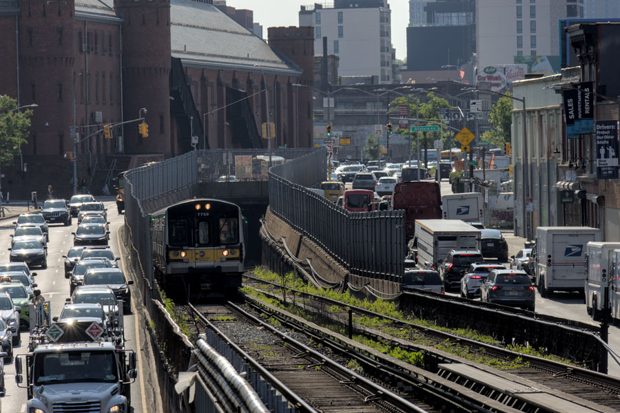
Car, Train & Transit Use
Long Island remains heavily car-dependent, but the region also has one of the most important commuter-rail systems in North America. Nassau residents are more likely than Suffolk residents to use rail or other transit for commuting because Nassau is closer to New York City, has shorter rail travel times to Manhattan, and has denser LIRRv service across several branches. Suffolk residents are more likely to rely on driving, especially outside western Suffolk and outside communities close to LIRR stations.
- Car commuting: Driving remains the dominant commute mode across both counties, especially for local jobs, reverse commutes, school-related travel, shopping, and suburban work trips.
- LIRR commuting: The Long Island Rail Road remains the region’s primary rail connection to Manhattan, Brooklyn, Queens, and major transfer points such as Jamaica.
- Post-pandemic ridership recovery: MTA reported that LIRR carried 82 million customers in 2025, up from 2024 and equal to 90% of 2019 pre-COVID ridership.
- Non-commutation growth: MTA reported that non-commutation LIRR ridership exceeded pre-pandemic levels in 2025, reflecting stronger off-peak, weekend, event, and leisure travel.
- Bus networks: NICE Bus serves Nassau County, while Suffolk County Transit serves Suffolk County. Bus use is important for local mobility but represents a smaller share of total commuting than driving.
LIRR Ridership Update
The Long Island Rail Road has continued its recovery from the COVID-era ridership collapse. Ridership patterns are different from 2019 because hybrid work reduced some traditional five-day commuting, while off-peak, weekend, and event-driven travel became more important. Grand Central Madison, East Side Access service patterns, event travel, and improved on-time performance have also influenced how riders use the system.
| LIRR Measure | Latest Public Figure | Notes |
|---|---|---|
| Total Annual Ridership | 82 million customers in 2025 | Up 6.5 million from 2024. |
| Recovery vs. 2019 | 90% of pre-COVID ridership | MTA comparison to 2019 annual ridership. |
| Commutation Ridership | 31 million customers in 2025 | Up 9.6% from 2024. |
| Non-Commutation Ridership | 51 million customers in 2025 | Up 7.9% from 2024 and above pre-pandemic levels. |
| On-Time Performance | 96.17% in 2025 | MTA reported performance above its goal. |
| Early 2026 Trend | 18.9 million riders through March 2026 | MTA reported year-to-date ridership 4.8% above 2025 through March. |
Note: MTA annual ridership figures are systemwide LIRR figures and are not directly divided between Nassau and Suffolk in the public annual summary. Station-level or branch-level ridership requires separate MTA datasets or reports.
Traffic Volumes & Major Road Corridors
Long Island’s road network carries heavy daily traffic across east-west highways, north-south arterials, parkways, village main streets, and commercial corridors. The Long Island Expressway (I-495), Northern State Parkway, Southern State Parkway, Sunrise Highway, Meadowbrook State Parkway, Wantagh State Parkway, Sagtikos / Sunken Meadow Parkway, and major county roads all carry significant commuter and commercial traffic.
- Long Island Expressway (I-495): The region’s primary east-west interstate route, carrying heavy commuter, commercial, and freight traffic across Nassau and Suffolk.
- Northern State Parkway: A major east-west parkway serving northern and central Nassau and western Suffolk commuting patterns.
- Southern State Parkway: One of the busiest parkways in the region, serving dense South Shore and central Long Island travel demand.
- Sunrise Highway / NY-27: A major South Shore and eastern Suffolk corridor, serving commuters, local traffic, freight, and seasonal East End travel.
- Meadowbrook, Wantagh, Seaford-Oyster Bay, Sagtikos, and Sunken Meadow parkways: Important north-south connectors linking neighborhoods, beaches, job centers, and east-west corridors.
NYSDOT’s Traffic Data Viewer is the best source for current Annual Average Daily Traffic (AADT), truck counts, traffic stations, and segment-level traffic volumes. Because AADT varies significantly by exact location, direction, interchange, and year, this page avoids presenting single fixed traffic-volume numbers for entire highways.
Commuting Patterns
Long Island commuting is best understood as several overlapping travel markets rather than one single pattern. Many residents commute into New York City, especially from Nassau and western Suffolk. Others work within their home county, commute between Nassau and Suffolk, travel to Queens or Brooklyn, or work from home part of the week. Hybrid work has made commuting less uniform than it was before 2020.
| Commute Pattern | Where It Is Most Common | Transportation Impact |
|---|---|---|
| NYC-bound rail commuting | Nassau, western Suffolk, and communities near LIRR stations | Supports LIRR peak-period demand and station-area parking / drop-off activity. |
| Local suburban commuting | Both counties, especially Suffolk | Relies heavily on cars, parkways, arterial roads, and local commercial corridors. |
| Reverse commuting | NYC or Nassau workers traveling to Long Island job centers | Supports reverse-peak LIRR travel and major highway flows. |
| Hybrid / remote work | Professional, office, technical, finance, and administrative workers | Reduces some five-day peak commuting but increases variation by day of week. |
| Seasonal and event travel | East End, beaches, parks, arenas, concert venues, and summer destinations | Creates weekend, off-peak, and seasonal congestion outside traditional commute hours. |
Hybrid work remains one of the biggest post-pandemic changes in the region’s transportation system. It has reduced some traditional commuter trips while increasing the importance of flexible travel, off-peak rail ridership, weekend service, and non-work trips.
Buses, Ferries & Local Transportation
Although Long Island is often described through its highways and LIRR branches, local transportation also includes buses, ferries, shuttles, paratransit, taxis, rideshare services, bicycles, and pedestrian connections. These modes are especially important for residents without cars, seniors, students, workers in service industries, people with disabilities, and communities where rail access is limited.
- NICE Bus: Provides bus service across Nassau County and connections to Queens and transit hubs.
- Suffolk County Transit: Provides bus service across Suffolk County, including local routes, regional routes, and connections to LIRR stations.
- Ferries: Long Island ferry routes connect communities including Shelter Island, Fire Island, the North Fork, Connecticut, and other coastal destinations.
- Paratransit and accessibility services: Transit agencies and local providers serve riders who need accessible transportation options.
Methodology
- Commute times: Based on U.S. Census Bureau American Community Survey (ACS) 2024 1-year estimates, accessed through Census Reporter and Census data tools.
- Transportation modes: Based on ACS journey-to-work data and related Census commuting tables. Mode shares can vary by table, geography, year, and whether work-from-home is included.
- Rail ridership: Based on MTA / Long Island Rail Road annual ridership reports, financial and ridership reports, and public MTA reporting.
- Traffic counts: Based on NYSDOT Traffic Data Viewer, traffic stations, Annual Average Daily Traffic (AADT), continuous counts, short counts, and traffic-volume reports.
- Coverage: Includes Nassau and Suffolk residents, commuters, highways, parkways, public transit, and regional transportation systems. Some datasets measure residents by place of residence, while others measure trips, riders, roads, stations, or vehicles.
- Limitations: Commute data, ridership data, and traffic data are not interchangeable. A commute-time estimate measures workers; LIRR ridership counts passenger trips; AADT counts vehicles on a road segment; and traffic conditions vary by time of day, season, direction, weather, and construction.
FAQ
Q: Why is Nassau’s average commute longer than Suffolk’s in the latest ACS data?
A: Nassau has a higher share of workers commuting toward New York City or other longer-distance job centers, while Suffolk has more workers who work within Suffolk or elsewhere on Long Island. Individual commutes vary widely by town, job location, mode, and schedule.
Q: Is the LIRR back to pre-pandemic ridership?
A: Not fully on an annual basis. MTA reported that LIRR reached 90% of 2019 pre-COVID ridership in 2025. However, non-commutation ridership exceeded pre-pandemic levels, showing that off-peak, weekend, leisure, and event travel have become more important.
Q: Which roads are most congested?
A: The Long Island Expressway, Northern State Parkway, Southern State Parkway, Sunrise Highway, Meadowbrook State Parkway, Wantagh State Parkway, and major local arterials are among the region’s most heavily traveled corridors. Exact traffic volumes should be checked by segment in the NYSDOT Traffic Data Viewer.
Q: Did commute patterns change after COVID?
A: Yes. Hybrid work, remote work, flexible schedules, and changing office patterns reduced some traditional peak commuting while increasing the importance of off-peak, weekend, and non-work travel. LIRR ridership has continued to recover, but the mix of riders is different from 2019.
Q: How often is this data updated?
A: ACS commute data is updated annually. MTA ridership data is released monthly and annually. NYSDOT traffic data is updated through traffic count programs, with the most recent published traffic data often reflecting the prior year after processing and quality control.
Data Sources & Updates
Data Last Updated: June 2026.
The traffic and commuting information presented on this page is compiled from official and public transportation data sources, including the Metropolitan Transportation Authority (MTA), the Long Island Rail Road (LIRR), MTA annual LIRR ridership reporting, MTA financial and ridership reports, the New York State Department of Transportation (NYSDOT), the NYSDOT Traffic Data Viewer, New York Open Data traffic resources, the U.S. Census Bureau, data.census.gov, the American Community Survey (ACS), and Census Reporter. Data is reviewed periodically and updated as new ACS commute estimates, MTA ridership reports, NYSDOT traffic counts, and regional transportation datasets become available.
Because transportation statistics come from multiple reporting systems, figures may not align perfectly across sources. Commute times, mode shares, LIRR ridership, traffic counts, bus ridership, ferry usage, and road congestion each measure different parts of the regional transportation system. Monthly ridership and traffic data may be revised, and traffic volumes can vary significantly by road segment, direction, season, and time of day.
