
Peconic River
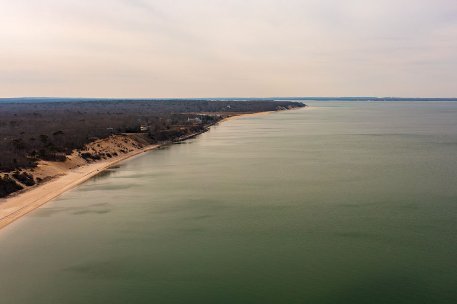
The Peconic River is the longest river on Long Island, flowing approximately 15 miles eastward through the Pine Barrens, wetlands, woodlands and coastal communities of Suffolk County. The river begins near Brookhaven National Laboratory and eventually empties into Flanders Bay at Riverhead.
In Short
The Peconic River is one of Long Island’s most important natural waterways. It passes through the towns of Brookhaven, Riverhead and Southampton, forms part of the eastern Pine Barrens landscape and changes from a freshwater river into a tidal estuary near Riverhead. The river’s mouth helped give Riverhead its name because the community sits at the head of the river.
A River Through the Pine Barrens
The Peconic River’s headwaters are located west of Brookhaven National Laboratory. From there, the river flows east through protected Pine Barrens forests, bogs, swamps and freshwater wetlands before reaching the more developed area around Riverhead.
Much of the river corridor remains surrounded by publicly protected land. This helps preserve important habitats and allows portions of the river to retain a relatively natural character despite crossing roads, rail lines and developed areas.
Freshwater River and Tidal Estuary
The upper Peconic River is primarily freshwater. As it approaches Riverhead, tidal influence becomes more significant and the river takes on the characteristics of an estuary. This transition connects freshwater wetlands with the brackish waters of Flanders Bay and the larger Peconic Bay system.
The flow of freshwater into the Peconic estuary is important to the health of surrounding bays, marshes and aquatic habitats. The river supports a variety of fish, birds, turtles, amphibians and other wildlife throughout its watershed.
Parks and Public Access
Several parks and natural areas provide opportunities to experience the Peconic River and its surrounding watershed. Peconic River County Park in Riverhead includes trails and natural areas near the river, while Indian Island County Park is located at the river’s estuarine mouth near Flanders Bay.
Other protected areas within the broader watershed include the Pine Barrens, Cranberry Bog County Park and portions of the river corridor near Calverton and Manorville. Access varies by property, and visitors should follow posted rules regarding parking, boating, fishing, hunting and seasonal use.
Boating, Fishing and Wildlife
The slow-moving lower river and connected waterways are used for canoeing, kayaking and other forms of non-motorized boating. Conditions vary along the river, and paddlers should be prepared for shallow water, wetlands, changing tides, fallen branches and limited access points.
The Peconic River watershed also provides opportunities for fishing and wildlife observation. Fish passage and habitat-improvement projects have been undertaken to help restore connections between the river, its tributaries and upstream freshwater areas.
History and Importance to Riverhead
The Peconic River has influenced settlement, transportation, agriculture and commerce in eastern Suffolk County for centuries. Riverhead developed around the point where the river reaches the Peconic estuary, and the waterway remains an important geographic feature of the community.
Today, the river is valued not only for its historical role but also for its ecological importance. Its protected headwaters, Pine Barrens surroundings and estuarine mouth make it one of the most diverse and significant waterways on Long Island.
Peconic River
Key Facts & Details
| Official name | Peconic River |
| Type | Freshwater river and tidal estuary |
| Length | Approximately 15 miles |
| Headwaters | Wetlands west of Brookhaven National Laboratory |
| Mouth | Flanders Bay near Riverhead |
| Watershed | Approximately 75 square miles |
| Towns crossed | Brookhaven, Riverhead and Southampton |
| Landscape | Pine Barrens, wetlands, bogs, swamps, woodlands, farms and coastal estuary |
| Major connected water | Flanders Bay and the Peconic Bay system |
| Public recreation | Canoeing, kayaking, fishing, hiking, bird-watching and wildlife observation in designated areas |
| Notable public areas | Peconic River County Park, Indian Island County Park and other protected lands within the watershed |
| Ecological importance | Provides freshwater inflow and habitat for the Peconic estuary |
| Related guide | Bays, Harbors, Inlets and Waterways |
The Peconic River is a defining natural feature of eastern Long Island, linking the Pine Barrens with the estuarine waters of Flanders Bay and the Peconic Bay system. Its combination of freshwater wetlands, protected forests, public parks and tidal habitat makes it one of the island’s most important waterways. Visitors exploring the river should use designated access areas, check current park regulations and remain aware that conditions differ between the freshwater upper river and the tidal lower river near Riverhead.
Are you ready for fall on Long Island? Check out these local seasonal guides:
🍎 Apple Picking 🍓 Strawberry Picking 🎃 Pumpkin Picking 👻 Haunted Houses 🍂 Farm Festivals
