
Laurel, New York
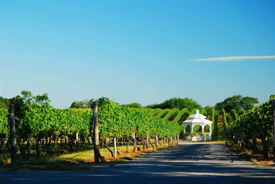
Laurel is a quiet hamlet on Long Island’s North Fork, known for its vineyards, working farms, wooded roads, and shoreline along the Great Peconic Bay. Located in the Town of Southold near the boundary with the Town of Riverhead, Laurel sits between Mattituck and Jamesport along Main Road.
The hamlet is primarily residential and agricultural, with vineyards, nurseries, farm fields, waterfront homes, and small local businesses spread across a lightly developed landscape. Laurel does not have a large downtown district, giving it a peaceful character even during the North Fork’s busy summer and fall tourism seasons.
Agricultural Heritage
Farming has shaped Laurel and the surrounding North Fork for generations. The area’s fertile soil and maritime climate supported potatoes, vegetables, fruit, flowers, and other crops grown for local markets and shipment to communities throughout the Northeast.
While some former farmland has been developed, agriculture remains visible throughout Laurel. Vineyards, produce farms, garden centers, nurseries, and roadside markets continue to preserve the rural appearance of the hamlet and connect it with the North Fork’s longstanding farming traditions.
Vineyards and North Fork Wine Country
Laurel lies within North Fork Wine Country, surrounded by vineyards and tasting rooms in Laurel, Mattituck, Cutchogue, and neighboring communities. The region’s climate, moderated by the surrounding bays and the Long Island Sound, supports a wide variety of wine grapes.
Wine tourism is especially active from late spring through the fall harvest season. Visitors often combine vineyard stops with farm markets, restaurants, antique shops, beaches, and scenic drives along Main Road and nearby country roads.
Laurel Lake Preserve
Laurel Lake Preserve protects woodlands, wetlands, and freshwater habitat in the northern portion of the hamlet. Walking trails pass through a landscape that contrasts with the nearby farms and vineyards, offering opportunities for hiking, nature observation, photography, and birdwatching.
The preserve is one of several protected natural areas on the North Fork and helps maintain open space in a region facing continued residential and tourism-related development.
Beaches and the Peconic Bay
Southern Laurel reaches the shoreline of the Great Peconic Bay, where calm water and protected coves support swimming, kayaking, paddleboarding, boating, and fishing. Local beaches and waterfront properties provide broad views across the Peconic Bay system toward the South Fork.
The bay is also an important ecological resource, supporting shellfish, finfish, wetlands, and migratory birds. Access rules at local beaches may vary by season and residency, so visitors should confirm parking and permit requirements before arriving.
Living in Laurel
Laurel includes a mixture of historic farmhouses, modest residential neighborhoods, waterfront homes, larger rural properties, and newer construction. Development is generally less dense than in communities farther west, and many roads remain bordered by farms, woods, vineyards, and open land.
Residents commonly travel to nearby Mattituck, Cutchogue, Riverhead, and Southold for major shopping, restaurants, healthcare, government services, and other everyday needs. Laurel is served by the Mattituck-Cutchogue Union Free School District.
Transportation
Main Road, designated New York State Route 25, is the principal east-west route through Laurel. It connects the hamlet with Riverhead and Jamesport to the west and Mattituck, Cutchogue, Southold, and Greenport to the east.
Laurel does not have its own Long Island Rail Road station. The nearest station is in Mattituck on the Ronkonkoma Branch, while additional rail service is available from Riverhead. Train service on the North Fork is limited compared with western Long Island, making personal vehicles the primary form of transportation.
Map of Laurel, New York
Key Facts & Details
| Location | North Fork of Suffolk County |
|---|---|
| Municipality | Town of Southold |
| Community Type | Hamlet and census-designated place |
| ZIP Code | 11948 |
| Known For | Vineyards, farms, Laurel Lake Preserve, rural roads, and bayfront scenery |
| Waterfront | Great Peconic Bay |
| Major Road | Main Road, New York State Route 25 |
| Nearest LIRR Station | Mattituck |
| School District | Mattituck-Cutchogue Union Free School District |
| Nearby Communities | Jamesport, Mattituck, Cutchogue, and Aquebogue |
| Regional Character | Agricultural, residential, coastal, and wine-producing |
Laurel remains one of the North Fork’s quieter communities, where vineyards, farms, woodlands, and the shoreline of the Great Peconic Bay come together within a compact rural hamlet. Its location between Riverhead and Mattituck makes it a convenient base for exploring eastern Long Island while preserving the peaceful agricultural character that continues to distinguish the North Fork.
Are you ready for fall on Long Island? Check out these local seasonal guides:
🍎 Apple Picking 🍓 Strawberry Picking 🎃 Pumpkin Picking 👻 Haunted Houses 🍂 Farm Festivals
