
Brooklyn–Queens Expressway (BQE / I-278)
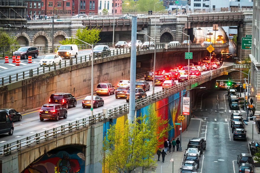
The Brooklyn–Queens Expressway (BQE), the best-known New York City segment of Interstate 278 (I-278), is one of the region’s most heavily traveled roadways. In everyday use, drivers often think of the BQE and adjacent I-278 approaches as a single corridor linking the Verrazzano-Narrows Bridge and southern Brooklyn with northern Brooklyn, western Queens, the Robert F. Kennedy (RFK) Bridge area, and onward connections into the Bronx. For Long Island travelers, it remains an important connector to the Long Island Expressway (I-495), Grand Central Parkway, major East River crossings, and freight routes serving New York City. Traffic patterns, lane configurations, and construction impacts can change, so it is wise to check conditions before peak-hour trips.
History
- Origins: The BQE was planned during the Robert Moses era as part of New York’s mid-20th-century highway buildout, intended to move both passenger traffic and commercial vehicles across the city.
- Construction: The corridor was built in stages from the 1940s into the 1960s. Its most famous engineering feature, the triple-cantilever section beside the Brooklyn Heights Promenade, dates to the mid-century buildout.
- Long-Term Role: Over time, the route became a critical link for commuting, shipping, airport access, and cross-borough travel between Brooklyn, Queens, Manhattan, Staten Island, and Long Island.
- Ongoing Infrastructure Work: Because the expressway carries heavy daily traffic on aging structures, rehabilitation, monitoring, and traffic-management efforts continue, especially around the Brooklyn Heights section.
Route Description
- Southern Gateway: For most travelers, the corridor begins at the Verrazzano-Narrows Bridge approach and the adjoining Gowanus Expressway in southwestern Brooklyn.
- Through Brooklyn: The route runs past Bay Ridge, Sunset Park, Gowanus, Brooklyn Heights, Downtown Brooklyn, the Brooklyn Navy Yard area, and Williamsburg.
- Through Queens: It crosses the Kosciuszko Bridge corridor and continues through western Queens, including Maspeth and Woodside, with key interchanges for the Long Island Expressway (I-495) and Grand Central Parkway.
- Northward Connections: Near Astoria and the RFK Bridge approaches, I-278 continues toward major Bronx links including the Bruckner Expressway and the Major Deegan Expressway.
Major Connections
- Verrazzano-Narrows Bridge – Main link to Staten Island and the broader I-278 corridor.
- Gowanus Expressway (I-278) – Southern Brooklyn continuation feeding the BQE corridor.
- Hugh L. Carey Tunnel (formerly the Brooklyn-Battery Tunnel) – Access to Lower Manhattan via connecting roadways.
- Williamsburg Bridge / Manhattan Bridge / Brooklyn Bridge – Major crossings into Manhattan reached from BQE-area approaches.
- Long Island Expressway (I-495) – Key route toward central and eastern Queens, Nassau, and Suffolk Counties.
- Grand Central Parkway / Robert F. Kennedy (RFK) Bridge – Connections to northern Queens, LaGuardia Airport, Harlem, and the Bronx.
Importance for Long Island Travelers
- Gateway to City Crossings: The corridor helps connect Long Island-bound routes with Manhattan bridges, tunnel approaches, and major cross-borough roadways.
- Airport Access: It is a common route to LaGuardia Airport via the Grand Central Parkway, depending on traffic and direction of travel.
- Commuter Corridor: Many Long Island residents pass through BQE-area interchanges while traveling to work, appointments, and city destinations.
- Freight & Commerce: The BQE is also an important trucking route supporting goods movement across NYC and into Long Island.
Travel Tips
- Expect Delays: Rush hours, weekends, incidents, and bridge-related backups can slow traffic significantly.
- Construction Can Affect Patterns: Lane shifts, reduced shoulders, and temporary closures may occur during ongoing repair work.
- Use Current Traffic Information: Before traveling, check live navigation, 511 services, and bridge or tunnel advisories for the latest conditions.
- Allow Extra Time for Connections: Interchanges to Manhattan crossings, the LIE, and the Grand Central Parkway can be especially slow at busy times.
Challenges
- Traffic Congestion: The BQE is routinely among the city’s most delay-prone highways, especially during weekday peaks and holiday travel periods.
- Aging Infrastructure: Complex elevated sections, including the Brooklyn Heights cantilever, require ongoing rehabilitation and long-term planning.
- Neighborhood Impacts: Heavy vehicle volumes contribute to air-quality, noise, and quality-of-life concerns in adjacent communities.
Brooklyn–Queens Expressway (BQE / I-278)
Selected Exits and Connections – Brooklyn–Queens Expressway (I-278)
Exit numbering, signed destinations, and available ramp movements can vary by direction and may change over time. Use this table as a general orientation guide and check current signage and navigation before driving.
| Exit | Destination / Connection | Notes |
|---|---|---|
| 17 | Verrazzano-Narrows Bridge / Belt Parkway | Southern gateway from Staten Island and southern Brooklyn |
| 18 | Fort Hamilton Parkway | Local access for Bay Ridge and Sunset Park |
| 20 | Prospect Expressway (NY 27) | Connection toward Park Slope, Windsor Terrace, Flatbush, and Ocean Parkway |
| 21 | Atlantic Avenue | Downtown Brooklyn access |
| 22 | Cadman Plaza West / Brooklyn Bridge | Toward Civic Center and Lower Manhattan connections |
| 23 | Flushing Avenue / Brooklyn Navy Yard | Access for the Navy Yard and nearby industrial and waterfront areas |
| 24 | Williamsburg Bridge | Route toward Manhattan’s Lower East Side |
| 25 | Broadway | Williamsburg and Bushwick-area access |
| 26 | Metropolitan Avenue | Connection for Williamsburg, Greenpoint, and local streets |
| 27 | Meeker Avenue / Kosciuszko Bridge | Queens connection and local industrial access |
| 29 | Long Island Expressway (I-495) | Key interchange toward the Midtown Tunnel approaches, central Queens, and Long Island |
| 30 | Grand Central Parkway / LaGuardia Airport | Link to northern Queens, LGA, and eastern parkway routes |
| 35 | Astoria Boulevard / RFK Bridge approaches | Connections toward Astoria, Randall’s Island, Manhattan, and the Bronx |
| 46 | Major Deegan Expressway (I-87) / Bruckner Expressway | I-278 continuation and major Bronx interchange |
The Brooklyn–Queens Expressway remains one of New York City’s most important transportation corridors. For drivers heading between Long Island, Brooklyn, Queens, Manhattan, and the Bronx, it is both a practical connector and a frequent bottleneck. Because the route is heavily used and subject to ongoing maintenance, checking current traffic and project advisories before you go is always a smart idea.
Are you ready for fall on Long Island? Check out these local seasonal guides:
🍎 Apple Picking | 🍂 Fall Festivals & Farm Activities | 👻 Haunted Houses | 🎃 Pumpkin Picking
