
Half Hollow Hills: History and Meaning
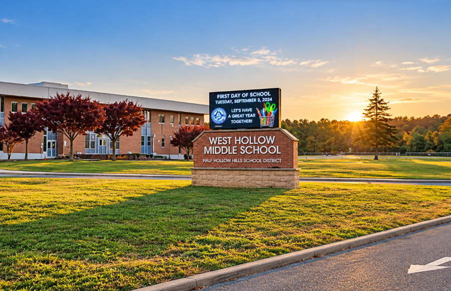
Half Hollow Hills is a historic geographic name for an area of central Long Island in western Suffolk County. It is not an incorporated village, hamlet, town, or census-designated place, although the name remains familiar to thousands of Long Islanders through the Half Hollow Hills Central School District, Half Hollow Road, local institutions, and historical references to the hills and communities between Huntington and Babylon.
The name is older than the modern school district and originally appeared as Half Way Hollow Hills. Historical accounts describe a wooded hollow roughly halfway between Long Island Sound on the north and the Atlantic side of Long Island to the south. The surrounding uplands became known as the Half Way Hollow Hills, a name that appeared on maps and in local records before gradually being shortened to Half Hollow Hills. Today, the term survives most prominently around Dix Hills, Melville, Wheatley Heights, and neighboring communities, even though Half Hollow Hills itself no longer functions as a clearly defined modern community.
What Is Half Hollow Hills?
Half Hollow Hills can mean different things depending on the context. Historically, it referred to a geographic area of hills and hollows in central Long Island. On old maps, Half Way Hollow Hills appears as a named locality in the southern portion of the Town of Huntington. In later years, the shortened Half Hollow Hills name became associated with local schools and eventually with the large central school district that continues to use the name today.
This explains why someone looking for Half Hollow Hills on a modern municipal map may have difficulty finding it. There is no Village of Half Hollow Hills and no present-day hamlet or census-designated place with boundaries comparable to Dix Hills, Melville, or Wheatley Heights. Instead, the name is a surviving piece of Long Island’s historical geography that became embedded in local institutions even as the communities around it developed their own modern identities.
Where Did the Name Half Way Hollow Hills Come From?
The older form of the name was Half Way Hollow Hills. Historical accounts describe Half Way Hollow as a wooded valley situated roughly halfway between Long Island’s northern and southern shores. One early description placed the hollow between two groups of uplands, with Dix Hills to the north and the Half Way Hollow Hills to the south.
The route through the area also had practical importance. Before modern roads crossed Long Island, Huntington farmers traveled south from the North Shore toward meadowlands along the Great South Bay, where salt hay was harvested for livestock. Local historical accounts identify the Half Way Hollows as a stopping or resting area along these north-south journeys. Over time, the geographic description became a recognizable local place-name.
The word “hollow” is significant because it describes a low area or valley between higher ground. Half Way Hollow therefore referred to the lower passage through the landscape, while Half Way Hollow Hills described the surrounding uplands. As the name evolved through everyday use, “Half Way” was shortened to “Half,” producing the Half Hollow Hills name familiar today.
The Hills Are a Real Geographic Feature
The hills behind the name are more than a historical expression. Central Long Island’s landscape was shaped by glaciers, and the Town of Huntington identifies Half Hollow Hills and Dix Hills as part of a distinctive group of hills near the southern portion of the town. These features are associated with the glacial landscape surrounding the Ronkonkoma Moraine.
Town geological research describes north-south trending hills in the Half Hollow Hills and Dix Hills area with an elongated, branching form. Researchers have interpreted these features as possible kame deltas, deposits of sand and gravel formed by meltwater during the glacial processes that helped create Long Island. The exact geological development is complex, but the important point for the history of the name is that Half Hollow Hills describes an actual hilly interior landscape rather than an arbitrary community name.
The geology also influenced later settlement and industry. Farther south, the lower Half Hollow Hills around present-day Wheatley Heights and Wyandanch contained deposits of clay and sand that proved valuable for brickmaking. By the late 19th century, brickyards in that area were producing more than 1.6 million bricks annually and shipping them by railroad for construction in New York City.
Early Settlement in the Half Hollow Hills
The Half Hollow area was part of the much larger colonial Town of Huntington, which once extended from Long Island Sound south to the Great South Bay. During the 17th century, Huntington residents traveled south to use meadowlands and other resources along the South Shore. Permanent settlement in the interior remained sparse compared with the established communities closer to Huntington Harbor.
Settlement expanded during the early 18th century. One of the better-known early settlers associated with the southern Half Hollow area was Jacob Conklin, who established a homestead around 1710 in what is now the Wheatley Heights area. Farms, woodlands, paths, and scattered homes gradually occupied the hills as families from the older Huntington settlement moved farther into the interior.
The area remained largely rural for generations. Agriculture, woodlands, nurseries, estates, and small settlements characterized much of the landscape well into the 20th century. Modern suburban development would eventually transform these surroundings, but old roads and place-names preserved pieces of the earlier geography.
Half Way Hollow Hills on Historic Maps
The historical use of the name can be seen directly on 19th-century maps. The 1873 Atlas of Long Island, New York by F.W. Beers includes a map titled “Half Way Hollow Hills, Part of Huntington.” The map depicts roads, individual properties, settlements, railroads, and other features across the southern portion of the old Town of Huntington.
That map is especially useful for understanding Half Hollow Hills today because it demonstrates that the name was not created for a modern suburban development or school system. Half Way Hollow Hills was already an established geographic designation decades before the suburban communities and school districts familiar to present-day Long Islanders took their modern form.
The Creation of the Town of Babylon
An important change occurred in 1872 when the southern portion of the Town of Huntington separated to form the new Town of Babylon. The new municipal boundary divided territory that had previously shared historical, transportation, and school connections.
This helps explain one of the unusual features of Half Hollow Hills today. School district boundaries had begun taking shape before the Town of Babylon was created, and those educational boundaries did not necessarily change when the new town line was drawn. As a result, the Half Hollow Hills school system eventually came to include territory in both the Town of Huntington and the Town of Babylon.
Wheatley Heights is a particularly good example. Although the community is located in the Town of Babylon, it has longstanding ties to the Half Hollow Hills school system. Town of Babylon historical records note that the area now known as Wheatley Heights has been part of the Half Hollow Hills school district since the 19th century. The town boundary changed, but the older school district relationship remained.
The Lower Half Hollow Hills
Historical references also use the term “lower Half Hollow Hills” for territory farther south, particularly around present-day Wheatley Heights and Wyandanch. The term reflects the continuation of the hilly interior landscape toward the flatter portions of the Town of Babylon.
This older geographic description is why Half Hollow Hills sometimes appears in histories of communities that modern residents may not immediately associate with the name. Before Wyandanch developed around its railroad station and before Wheatley Heights acquired its present identity, the broader landscape could be described in relation to the Half Way Hollow Hills.
In Wyandanch and Wheatley Heights, natural clay and sand deposits contributed to a substantial brickmaking industry during the late 19th century. Historical references to the “lower Half Hollow Hills” therefore describe both a physical landscape and an earlier way of identifying territory before today’s hamlet names became firmly established.
From Half Way Hollow Hills to Half Hollow Hills
As Long Island developed, the older Half Way Hollow Hills name gradually contracted to Half Hollow Hills. Roads, schools, organizations, and institutions helped preserve the shortened version even as the historical geographic identity became less distinct.
Half Hollow Road remains one of the clearest reminders of the older name. The road runs through the Dix Hills area and follows a corridor associated with the historic Half Hollow landscape. Other surviving references include historic properties, cemeteries, schools, and organizations that have used Half Hollow or Half Hollow Hills in their names.
By the 20th century, suburbanization increasingly replaced farms, nurseries, woodland, and large estates with residential neighborhoods. Dix Hills and Melville became the dominant modern community names across much of the northern portion of the historic Half Hollow Hills area, while Wheatley Heights and Wyandanch became established identities farther south.
The Half Hollow Hills School District
The institution most responsible for keeping the Half Hollow Hills name prominent today is the Half Hollow Hills Central School District. The district’s roots extend into the earlier local school districts that served the rural communities of the area. Historical district material notes that the Half Hollow Hills district merged with the Dix Hills School District in 1931.
The modern Half Hollow Hills Central School District was organized in 1954 through the centralization of three union free school districts. At the time, the newly organized district served 1,146 students. Its territory crossed the boundary between the towns of Huntington and Babylon, continuing a geographic arrangement whose origins predated the creation of the Town of Babylon itself.
The district expanded during a period of rapid suburban growth on Long Island. Areas that had been predominantly rural changed dramatically during the decades following World War II as new roads, homes, businesses, and residential subdivisions spread across western Suffolk County.
Today, the Half Hollow Hills Central School District is headquartered in Dix Hills and serves communities that include Dix Hills, Melville, Wheatley Heights, and portions of neighboring areas. Its boundaries should not be confused with the boundaries of a single community. The school district is a modern governmental entity with defined educational boundaries, while Half Hollow Hills as a historical place-name describes a broader and less precisely bounded geographic area.
What Does Half Hollow Hills Mean Today?
For most Long Islanders today, Half Hollow Hills means the school district. Families may describe a home as being “in Half Hollow Hills” when they are referring to the school district rather than the municipality or hamlet in which the property is physically located. A house can therefore have a Dix Hills, Melville, Wheatley Heights, or another local address while still being associated with Half Hollow Hills through its school district.
That modern usage can obscure the much older origin of the name. Half Hollow Hills was not invented as a school district label. The school district inherited a name that had already described this part of central Long Island for generations.
The result is a particularly interesting example of how Long Island place-names survive. Political boundaries changed, new hamlets emerged, farms became suburbs, and old rural districts were consolidated into larger school systems, yet the Half Hollow Hills name remained recognizable long after its original geographic meaning became unfamiliar to many residents.
Why Half Hollow Hills Has No Exact Modern Boundary
There is no single modern boundary that can accurately be labeled Half Hollow Hills in the same way that a map can outline an incorporated village or census-designated place. Historical references describe a landscape and locality rather than a municipality surveyed according to today’s governmental boundaries.
The modern school district does have defined boundaries, but those should not automatically be treated as the boundaries of historic Half Hollow Hills. Likewise, the present-day hamlets of Dix Hills, Melville, Wheatley Heights, Wyandanch, and surrounding communities have identities and boundaries that developed independently of the older geographic term.
Understanding that distinction makes many local historical references clearer. A document describing property in Half Way Hollow Hills, for example, may be referring to land that would now be identified with a different community name. Likewise, a modern reference to the Half Hollow Hills school district does not necessarily mean the location was historically considered part of precisely the same geographic area.
Key Facts and Details
| Name | Half Hollow Hills |
| Historic Name | Half Way Hollow Hills |
| What It Is | A historic geographic name in central Long Island; today most prominently associated with the Half Hollow Hills Central School District |
| What It Is Not | Half Hollow Hills is not an incorporated village, town, or census-designated place |
| County | Suffolk County |
| Primary Modern Area | Central and western Suffolk County, particularly around Dix Hills, Melville, Wheatley Heights, and surrounding communities |
| Historic Geography | Interior hills and hollows between Long Island’s North Shore and South Shore |
| Name Meaning | Derived from Half Way Hollow, historically described as a hollow or valley roughly halfway across Long Island |
| Historic Transportation Role | Associated with routes used by Huntington residents traveling south toward Great South Bay meadowlands |
| Geology | Part of a distinctive glacially formed hilly landscape associated with central Long Island and the Ronkonkoma Moraine |
| Historic Map Evidence | Shown as “Half Way Hollow Hills” on the 1873 F.W. Beers atlas of Long Island |
| Historic Town | Originally within the larger Town of Huntington |
| Town Boundary Change | The Town of Babylon separated from Huntington in 1872, dividing territory connected to older school districts and communities |
| Lower Half Hollow Hills | Historic term associated with areas around present-day Wheatley Heights and Wyandanch |
| Historic Industry in Lower Hills | Brickmaking supported by deposits of clay and sand |
| Surviving Road Name | Half Hollow Road |
| School District | Half Hollow Hills Central School District |
| Central School District Established | 1954 through the centralization of three union free school districts |
| District at Formation | 1,146 students in 1954 |
| School District Towns | Territory in both the towns of Huntington and Babylon |
| Modern Meaning | Most commonly understood as the school district and the communities it serves |
Half Hollow Hills is a reminder that Long Island’s geography cannot always be understood through modern village, hamlet, and town boundaries alone. The name began as Half Way Hollow Hills, describing a real landscape of hills and hollows in the island’s interior, appeared on historic maps, became associated with farms, roads, schools, and communities, and survived major changes including the creation of the Town of Babylon and the suburban transformation of western Suffolk County. Today the name is most visible through the Half Hollow Hills Central School District, but behind that familiar institution is a much older geographic identity connecting Dix Hills, Melville, Wheatley Heights, Wyandanch, and the historical development of central Long Island.
Are you ready for fall on Long Island? Check out these local seasonal guides:
🍎 Apple Picking | 🍂 Fall Festivals & Farm Activities | 👻 Haunted Houses | 🎃 Pumpkin Picking
