
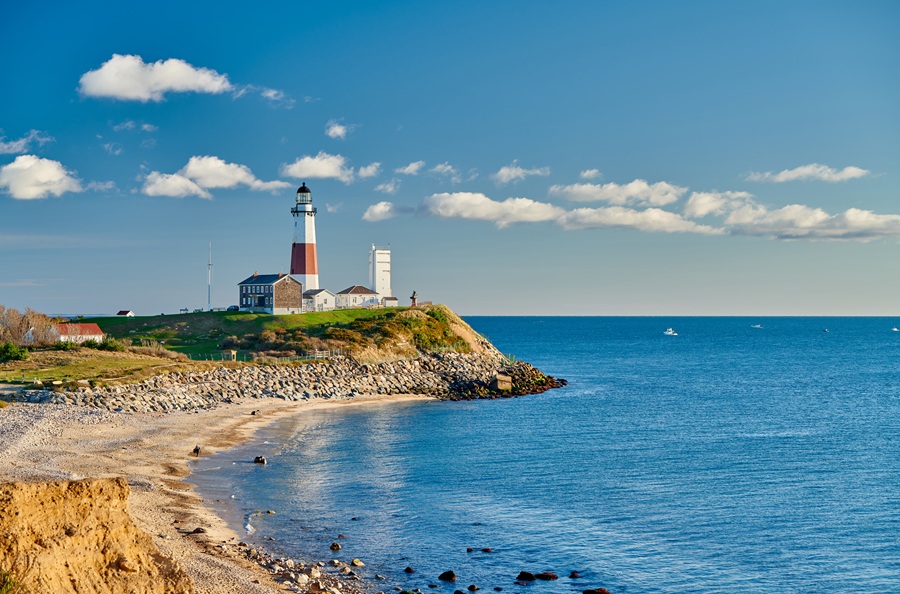
The East End is the eastern region of Long Island, commonly defined as the five eastern towns of Suffolk County: Riverhead, Southold, Shelter Island, Southampton, and East Hampton. It encompasses the North Fork, South Fork, and the island communities between them, bringing together farmland, vineyards, beaches, historic villages, and working waterfronts.
Which Places Are Part of the East End?
The five-town definition provides the clearest way to understand the region. These are municipal towns, each containing smaller communities, rather than just the downtown areas that share their names. For example, the Town of East Hampton includes Montauk, while the Town of Southold includes the incorporated village of Greenport.
The North Fork extends through the Riverhead and Southold areas and is particularly associated with farms, vineyards, farm stands, and maritime communities. The South Fork extends through Southampton and East Hampton towns and includes the communities commonly known as the Hamptons, along with Montauk at its eastern end.
Shelter Island lies between the forks and is both an island and a separate town. Ferry connections link it with the North Fork at Greenport and the South Fork near Sag Harbor, making it a distinct part of the East End’s geography and community life.
Is the East End the Same as the Hamptons?
No. The Hamptons are part of the East End, but the names are not interchangeable. “The Hamptons” generally describes communities within Southampton and East Hampton towns on the South Fork. “The East End” is the broader regional term, also covering the North Fork, Riverhead, and Shelter Island.
This distinction matters when planning a visit. A North Fork vineyard trip, a Shelter Island getaway, and a Hamptons beach weekend all take place on the East End, but they involve different communities, travel routes, and experiences.
What Defines the East End’s Landscape?
The region’s two forks surround an interconnected system of bays and coastal waters. Peconic Bay lies between the forks, while Gardiners Bay opens farther east. Long Island Sound borders the northern coast, and the Atlantic Ocean borders the southern coast.
These waterways help explain the East End’s fishing traditions, boating culture, beaches, and historic waterfront settlements. Inland, working farms, vineyards, woodlands, and protected landscapes give much of the region a more rural character than the heavily developed areas farther west, although busy commercial centers and residential neighborhoods are also part of the landscape.
What Is the East End Known For?
Visitors come for ocean and bay beaches, wineries, fresh local produce, seafood, galleries, historic sites, and outdoor recreation. The North Fork is especially associated with agricultural tourism and waterfront villages, while the South Fork is widely known for its beach communities, cultural attractions, and summer destinations. Montauk adds fishing, surfing, state parks, and the historic Montauk Point Lighthouse.
The East End is also a year-round home to residents, businesses, farms, and maritime industries. Summer weekends and the fall harvest season can bring substantial traffic and visitor activity. Beach parking requirements, ferry schedules, and attraction hours vary by location and season, so checking the rules for each destination helps make a visit easier.
Key Facts & Details
| Category | Information |
|---|---|
| Regional Definition | The five eastern towns of Suffolk County on Long Island. |
| Five Towns | Riverhead, Southold, Shelter Island, Southampton, and East Hampton. |
| Principal Geographic Areas | North Fork, South Fork, and Shelter Island. |
| Relationship to the Hamptons | The Hamptons form part of the East End on the South Fork; the East End is the broader region. |
| Well-Known Destinations | Greenport, Riverhead, Shelter Island, the Hamptons, and Montauk. |
| Major Bodies of Water | Long Island Sound, Peconic Bay, Gardiners Bay, and the Atlantic Ocean. |
| Known For | Beaches, farms, vineyards, fishing, boating, historic communities, art, and protected coastal landscapes. |
| Featured Landmark | Montauk Point Lighthouse, completed in 1796 and first lit in 1797. |
| County | Suffolk County. |
| State | New York State. |
Understanding the East End as a five-town region makes its geography easier to navigate. It brings together the farms and waterfront communities of the North Fork, the beaches and cultural destinations of the South Fork, and the island setting of Shelter Island. Each has its own identity, while sharing the coastal landscapes and community traditions of eastern Long Island.