
Scenic Overlooks & Viewpoints
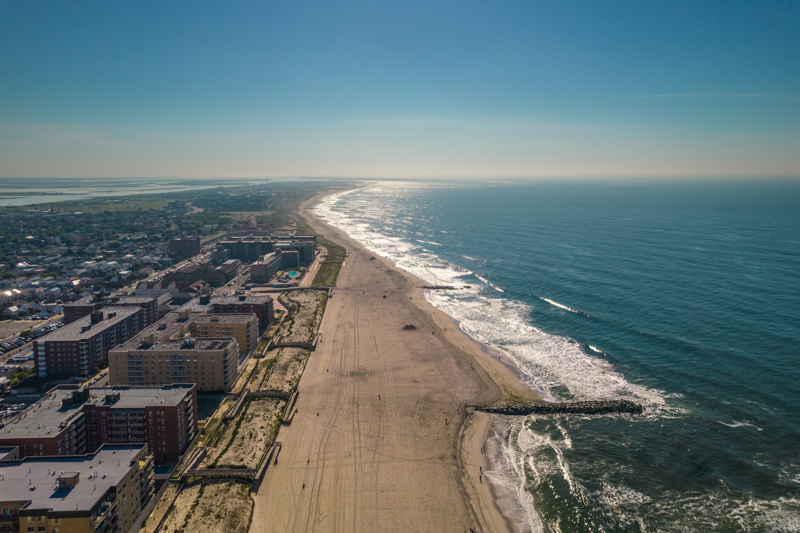
Long Island’s scenic overlooks and viewpoints range from developed hilltop parks and lighthouse towers to bluff-top trails overlooking the Long Island Sound and the Atlantic Ocean. Although the region does not maintain a single official overlook inventory, public parks and preserves across Nassau County and Suffolk County provide a surprising variety of elevated and panoramic views.
This directory includes 24 public scenic overlooks and viewpoints that have a distinct viewing feature, meaningful elevation, a marked observation area, or a trail leading to an unusually expansive vista. Ordinary beaches and waterfront parks were not included solely because they face the water.
Interactive Map of Long Island Scenic Overlooks
Select a marker or directory entry to review the viewpoint type, what can be seen, basic access information, and a link to the managing park or organization. Marker positions identify the viewing feature or the most practical public access point and should not be interpreted as permission to enter closed, restricted, or unsafe areas.
What Counts as a Scenic Overlook?
Long Island has few places formally labeled as roadside scenic overlooks. For this directory, a location qualifies when it contains a developed overlook, observation platform, hilltop or summit, lighthouse tower, coastal bluff, dune viewpoint, or public trail with a clearly identifiable panoramic view. This approach recognizes the island’s coastal geography without treating every beach, marina, pier, or waterfront lawn as an overlook.
The Highest and Broadest Views
Several of the most expansive inland views come from elevated former industrial land, natural high points, and hilltop memorials. Norman J. Levy Park and Preserve in Merrick rises above the surrounding South Shore landscape and can provide views toward the Manhattan skyline, Jones Beach Tower, and nearby bays. Bald Hill in Farmingville offers a broad central Suffolk panorama, while Jayne’s Hill in West Hills County Park marks Long Island’s highest natural point, although tree cover makes its views more seasonal and subtle.
North Shore Bluff Viewpoints
The North Shore contains the greatest concentration of bluff overlooks. Glacial hills and eroding coastal cliffs create elevated views at places such as Caumsett State Historic Park Preserve, Sunken Meadow State Park, Nissequogue River State Park, Wildwood State Park, Hallock State Park Preserve, Goldsmith’s Inlet County Park, and Inlet Pond County Park. These locations look across the Long Island Sound, tidal marshes, river mouths, beaches, and undeveloped shoreline.
East End Ocean and Dune Views
On the East End, the landscape changes from wooded Sound bluffs to exposed dunes and Atlantic headlands. Shadmoor State Park contains elevated coastal viewing platforms above the ocean. The Walking Dunes trail crosses a shifting dune environment near Napeague Harbor. At Montauk Point, visitors can look across the Atlantic Ocean and Block Island Sound from developed park overlooks and the surrounding lighthouse grounds.
Lighthouse Towers and Observation Platforms
Lighthouse towers provide some of the island’s most elevated public coastal views, but tower access is usually more limited than general park access. Horton Point Lighthouse in Southold opens according to museum and program schedules. Other lighthouse grounds may remain accessible when towers are closed, but visitors should always confirm admission, operating dates, age or height restrictions, and weather-related closures before traveling.
Scenic Overlooks and Viewpoints Directory
Locations are divided by county below. Names link to official park, preserve, refuge, municipal, or managing-organization information whenever an appropriate source is available.
Nassau County
Norman J. Levy Park & Preserve Summit
Merrick, Nassau County
Viewpoint type: Hilltop overlook
What you can see: Manhattan skyline, Jones Beach Tower, Merrick Bay and the South Shore
Access: Paved and gravel paths climb from the park entrance to the summit; park rules and hours apply.
Sands Point Preserve Cliffs
Sands Point, Nassau County
Viewpoint type: Coastal bluff
What you can see: Long Island Sound, Hempstead Harbor and the preserve shoreline
Access: Admission or parking fees may apply; reach the shoreline viewpoints by preserve trails.
Garvies Point Preserve Bluff Trail
Glen Cove, Nassau County
Viewpoint type: Coastal bluff
What you can see: Hempstead Harbor, tidal shoreline and surrounding bluffs
Access: Public preserve trails; museum schedules and some facilities may have separate hours.
Morgan Memorial Park
Glen Cove, Nassau County
Viewpoint type: Elevated waterfront viewpoint
What you can see: Hempstead Harbor and the western Long Island Sound shoreline
Access: Municipal park access and parking regulations may vary seasonally.
Sea Cliff Memorial Park
Sea Cliff, Nassau County
Viewpoint type: Bluff-top park
What you can see: Hempstead Harbor and the western North Shore
Access: Small village park reached from Sea Cliff streets; observe posted parking rules.
Sagamore Hill Nature Trail Viewpoint
Cove Neck, Nassau County
Viewpoint type: Scenic trail viewpoint
What you can see: Cold Spring Harbor, salt marsh and wooded shoreline
Access: Trail access is subject to National Park Service hours and site conditions.
Suffolk County
Cold Spring Harbor State Park Trail
Cold Spring Harbor, Suffolk County
Viewpoint type: Hillside trail viewpoint
What you can see: Cold Spring Harbor, village rooftops and surrounding hills
Access: Steep trail sections begin near Route 25A; parking is limited and roadside conditions require care.
Caumsett State Historic Park Bluffs
Lloyd Harbor, Suffolk County
Viewpoint type: Coastal bluff
What you can see: Long Island Sound and the Lloyd Neck shoreline
Access: The shoreline is reached by a substantial walk or bicycle ride from the main parking area; vehicle fees may apply.
Target Rock National Wildlife Refuge
Lloyd Harbor, Suffolk County
Viewpoint type: Shoreline viewpoint
What you can see: Huntington Bay, Long Island Sound and rocky shoreline
Access: Short refuge trails lead downhill from the parking area; federal refuge rules apply.
Jayne’s Hill
West Hills, Suffolk County
Viewpoint type: Natural summit
What you can see: Wooded high point with broader seasonal views through the trees
Access: Reached by hiking trails in West Hills County Park; the summit is not a developed roadside overlook.
Bald Hill Veterans Memorial
Farmingville, Suffolk County
Viewpoint type: Hilltop overlook
What you can see: Wide views across central Suffolk County from one of Long Island’s highest developed points
Access: Road access and parking are available near the memorial; special events can affect access.
Avalon Nature Preserve Overlook
Stony Brook, Suffolk County
Viewpoint type: Scenic trail viewpoint
What you can see: Stony Brook Harbor, landscaped preserve grounds and surrounding woodland
Access: Pedestrian preserve with designated parking areas; observe posted hours and trail rules.
Sunken Meadow Bluff Viewpoints
Kings Park, Suffolk County
Viewpoint type: Coastal bluff
What you can see: Long Island Sound, tidal marshes and the mouth of the Nissequogue River
Access: Multiple park paths provide views; seasonal vehicle-use fees and facility schedules may apply.
Nissequogue River State Park Bluffs
Kings Park, Suffolk County
Viewpoint type: Coastal bluff
What you can see: Nissequogue River and Long Island Sound from bluff-top trails
Access: Views require walking on park trails; remain in public areas and follow posted restrictions.
Cordwood Landing County Park Bluff Overlook
Miller Place, Suffolk County
Viewpoint type: Coastal bluff
What you can see: Long Island Sound from a marked bluff overlook
Access: Natural-surface trails lead from the parking area to the bluff; conditions may be muddy or uneven.
Wildwood State Park Bluff
Wading River, Suffolk County
Viewpoint type: Coastal bluff
What you can see: Long Island Sound from the park’s high bluff and shoreline approaches
Access: Park roads and trails lead toward the bluff; camping and seasonal vehicle fees may apply.
Hallock State Park Preserve Bluff
Northville, Suffolk County
Viewpoint type: Coastal bluff
What you can see: Long Island Sound, beach and undeveloped North Fork shoreline
Access: A trail walk is required from the visitor area; preserve hours and conditions apply.
Goldsmith’s Inlet County Park Bluff
Peconic, Suffolk County
Viewpoint type: Coastal bluff
What you can see: Long Island Sound, Goldsmith’s Inlet, marsh and beach
Access: A trail crosses the inlet area and climbs the forested bluff; use caution on natural surfaces.
Inlet Pond County Park Bluff Overlook
Greenport, Suffolk County
Viewpoint type: Observation platform / bluff
What you can see: Long Island Sound, Inlet Pond and coastal habitat
Access: The county trail map identifies an observation platform and bluff overlook reached by marked trails.
Horton Point Lighthouse Tower
Southold, Suffolk County
Viewpoint type: Lighthouse tower
What you can see: Long Island Sound and the North Fork coastline
Access: Tower access is limited to scheduled museum openings and programs; grounds access may differ.
Mashomack Preserve Viewpoints
Shelter Island, Suffolk County
Viewpoint type: Scenic trail viewpoint
What you can see: Tidal creeks, marshes, wooded shoreline and Gardiners Bay approaches
Access: Several trail loops require varying walking distances; preserve hours and seasonal closures apply.
Walking Dunes Trail
Napeague, Suffolk County
Viewpoint type: Dune viewpoint
What you can see: Migrating dunes, Napeague Harbor and the surrounding coastal landscape
Access: Natural sand trail with exposed conditions; parking is limited and dune protection rules apply.
Shadmoor State Park Viewing Platforms
Montauk, Suffolk County
Viewpoint type: Observation platform / bluff
What you can see: Atlantic Ocean, beach and dramatic coastal bluffs
Access: Trails lead to elevated viewing platforms; bluff edges can be unstable and fenced areas must be respected.
Montauk Point Overlooks
Montauk, Suffolk County
Viewpoint type: Developed coastal overlook
What you can see: Atlantic Ocean, Block Island Sound, offshore rocks and converging tides
Access: State park parking fees may apply; lighthouse admission is separate from general overlook access.
Planning a Visit
Access varies considerably. Some overlooks are close to paved parking areas, while others require a steep climb, a long walk, or travel over sand and natural-surface trails. State and county parks may charge seasonal vehicle-use fees. Lighthouse towers, museums, preserves, and special programs may have separate admission charges or limited operating dates.
Bluff edges can be unstable, particularly after storms, heavy rain, freezing weather, or coastal erosion. Remain behind fences and warning signs, keep children and pets away from drop-offs, and do not create informal paths down steep slopes. Visitors should also check current weather, trail conditions, park hours, parking restrictions, and accessibility information before leaving home.
Methodology
This directory was compiled from official state, county, federal, municipal, museum, preserve, and conservation-organization information. A location was included when available descriptions or official maps identified a bluff overlook, observation platform, elevated viewpoint, summit, lighthouse tower, or scenic trail with a distinctive broad view. Coordinates were checked against mapped park features and practical public access points before being added to the interactive map.
The directory is not a ranking and does not evaluate scenery, trail difficulty, safety, accessibility, or visitor experience. Conditions and public access can change because of erosion, construction, habitat protection, weather, special events, seasonal schedules, or agency rules. Ordinary beaches and waterfront parks were excluded unless they contained a distinct elevated or purpose-built viewing feature.
Key Facts and Details
| Locations included | 24 scenic overlooks and viewpoints |
| Counties covered | Nassau County and Suffolk County |
| Viewpoint types | Hilltops, natural summits, coastal bluffs, observation platforms, dune viewpoints, scenic trails, lighthouse towers, and elevated waterfront parks |
| Primary landscapes | Long Island Sound, Atlantic Ocean, bays, harbors, tidal marshes, dunes, river mouths, and inland panoramas |
| Access | Ranges from nearby parking and paved paths to longer natural-surface hikes |
| Possible costs | Seasonal vehicle-use, parking, preserve, museum, or lighthouse admission fees may apply |
| Safety | Remain behind barriers near bluffs and follow all posted trail, erosion, wildlife, and access restrictions |
| Map filename | long-island-scenic-overlooks-map.html |
Long Island may not have the mountain overlooks found in other parts of New York, but its glacial hills, coastal bluffs, lighthouse towers, dunes, and elevated preserves create a varied collection of public viewpoints. Together, these locations reveal the island from perspectives that are easy to miss at road level, from distant skyline views in Nassau County to open-ocean horizons at Montauk Point. The interactive map and directory provide a starting point for finding those views while planning around current access rules, trail conditions, and seasonal operations.
Are you ready for fall on Long Island? Check out these local seasonal guides:
🍎 Apple Picking 🍓 Strawberry Picking 🎃 Pumpkin Picking 👻 Haunted Houses 🍂 Farm Festivals
