
Highways & Parkways
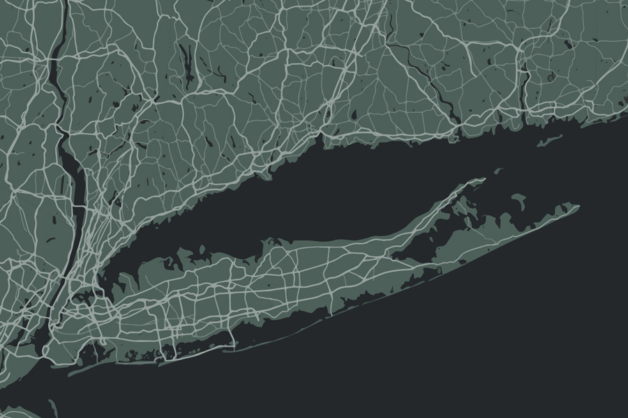
Getting around Long Island means knowing its network of expressways, parkways, and scenic routes. Whether you’re commuting into New York City, traveling between Nassau and Suffolk Counties, or exploring beaches and wineries on the East End, the Island’s road system shapes daily life. Below is a guide to Long Island’s major roadways, their history, and where they’ll take you.
Long Island Expressway (I-495)
- Route: Runs east–west across the Island from Queens through Nassau and Suffolk, ending in Riverhead.
- Nickname: “The LIE” — the backbone of Long Island traffic.
- Use: Primary commuter route into NYC; connects to major north–south parkways.
- Fun fact: Known for heavy rush-hour congestion, but also for being the direct corridor to the Hamptons.
Northern State Parkway
- Route: Runs parallel to the LIE in Nassau and western Suffolk.
- Use: Scenic alternative to I-495 with lighter trucks prohibited (parkways are cars only).
- History: Built in the 1930s as part of Robert Moses’ parkway system.
Southern State Parkway
- Route: Extends from Queens across Nassau into Suffolk, connecting to Sunrise Highway.
- Use: Major commuter artery for South Shore towns; also connects to the Belt Parkway in Brooklyn.
- Design: Famous for its winding curves and low stone overpasses.
Meadowbrook State Parkway
- Route: Runs north–south in Nassau, from the Northern State Parkway to Jones Beach State Park.
- Use: Popular for beachgoers heading to Jones Beach and for access to Eisenhower Park.
Wantagh State Parkway
- Route: Connects Northern State Parkway to Jones Beach, running parallel to the Meadowbrook.
- Use: Major beach route; considered a sister road to the Meadowbrook.
Sunken Meadow State Parkway
- Route: Runs from Northern State Parkway up to Sunken Meadow State Park in Kings Park.
- Use: Provides North Shore access; scenic drive to Smithtown Bay.
Sagtikos State Parkway / Robert Moses Causeway
- Route: Sagtikos Parkway connects Southern to Northern State Parkway; becomes the Robert Moses Causeway leading to Fire Island.
- Use: Access to Robert Moses State Park, Fire Island beaches, and Captree State Park.
Ocean Parkway
- Route: Runs along Jones Beach Island between Jones Beach and Captree.
- Use: Scenic coastal drive with access to beach communities, state parks, and fishing piers.
Sunrise Highway (NY-27)
- Route: Extends from Queens to Montauk, running along the South Shore.
- Use: Major east–west route through southern Long Island towns, serving commuters and Hamptons travelers.
- Notable: Known as “Route 27,” it’s the main alternative to the LIE for reaching the East End.
Route 25 / Route 25A
- Route 25: Runs from Queens through Nassau and Suffolk to Orient Point.
- Route 25A: A North Shore scenic route running parallel in Nassau and western Suffolk.
- Use: Local commercial corridors with shops, restaurants, and historic districts.
- History: Route 25 is one of Long Island’s oldest continuous highways.
Other Key Roads
- Bethpage State Parkway, also known as the Philip B. Healey Memorial Parkway, connects the Southern State Parkway in North Massapequa to Bethpage State Park.
- Veterans Memorial Highway (NY-454): Central Suffolk connector to MacArthur Airport.
- Route 347 (Nesconset Highway): 15-mile east–west corridor from Smithtown to Port Jefferson Station, home to Smith Haven Mall and lined with shopping centers, offices, and commuter links.
- Nicolls Road (CR-97): Major north–south road linking Stony Brook University with Patchogue.
- Montauk Highway (NY-27A): Historic South Shore road running parallel to Sunrise Highway, popular for East End scenic drives.
- Hempstead Turnpike (NY 24): Major east–west artery on Long Island, connecting Queens through Nassau County into Suffolk.
- Seaford–Oyster Bay Expressway (NY-135): Limited-access north–south expressway running through central Nassau County, Long Island stretching approximately 15 miles to the North Shore.
- William Floyd Parkway (CR-46): Long, wooded stretches connecting the South Shore to the North Shore of Suffolk County.
- Loop Parkway (NY 909C): Short coastal connector road on Long Island’s South Shore that crosses Baldwin Bay and links the Meadowbrook State Parkway to Lido Boulevard near Point Lookout.
Long Island’s major roadways define its daily rhythm – commuters on the LIE, beachgoers on the Meadowbrook and Wantagh, and travelers cruising Sunrise Highway toward the Hamptons. Understanding the Island’s highways and parkways helps locals and visitors navigate more smoothly, avoid bottlenecks, and discover scenic routes to some of Long Island’s best destinations.
