
Long Island Beaches
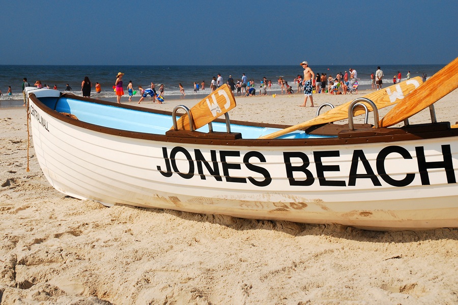
Long Island is surrounded by the Atlantic Ocean, Long Island Sound, and an extensive network of bays, harbors, and inlets, giving residents and visitors access to an unusually wide range of beaches. This interactive map and directory brings together major public beaches across Nassau County and Suffolk County, including ocean beaches, Sound beaches, bay beaches, state parks, county parks, town beaches, village beaches, and beach communities on Fire Island.
Use the map to search by beach name or community and narrow the directory by shoreline, county, or operating agency. Beach access, parking rules, seasonal fees, lifeguard schedules, and residency requirements can change, so visitors should confirm current regulations with the government agency or municipality responsible for each beach before traveling.
Long Island Beaches Map
The directory is intended to help users compare locations and understand the geography of Long Island’s beaches. A marker does not necessarily mean unrestricted public parking or admission. Some town and village beaches require resident permits, seasonal stickers, daily parking payments, or other credentials.
Atlantic Ocean Beaches
Long Island’s ocean beaches run along the barrier islands and South Fork, facing the open Atlantic. These beaches generally have the strongest surf, broad sandy shorelines, and some of the island’s best-known swimming destinations. Major examples include Jones Beach State Park, Robert Moses State Park, Cupsogue Beach County Park, Coopers Beach, and Ditch Plains Beach.
Long Island Sound Beaches
Sound beaches line the North Shore and are generally known for calmer water, scenic bluffs, rocky sections, and sunset views. Examples include Sunken Meadow State Park, Wildwood State Park, Cedar Beach in Mount Sinai, and Gold Star Battalion Beach.
Bay and Harbor Beaches
Bay and harbor beaches are found along the Great South Bay, Peconic bays, Shinnecock Bay, Moriches Bay, Hempstead Harbor, Oyster Bay Harbor, and other protected waterways. These beaches often have gentler water than Atlantic-facing beaches and may be particularly suitable for families, paddling, or small-craft access. Examples include TOBAY Beach, Heckscher State Park, and Meschutt Beach County Park.
Fire Island Beaches
Fire Island contains a long chain of Atlantic beaches reached by bridge, ferry, private boat, or community walkways. Beach access varies considerably among communities such as Ocean Beach, Cherry Grove, Fire Island Pines, Saltaire, and Fair Harbor. The island also includes protected destinations within Fire Island National Seashore, including Sailors Haven.
Understanding Beach Access
Beach access on Long Island is controlled by several different levels of government. New York State operates major state parks, while Nassau and Suffolk counties maintain county beaches. Towns, cities, and incorporated villages also operate local beaches, many of which use resident permits or seasonal parking systems.
- State beaches are generally open to the public, although vehicle entrance fees may apply.
- County beaches may charge parking or recreation fees and can have separate camping or outer-beach rules.
- Town beaches frequently require resident permits, seasonal stickers, or daily parking payments.
- Village beaches may limit parking or admission to village residents and their guests.
- Fire Island beaches may require ferry transportation and can have community-specific rules.
Visitors should also check whether swimming is permitted and whether lifeguards are on duty. A beach may remain physically accessible outside the supervised season while swimming is prohibited or undertaken at the visitor’s own risk.
How to Use the Beach Map
Search for a beach, community, town, or shoreline using the map’s search field. The available filters can be used to narrow results by county, shoreline, or operating agency. Select a beach from the directory or click its marker to view its location, shoreline type, operator, general access information, and a link to its LongIslandGuide page when one is available.
The map is designed as a geographic planning tool rather than a real-time statement of beach conditions. Temporary closures, water-quality advisories, storm damage, lifeguard availability, parking capacity, and seasonal regulations may not be reflected immediately.
Methodology
The Long Island beaches directory was assembled from official listings published by New York State Parks, the National Park Service, Nassau County, Suffolk County, Long Island’s town governments, incorporated villages, and municipal recreation departments. Locations were grouped by shoreline and operating authority, then reviewed against existing LongIslandGuide destination pages.
The directory focuses on significant public, municipal, and community beaches that are useful to residents and visitors. Private residential shoreline, informal access points, small neighborhood strips without established public facilities, and locations where legal access could not be confirmed may be excluded. Beach names and access rules can change, and additional locations may be added as official information becomes available.
Key Facts & Details
| Feature | Details |
|---|---|
| Geographic Coverage | Major beaches across Nassau County, Suffolk County, and Fire Island |
| Beach Types | Atlantic Ocean, Long Island Sound, bay, harbor, river, and selected lake beaches |
| Operators Included | New York State, National Park Service, county, town, city, village, and community authorities |
| Map Features | Beach search, shoreline filters, county filters, operator filters, directory listings, and location popups |
| Access Considerations | Parking permits, resident restrictions, seasonal fees, ferry access, and lifeguard schedules vary by beach |
| Related Guide | See the editorial guide to the best beaches on Long Island for a curated selection of standout destinations |
With ocean surf, protected bays, North Shore sunsets, family-oriented swimming areas, and remote Fire Island shorelines, Long Island offers a beach for nearly every type of coastal visit. The map provides a starting point for comparing locations, but current access rules and operating conditions should always be confirmed before departure.
Are you ready for fall on Long Island? Check out these local seasonal guides:
🍎 Apple Picking 🍓 Strawberry Picking 🎃 Pumpkin Picking 👻 Haunted Houses 🍂 Farm Festivals
