
The Montauk Project at Camp Hero: Legend, History & Visiting Info
The Montauk Project is the name commonly given to a set of conspiracy claims alleging that secret U.S. government experiments, ranging from psychological warfare and mind-control research to teleportation and time travel, took place at Camp Hero, later Montauk Air Force Station, on the eastern tip of Long Island. The legend spread widely after the 1992 book The Montauk Project: Experiments in Time and later sequels. The real site today is Camp Hero State Park, a public coastal preserve known for its dramatic bluffs, WWII gun batteries, decommissioned radar tower, trails, surfing, and fishing.
A Short, Straight Timeline
- 1942: The U.S. Army establishes Camp Hero as a coastal defense post during WWII. Some structures were designed to blend into the landscape with a “fishing village” look. Large gun batteries helped defend the approaches to New York.
- Early 1950s: Portions of the property transfer to the Air Force, and Montauk Air Force Station develops as part of the Cold War air-defense network.
- Around 1960: The giant AN/FPS-35 search radar is installed as part of the broader era of integrated continental air defense, often associated with SAGE.
- 1981–1982: Radar operations end in 1981; formal closure and transfers follow soon after.
- 2002: Camp Hero State Park opens to the public, with the radar tower remaining the park’s most recognizable landmark.
What the Montauk Project Is (and Isn’t)
The stories told in books, documentaries, podcasts, and online retellings describe secret research under Camp Hero involving mind control, remote viewing, the so-called “Montauk Chair,” alleged child abductions sometimes called the “Montauk Boys,” time portals, and even a creature said to have been unleashed on the base. These claims often connect themselves loosely to the earlier Philadelphia Experiment legend and wider Cold War black-budget mythology.
What’s verified:
- Camp Hero and Montauk Air Force Station were real military installations with documented roles in WWII coastal defense and Cold War radar surveillance.
- The AN/FPS-35 radar tower and former gun-battery areas are historically significant features that remain visible from parts of the park today.
- Public records and environmental reviews describe military uses, site management, and remediation work, not verified evidence of exotic experiments.
Bottom line: The Montauk Project is one of Long Island’s best-known conspiracy legends and has had an outsized influence on pop culture, but it is not accepted as established historical fact by credible evidence-based sources.
Pop Culture & “Stranger Things”
The Montauk legend helped shape modern sci-fi storytelling. In early development, the series that became Netflix’s Stranger Things was associated with the working title “Montauk” before the setting shifted to fictional Hawkins, Indiana. The finished show echoes Cold War experiment themes and conspiracy atmosphere, even though its monsters and portals are pure fiction.
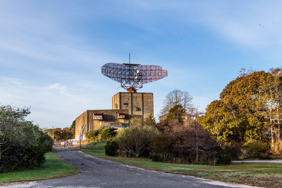
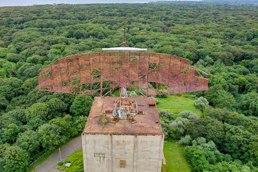
The Radar Tower: What You’re Looking At
- Type: AN/FPS-35 long-range search radar.
- Why it’s unique: The Montauk tower is widely cited as the last surviving AN/FPS-35 installation with its antenna still mounted. By 1981, it was among the final examples of its type still operating.
- Why visitors notice it: Even decommissioned, the structure dominates the bluff line and gives Camp Hero its unmistakable Cold War silhouette.
- Access: You can photograph the tower from open areas in the park, but the structure itself is closed.
How to Visit Camp Hero (Practical Info)
- Park: Camp Hero State Park, 1898 Montauk Hwy, Montauk, NY. This is a day-use park with trails, bluff overlooks, surf-fishing access, and former military features visible from open areas. Hours, parking rules, and seasonal services may vary, so check ahead before visiting.
- What to bring: Sturdy shoes for uneven ground, a wind layer for the bluffs, sun protection, and water. Services inside the park can be limited.
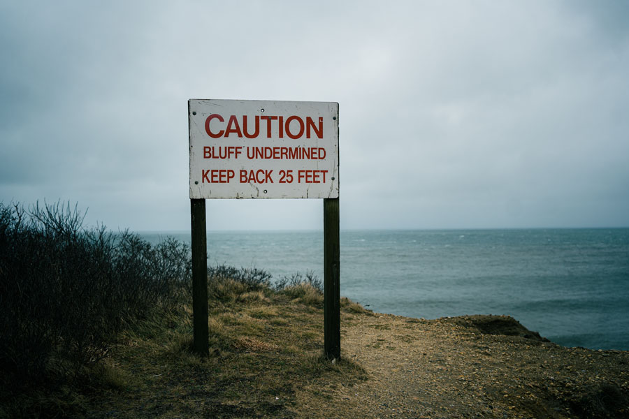
- Photos: The radar tower is visible from several vantage points. Respect all posted closures, fencing, and no-entry zones.
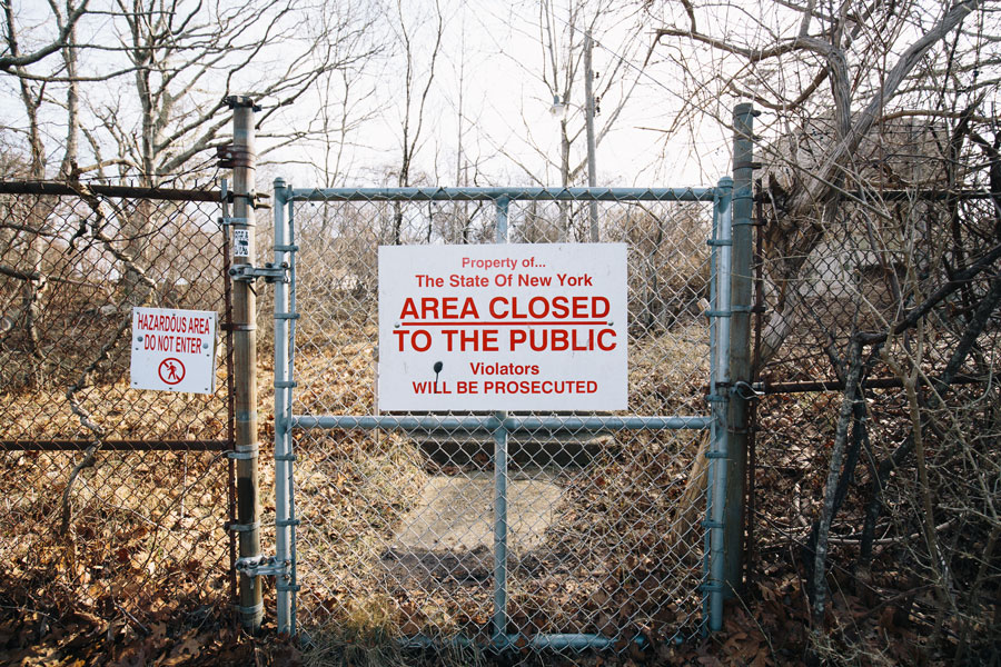
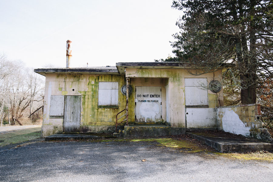
- Know the limits: Do not enter sealed buildings, closed bunkers, or fenced former military areas, even if they appear accessible from a distance.
- Context stop: Pair your visit with Montauk Point Lighthouse for maritime history and ocean views, then continue into nearby Montauk village for dining and beach-town atmosphere.
- Safety/odd finds: If you encounter anything that looks like old munitions or another hazardous object, do not touch it. Move away, notify park staff if possible, and call 911 in an emergency.
Vicinity of the Tower
Snapshot QuickFacts
| Topic | Fast Answer |
|---|---|
| Where is it? | Camp Hero State Park, 1898 Montauk Hwy, Montauk, NY, on Long Island’s far eastern end. |
| What’s the big tower? | A decommissioned AN/FPS-35 long-range search radar. It is widely described as the last surviving example of its type still carrying its antenna. |
| When did the base operate? | Camp Hero dates to WWII; the later Montauk Air Force Station served during the Cold War. Radar operations ended in 1981, with closure following soon after. |
| When did it become a park? | Camp Hero State Park opened to the public in 2002. |
| Is the “Montauk Project” proven? | No. It is generally treated as conspiracy folklore rather than verified history. |
| Is the radar active? | No. It has long been decommissioned, and the antenna no longer rotates. |
| Can you visit the tower interior? | Not as a standard visitor. The tower and most former military buildings are closed; park access focuses on trails, overlooks, and shoreline areas. |
Frequently Asked Questions
Did secret experiments really happen here?
No verified evidence has surfaced. The claims come chiefly from late-20th-century books and anecdotal accounts, not documented historical records.
What was Camp Hero actually used for?
Its documented roles were WWII coastal defense and, later, Cold War radar surveillance as Montauk Air Force Station.
What is SAGE and how does it relate?
SAGE, short for Semi-Automatic Ground Environment, was the U.S. air-defense computer network that linked radar sites to command centers. Montauk’s radar history fits into that broader mission.
Can I go inside the radar tower?
Not as a general visitor. The tower is closed, and most former military structures are off-limits. Plan on viewing and photographing it from designated park areas.
Why do some sources say 1981 and others 1982 for closure?
Because radar operations ended in 1981, while administrative shutdown and property transfer happened afterward. Both dates appear in summaries for different reasons.
Is Camp Hero environmentally safe?
The former base has been the subject of investigation and cleanup over time, and the park today operates as a public recreation area. That said, some sections remain fenced or closed, so stay on open trails and follow all posted warnings.
