
Rocky Point Pine Barrens State Forest
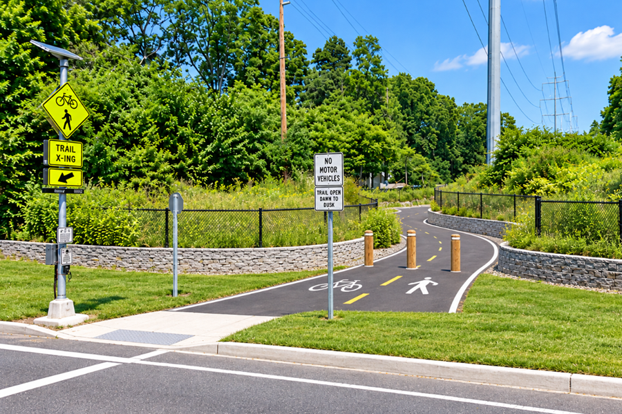
The Rocky Point Natural Resources Management Area, now identified by the New York State Department of Environmental Conservation as Rocky Point Pine Barrens State Forest, protects nearly 6,000 acres of forest and open land in the Town of Brookhaven in Suffolk County. Located around Rocky Point, Ridge, and nearby central Long Island communities, the property is one of the largest publicly accessible sections of the Long Island Pine Barrens.
The preserve combines pitch pine and oak forest, sandy trails, open areas, historic firebreaks, wildlife habitat, and miles of recreational routes. Visitors use the property for hiking, mountain biking, horseback riding, hunting, wildlife observation, and other outdoor activities, although access rules vary by season and permits are required.
Nearly 6,000 Acres of Pine Barrens
Rocky Point Pine Barrens State Forest occupies a substantial block of protected land within the Central Pine Barrens of Suffolk County. Unlike a conventional park with playgrounds, athletic fields, paved paths, and concentrated visitor facilities, Rocky Point is primarily managed as forestland and wildlife habitat.
The landscape is dominated by the sandy soils, pitch pine, scrub oak, and other vegetation characteristic of the Long Island Pine Barrens. Its large uninterrupted stretches of woodland are particularly important on an island where residential and commercial development surrounds many remaining natural areas.
The property is crossed by a network of trails, old roads, firebreaks, and recreational routes. Separate DEC maps are available for hiking, mountain biking, horseback riding, huntinghiking, mountain biking, horseback riding, hunting, reflecting the different ways the forest is used throughout the year.
From RCA Communications Center to State Forest
Rocky Point has an unusual history that distinguishes it from many other Pine Barrens preserves. Before becoming public conservation land, much of the property was operated by the Radio Corporation of America, better known as RCA, as a major international communications center.
Beginning during the early era of long-distance radio communication, RCA used the remote and relatively undeveloped Rocky Point landscape for enormous antenna systems capable of transmitting signals across the Atlantic and around the world. The large amount of open land required by the communications facility ultimately helped preserve thousands of acres from residential development.
As satellite communications and newer technologies made the sprawling radio facility obsolete, the property eventually transitioned into conservation land. The former communications site is today part of a protected forest landscape rather than a major industrial communications complex.
Hiking and Exploring the Forest
Hiking is one of the most accessible ways to experience Rocky Point. Trails pass through pine and oak woodland, open areas, and sections of forest that have been shaped by decades of fire management and ecological restoration.
The Paumanok Path, Long Island’s major long-distance hiking route, also passes through the Rocky Point area as it travels east across Suffolk County. This connects Rocky Point to a much larger network of Pine Barrens preserves, public lands, and natural areas extending toward the East End.
Because the forest is large and contains numerous intersecting roads and trails, visitors should use an official map rather than relying entirely on trail signs. Conditions may also change because of prescribed burns, forest management work, hunting seasons, or temporary closures.
Mountain Biking
Rocky Point has become one of Long Island’s better-known destinations for off-road cycling. Designated routes pass through the forest over mostly sandy terrain typical of central Suffolk County, with loops and interconnected trail sections used by recreational and experienced mountain bikers.
Mountain biking is permitted only where allowed by DEC rules, and riders should use the agency’s current Rocky Point mountain biking map before entering the property. Trail conditions can vary considerably after heavy rain, storms, prescribed burns, and forest management activities.
Horseback Riding
Equestrian use is another established activity at Rocky Point. The DEC maintains a separate horse-riding map identifying routes where horseback riding is permitted within the forest.
Horseback riders share portions of the property with hikers, hunters, cyclists, and other recreationists, making awareness of trail rules and seasonal restrictions particularly important. Riders should consult current DEC information before visiting because individual trails can be restricted or temporarily closed when conditions could cause damage to the forest or trail surface.
Hunting at Rocky Point
Rocky Point is also an important public hunting area on Long Island. Hunting is permitted subject to New York State hunting regulations and additional access requirements specific to state-managed lands in Suffolk County.
Access rules become more restrictive during portions of hunting season. According to the DEC, daily permits are required from November 1 through December 31 and during the January deer season, with reservations required on weekends, holidays, and during the January deer season. Seasonal permit access generally applies during the remainder of the year.
Hikers, cyclists, horseback riders, and other visitors should remain aware that hunting takes place within the property. Wearing highly visible clothing during hunting seasons and reviewing current DEC access rules before entering the forest are sensible precautions.
The 1995 Rocky Point Wildfire
Rocky Point occupies an important place in Long Island’s wildfire history. On August 21, 1995, a major wildfire began within what was then known as the Rocky Point Natural Resources Management Area during one of the driest summers recorded on Long Island.
The Rocky Point fire burned approximately 1,800 acres before being brought under control. Only days later, the much larger Sunrise Fire erupted farther east, creating one of the most serious wildfire emergencies in modern Long Island history. Thousands of firefighters and emergency personnel ultimately participated in the response to the two fires.
The 1995 fires became an important turning point in how agencies approached wildfire preparedness, forest management, and prescribed burning within the Pine Barrens. Fire is a natural ecological process in this environment, but accumulated vegetation can also create dangerous fuel loads when long periods pass without fire.
Prescribed Fire and Forest Management
Today, prescribed burning is an important management tool at Rocky Point. The DEC uses carefully planned fires to reduce accumulated vegetation, restore Pine Barrens habitat, improve conditions for native plants and animals, and reduce the potential severity of uncontrolled wildfires.
Prescribed burns have continued at Rocky Point in recent years. DEC Forest Rangers and partner agencies conducted burns within the management area again in 2025 as part of ongoing Pine Barrens restoration and wildfire-management work.
Firebreaks have also been restored and maintained throughout sections of the property to provide access for firefighters and create defensible space between forestland and surrounding development.
Southern Pine Beetle Research
Rocky Point also serves as an outdoor laboratory for studying one of the most serious threats facing Long Island’s pine forests: the southern pine beetle. The invasive forest pest was detected at Rocky Point in 2015 and can kill large numbers of pitch pine trees when infestations spread through dense forest stands.
The DEC established a demonstration forest at Rocky Point to study methods of controlling southern pine beetle damage. Management techniques include thinning trees and using prescribed fire to create healthier spacing between surviving pines. These practices can improve forest health while making it more difficult for beetles to spread between trees.
The demonstration forest has also been used to educate the public and provide scientific information about the relationship between controlled fire, forest density, Pine Barrens ecology, and southern pine beetle management.
Wildlife and Pine Barrens Habitat
The forest supports wildlife associated with Long Island’s Pine Barrens and interior woodlands, including white-tailed deer, small mammals, songbirds, raptors, reptiles, amphibians, and numerous insects. Open areas, forest edges, pine stands, oak woodland, and regenerating sections of forest create a variety of habitat within the same property.
Large blocks of protected land such as Rocky Point are especially important because many wildlife species depend on extensive connected habitat rather than small isolated parcels. Rocky Point also connects ecologically with other protected lands in central Suffolk County, strengthening the larger Pine Barrens conservation network.
Access and Permits
Rocky Point Pine Barrens State Forest is open for recreation year-round and does not charge an entrance fee, but visitors must comply with special access rules for state-managed lands in Suffolk County. The DEC currently requires a free three-year Managed Land Access Permit for access to the property.
Parking areas and trail access points are distributed around the forest rather than concentrated at a single main entrance. Roads bordering or crossing portions of the property include Rocky Point-Yaphank Road, Whiskey Road, Miller Place-Yaphank Road, Wading River Hollow Road, and other local roads within the Rocky Point and Ridge area.
Visitors should consult the New York State Department of Environmental Conservation before visiting for current maps, permit requirements, hunting restrictions, temporary closures, prescribed burn notices, and other property-specific information.
Visiting Rocky Point Pine Barrens State Forest
Rocky Point is best approached as a large natural forest rather than a developed public park. Visitors should carry water, use insect and tick protection, wear footwear appropriate for sandy and uneven trails, and bring an official trail map. Cell service and trail markings should not be relied upon as the only means of navigation.
The property’s combination of recreation, communications history, wildfire history, ecological restoration, and Pine Barrens habitat makes it one of the more distinctive public natural areas in central Suffolk County.
Rocky Point Natural Resources Management Area
Key Facts & Details
| Category | Details |
|---|---|
| Common Name | Rocky Point Natural Resources Management Area |
| Current DEC Name | Rocky Point Pine Barrens State Forest |
| Location | Town of Brookhaven, Suffolk County, Long Island, New York |
| Nearby Communities | Rocky Point, Ridge, and Miller Place |
| Size | Nearly 6,000 acres |
| Natural Region | Long Island Pine Barrens |
| Historic Use | Former RCA international radio communications facility |
| Recreation | Hiking, mountain biking, horseback riding, hunting, wildlife viewing, and nature observation |
| Major Trail | Paumanok Path |
| 1995 Wildfire | Approximately 1,800 acres burned during the Rocky Point fire |
| Forest Management | Prescribed burning, firebreak maintenance, forest thinning, and habitat restoration |
| Southern Pine Beetle | Detected at Rocky Point in 2015; demonstration forest established for research and management |
| Permit | Free three-year Managed Land Access Permit required |
| Admission | Free |
| Open | Year-round, subject to seasonal access rules and temporary closures |
| Management | New York State Department of Environmental Conservation |
| Official Information | NYS Department of Environmental Conservation |
Rocky Point Natural Resources Management Area combines nearly 6,000 acres of protected Pine Barrens with an unusually rich history of international communications, wildfire, recreation, and modern forest science. Today, Rocky Point Pine Barrens State Forest remains an important destination for hikers, cyclists, equestrians, hunters, and nature enthusiasts while serving an equally important role in protecting wildlife habitat, managing wildfire risk, studying forest health, and preserving one of the largest remaining natural landscapes in central Long Island.
Are you ready for fall on Long Island? Check out these local seasonal guides:
🍎 Apple Picking 🍓 Strawberry Picking 🎃 Pumpkin Picking 👻 Haunted Houses 🍂 Farm Festivals
