
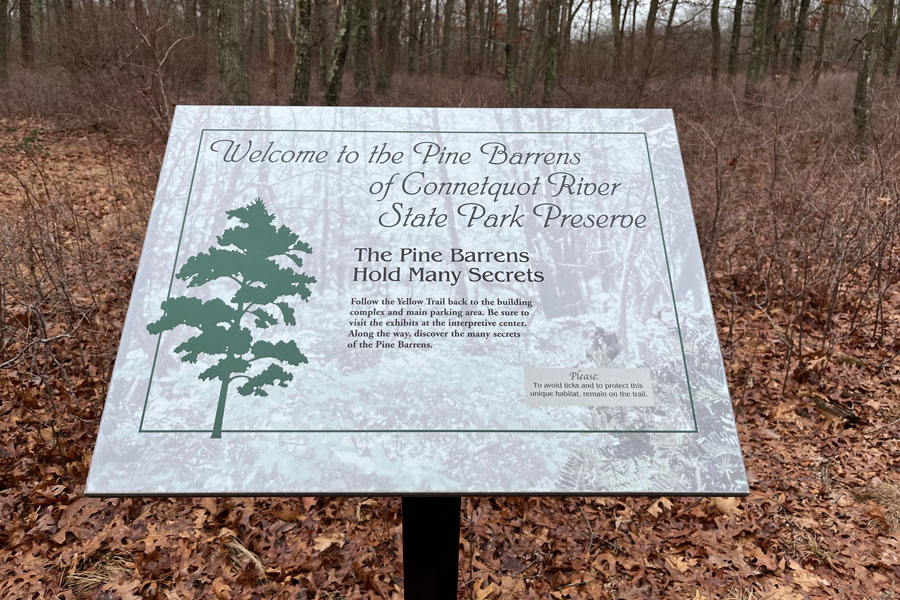
The Long Island Pine Barrens, also known as the Central Pine Barrens, is a region of more than 100,000 acres in central and eastern Suffolk County. Spanning portions of Brookhaven, Riverhead, and Southampton towns, it contains pine-oak forests, wetlands, ponds, streams, and rare ecological communities. It is a conservation and land-use planning region rather than a single park, with an important role in protecting wildlife habitat and Long Island’s groundwater supply.
Why Is It Called the Pine Barrens?
The name describes a landscape associated with pine trees and sandy, nutrient-poor soils. “Barrens” does not mean the area is empty or lifeless. These conditions support distinctive plant communities adapted to acidic soils, limited nutrients, and periodic fire, including pitch pine, scrub oak, and low-growing shrubs.
The region also contains wetlands, coastal plain ponds, and streams, creating a varied landscape rather than an uninterrupted pine forest. Its mix of dry uplands and freshwater habitats supports plants and animals that depend on conditions uncommon in more developed parts of Long Island.
Where Are the Pine Barrens?
The Central Pine Barrens occupies parts of eastern Brookhaven Town, southern Riverhead Town, and western Southampton Town. Woodlands and public recreation areas around Calverton provide examples of the region’s forest, pond, and wetland environments.
The boundary encompasses land with different owners, uses, and levels of protection. Some properties are publicly owned preserves or recreation areas, while others are private. Being within the Pine Barrens does not automatically mean a property is open to visitors.
How Is the Region Protected?
The Long Island Pine Barrens Protection Act of 1993 established a regional framework for conserving this landscape and managing development. The Central Pine Barrens is divided into a Core Preservation Area and a Compatible Growth Area, with different land-use requirements applying to each.
The Core Preservation Area is subject to particularly strong development restrictions, with specified exceptions and review procedures. The Compatible Growth Area allows development that meets applicable environmental and planning requirements. This distinction is important: the entire region is not one uniformly preserved public forest.
The Central Pine Barrens Joint Planning and Policy Commission helps administer the regional planning framework. State, county, town, nonprofit, and private landowners also have roles in managing individual properties and conserving habitat.
Why Does It Matter for Drinking Water?
Rainwater moving through the region’s permeable soils helps replenish the underground aquifer system. Protecting forests, wetlands, and recharge areas reduces development pressure and helps limit potential sources of groundwater contamination. This is particularly important in Suffolk County, where groundwater supplies drinking water.
The sandy ground should not be treated as a filter that removes every pollutant. Contaminants can also move into groundwater, making protection of the land above the aquifer essential. Conserving the Pine Barrens therefore supports both ecological health and the long-term protection of water resources.
What Makes Its Habitats Distinctive?
Pitch pine woodlands, oak forests, dwarf pine communities, ponds, and wetlands support a concentration of rare and threatened plants and animals. Changes in soil moisture, elevation, and fire history create different habitats within a relatively small geographic area.
Fire is a natural influence on many pine barrens communities. Land managers may use carefully planned prescribed burns to maintain habitat and manage accumulated vegetation. These supervised operations are different from uncontrolled wildfires, and visitors should follow closures and instructions whenever habitat-management work is underway.
Where Can You Visit the Pine Barrens?
Otis Pike Preserve provides opportunities to explore forest, wetlands, ponds, and portions of the upper Peconic River watershed. Its separate parcels have multiple access points, so visitors should select a particular section and consult its map before arriving. Hiking, wildlife observation, paddling, fishing, and seasonal hunting are subject to the rules for each location and activity.
Calverton Pine Barrens State Forest offers another place to experience the region’s woodland habitat. Together, these destinations illustrate why visiting the Pine Barrens requires choosing a specific property rather than looking for one entrance serving the entire region.
Review current maps, access permits, parking arrangements, and seasonal restrictions before your trip. Use designated trails and launches, respect private property, and bring water, suitable footwear, and tick protection. Visitors planning hunting activities should consult the applicable regulations and property-specific requirements.
Key Facts & Details
| Category | Information |
|---|---|
| Regional Name | Long Island Pine Barrens, also known as the Central Pine Barrens. |
| Location | Central and eastern Suffolk County on Long Island. |
| Towns | Portions of Brookhaven, Riverhead, and Southampton. |
| Approximate Extent | More than 100,000 acres; published totals vary with the boundary reference used. |
| Landscape | Pine-oak forests, dwarf pine communities, wetlands, coastal plain ponds, and streams. |
| Meaning of “Barrens” | A reference to nutrient-poor soils and their distinctive vegetation, rather than an absence of life. |
| Protection Framework | The Long Island Pine Barrens Protection Act of 1993 and the regional comprehensive land-use plan. |
| Land-Use Areas | Core Preservation Area and Compatible Growth Area, with different development restrictions and requirements. |
| Environmental Importance | Groundwater recharge, drinking-water protection, and conservation of rare habitats and species. |
| Public Places to Explore | Otis Pike Preserve and Calverton Pine Barrens State Forest. |
| Recreation | Hiking, wildlife observation, photography, and designated opportunities for paddling, fishing, and seasonal hunting, depending on the property. |
| Public Access | Multiple separately managed properties and trailheads; private land is not automatically open to visitors. |
| Official Regional Information | Central Pine Barrens Joint Planning and Policy Commission. |
| State | New York State. |
The Long Island Pine Barrens connects habitat conservation with the protection of the groundwater beneath Suffolk County. Exploring public lands such as Otis Pike Preserve or Calverton Pine Barrens State Forest offers a closer look at that relationship, from sandy forest trails to freshwater wetlands. Choosing a designated destination and following its access rules helps visitors experience the region while respecting its ecological importance and varied ownership.