
The Hudson River
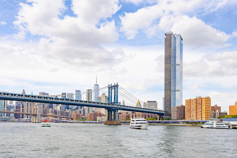
The Hudson River is one of the most important waterways in New York and the northeastern United States. Flowing from the Adirondack Mountains to New York Harbor, it helped shape the history, economy, scenery, and growth of the Hudson Valley, New York City, and the broader region.
For Long Islanders, the Hudson is especially relevant because its southern end helps define the harbor and waterfront system at the western gateway to Long Island. The river has long been tied to shipping, transportation, military history, recreation, and environmental restoration, and it remains a major geographic landmark in the greater New York metropolitan area.
Where Is the Hudson River?
The Hudson River’s commonly cited headwaters begin at Lake Tear of the Clouds near Mount Marcy in the Adirondacks. From there, the river flows generally south through eastern New York State before reaching New York Harbor and Upper New York Bay at the edge of Manhattan, New Jersey, and nearby parts of Brooklyn and Staten Island.
The river passes through or near many well-known places, including Albany, Kingston, Poughkeepsie, Beacon, West Point, Yonkers, and New York City. South of Troy, much of the Hudson functions as a tidal estuary, meaning water levels and currents are influenced by ocean tides.
Long Island lies southeast of the Hudson’s mouth, separated from mainland New York by the East River and New York Harbor. That relationship helps explain why the river is such an important reference point in regional geography.
Why the Hudson River Matters to Long Island
The Hudson River is geographically tied to Long Island because the island’s western end lies near the river’s mouth at New York Harbor. In broad geographic terms, Long Island extends eastward from the harbor area for roughly 118 miles.
The river also helped shape the economic and cultural growth of the entire New York metropolitan region, including Long Island. Shipping routes, trade networks, immigration, railroads, bridges, tunnels, and port development around the Hudson River contributed directly to the rise of New York City and surrounding suburban regions.
Today, many Long Islanders experience the Hudson region through work commutes, tourism, special events, and day trips into Manhattan and the Hudson Valley.
History of the Hudson River
The Hudson River corridor was home to Native American peoples for thousands of years before European exploration, including Lenape, Mahican, and related communities that used the waterway for travel, fishing, and trade. In 1609, Henry Hudson sailed up the river while working for the Dutch East India Company, helping open the area to Dutch colonial expansion and the later rise of New Amsterdam, which became New York City.
During the American Revolution, the Hudson River became strategically vital because controlling the river meant influencing movement between New England and the southern colonies. Important Revolutionary War locations such as West Point developed along the river.
In the 1800s, the Hudson River became a major transportation corridor linked to steamships, railroads, industrialization, and the Erie Canal system. It also inspired the famous Hudson River School art movement, known for dramatic landscape paintings celebrating the beauty of the American wilderness.
The Hudson River as a Tidal Estuary
One of the Hudson’s most distinctive features is that much of the lower river behaves as an estuary rather than a simple one-way freshwater stream. Tidal influence reaches well inland, creating a dynamic river environment with changing water levels and varying salinity closer to the harbor.
This helps support a rich ecosystem of fish, birds, wetlands, and shoreline habitat. Species commonly associated with the Hudson River include striped bass, Atlantic sturgeon, and bald eagles.
Major Bridges and Crossings
The Hudson River is crossed by numerous important bridges, tunnels, and transportation systems that connect New York State and New Jersey. Some of the best-known crossings include:
- George Washington Bridge
- Lincoln Tunnel
- Holland Tunnel
- Mario M. Cuomo Bridge
- Bear Mountain Bridge
- Walkway Over the Hudson
These crossings help support the transportation needs of the greater New York metropolitan region, including residents and businesses on Long Island. Traffic patterns, tolling, and transit connections can change, so check current travel conditions before heading across the river.
Tourism and Recreation
The Hudson River attracts millions of visitors each year for sightseeing, boating, hiking, fishing, historic tours, and scenic drives. The Hudson Valley is especially known for its small towns, wineries, historic estates, mountain views, and seasonal foliage.
Popular attractions and destinations associated with the Hudson River include:
- Hudson River Park and other waterfront parks
- U.S. Military Academy at West Point and nearby viewpoints
- Walkway Over the Hudson State Historic Park
- Storm King Art Center
- Hudson Valley wineries, orchards, and farm markets
- Beacon, Cold Spring, and other river towns
- River cruises and sightseeing tours
From Long Island, visitors often reach the lower Hudson by taking the Long Island Rail Road into Manhattan and connecting by subway, bus, or foot to the west side waterfront. Hudson Valley destinations are often easiest by car, Metro-North, or Amtrak, depending on the stop. Hours, parking availability, seasonal boat service, and tour schedules vary, so check ahead before visiting.
Environmental Recovery and Conservation
During the industrial era, portions of the Hudson River were heavily polluted by factories, sewage, and industrial waste. Major cleanup and restoration efforts by community groups, environmental advocates, and public agencies have improved conditions over time.
Today, the Hudson is often cited as an important environmental recovery story, though conservation work continues. Water quality, habitat protection, shoreline management, and fish consumption advisories can vary by location, so visitors should follow current local guidance for boating, fishing, and swimming-related activities.
The Hudson River in Popular Culture
The Hudson River has appeared in countless films, books, paintings, songs, and television programs. Its dramatic scenery and proximity to New York City have made it one of America’s most recognizable waterways.
The river is also closely tied to New York State identity and remains a defining natural feature of the Northeast.
Hudson River at 4.5-mile Hudson River Park
The map below highlights Hudson River Park on Manhattan’s west side, one of the easiest public-access locations for experiencing the Hudson near its southern end. It is best used as a starting point for the lower river rather than as a map of the full Hudson River corridor.
Key Facts and Details
| Feature | Details |
|---|---|
| Name | Hudson River |
| Location | New York State, United States |
| Length | Approximately 315 miles |
| Source | Lake Tear of the Clouds, Adirondack Mountains |
| Mouth | New York Harbor / Upper New York Bay |
| Type | River; lower portion is a tidal estuary |
| Major Cities Along River | Albany, Kingston, Poughkeepsie, Yonkers, New York City |
| Known For | Shipping, history, tourism, scenery, and environmental significance |
| Connected Regions | Hudson Valley, New York City, Long Island region |
The Hudson River is far more than a line on the map. It is one of the defining waterways of New York State and the northeastern United States, shaping commerce, transportation, military strategy, art, tourism, and environmental policy for generations. For Long Island, it remains an essential part of the region’s western setting and of the larger story of how the New York metropolitan region grew into one of the world’s most influential urban areas.
Are you ready for fall on Long Island? Check out these local seasonal guides:
🍎 Apple Picking | 🍂 Fall Festivals & Farm Activities | 👻 Haunted Houses | 🎃 Pumpkin Picking
