
Southern State Parkway
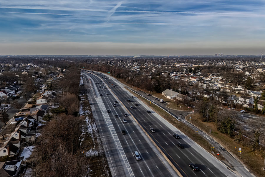
The Southern State Parkway is a core east–west artery on Long Island’s South Shore. Opened in stages beginning in the 1920s–30s as part of Robert Moses’ parkway system, it runs from the Cross Island Parkway in Queens through Nassau County and into Suffolk County, where it transitions to the Heckscher State Parkway approaching Heckscher State Park. Like other parkways in the region, it is passenger-cars only (no trucks/commercial vehicles) and is known for its classic stone overpasses, tight curves, and heavy commuter volumes.
Route and Features
- Western Terminus: Cross Island Parkway (Cambria Heights, Queens)
- Eastern Terminus: Heckscher State Parkway (East Islip), continuing toward Heckscher State Park
- Length: ~25 miles (Southern State segment proper; continuous corridor extends further via Heckscher)
- Counties: Queens (briefly), Nassau, Suffolk
- Restrictions: Passenger cars only; commercial vehicles/trucks prohibited
- Character: Tree-lined medians, narrow lanes/shoulders in legacy segments, frequent interchanges with other parkways
Southern State Parkway – Exit List
| Exit | Destination / Roadway | Notes |
|---|---|---|
| 13 | Cross Island Parkway | Western terminus; Queens/Nassau border |
| 15A | Linden Blvd (NY-27) | Elmont |
| 15S | Elmont Rd | Elmont / Valley Stream |
| 17N | Hempstead Ave (NY-24) North | Garden City / Hempstead |
| 17S | Hempstead Ave (NY-24) South | West Hempstead |
| 18 | Eagle Ave | West Hempstead |
| 19 | Peninsula Blvd (CR-2) | Hempstead / Rockville Centre |
| 20 | Grand Ave / Baldwin Rd | Baldwin / Freeport |
| 21 | Nassau Rd | Roosevelt / Freeport |
| 22N | Meadowbrook Pkwy North | Eisenhower Park / Roosevelt Field |
| 22S | Meadowbrook Pkwy South | Jones Beach access |
| 23 | Wantagh State Pkwy | Levittown (north) / Jones Beach (south) |
| 25N | Newbridge Rd (NY-106) North | Hicksville |
| 25S | Bellmore Rd (NY-106) South | Bellmore |
| 27 | Seaford–Oyster Bay Expwy (NY-135) | Seaford / Syosset |
| 28N | Wantagh Ave North | Levittown |
| 28S | Wantagh Ave South | Wantagh |
| 29 | Hicksville Rd (NY-107) | Massapequa |
| 30 | Broadway | Massapequa |
| 31 | Bethpage State Pkwy | Bethpage State Park |
| 32 | NY-110 (Broadhollow Rd) | Amityville / Farmingdale |
| 33 | Straight Path | Wyandanch |
| 34 | New Hwy | North Amityville |
| 36 | Wellwood Ave | North Lindenhurst |
| 37 | Belmont Ave | Babylon |
| 38 | Little East Neck Rd | Babylon |
| 39 | Deer Park Ave (NY-231) | North Babylon |
| 40 | Bay Shore Rd | Bay Shore |
| 41 | Robert Moses Causeway | Access to Fire Island / Robert Moses State Park |
| 42 | Fifth Ave | Bay Shore |
| 43 | Islip Ave (NY-111) | Islip |
| 44 | Brentwood Rd | Brentwood |
| 45 | Wicks Rd | Brentwood |
| 46 | Sagtikos State Pkwy | Links north to Sunken Meadow, south to Robert Moses Causeway |
| 47 | Bay Shore Rd / Broadway | Islip Terrace |
| 48 | Carleton Ave (CR-17) | Central Islip / East Islip |
| 49 | Heckscher State Pkwy | Eastern terminus – continues east to Heckscher State Park |
Notes:
- Exits start at 13 because numbering continues from the Cross Island Parkway system.
- Parkway length: about 25 miles.
- This format matches the multi-column exit charts we’ve already done for the LIE and Northern State Parkway.
Notable Facts
- Designed as a scenic, limited-access parkway for passenger cars – part of Robert Moses’ vision for Long Island mobility and recreation access.
- Shares the South Shore role with Sunrise Highway (NY-27) but provides a parkway-only alternative with key beach connectors (Meadowbrook/Wantagh).
- Legacy design elements (stone bridges, tighter curves) contribute to its distinct look – and to modern operational challenges during peak traffic.
