
Paumanok Path
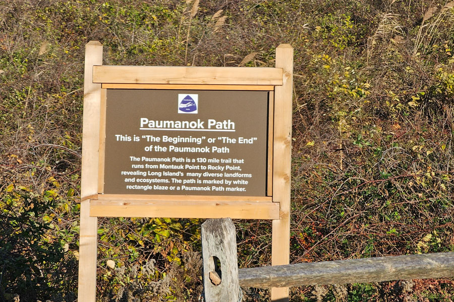
The Paumanok Path is Long Island’s premier long-distance hiking trail, stretching approximately 125 miles from Rocky Point on the North Shore to Montauk Point at the island’s eastern tip. Named after “Paumanok,” the Native American name for Long Island made famous by poet Walt Whitman, the trail passes through some of the island’s most scenic forests, parks, nature preserves, wetlands, and coastal landscapes. It offers hikers an opportunity to experience the remarkable diversity of Long Island’s natural environment while traveling across much of Suffolk County.
Unlike traditional rail trails or paved greenways, the Paumanok Path follows a combination of woodland trails, preserve lands, quiet road sections, and public park properties. Along the route, hikers encounter pitch pine forests, freshwater wetlands, rolling moraine hills, salt marshes, beaches, and some of the largest protected natural areas remaining on Long Island.
History
The Paumanok Path was developed by the Long Island Greenbelt Trail Conference to create a continuous hiking route showcasing the island’s unique landscapes and ecological diversity. Over the years, volunteers have worked to establish, maintain, and improve the trail while coordinating with public agencies and conservation organizations that manage many of the parks and preserves along its route.
Today, the trail has become a destination for day hikers, backpackers, trail runners, birdwatchers, photographers, and outdoor enthusiasts seeking to experience Long Island beyond its beaches and suburban communities.
Things to Do
Most visitors explore the Paumanok Path in shorter day hikes rather than attempting the entire route. Individual sections pass through state parks, county parks, forests, and nature preserves, making it easy to choose hikes of varying lengths and difficulty. Popular activities include hiking, trail running, birdwatching, wildlife photography, and nature study.
The trail is especially popular during spring and fall, when comfortable temperatures and changing foliage provide ideal hiking conditions. Because portions of the trail cross environmentally sensitive habitats, visitors are encouraged to remain on designated trails and follow Leave No Trace principles.
Highlights Along the Route
The Paumanok Path passes through many of Long Island’s best-known natural areas, including Brookhaven State Park, the Long Island Central Pine Barrens, Hither Hills State Park, and numerous county preserves and conservation lands. Along the journey, hikers experience forests, wetlands, kettle ponds, coastal bluffs, beaches, and open grasslands that showcase the island’s remarkable ecological diversity.
Planning Your Hike
Because the trail covers approximately 125 miles, most visitors choose individual trail segments rather than hiking the entire route. Carrying water, wearing appropriate footwear, checking weather conditions, and bringing trail maps or GPS navigation are recommended. Some sections include road walks between preserves, while others travel through remote woodland environments with limited services.
Key Facts & Details
| Feature | Details |
|---|---|
| Location | Suffolk County, Long Island |
| Length | Approximately 125 miles |
| Trail Type | Long-distance hiking trail |
| Western Terminus | Rocky Point |
| Eastern Terminus | Montauk Point |
| Activities | Hiking, trail running, birdwatching, wildlife photography, and nature observation |
| Terrain | Woodland trails, wetlands, beaches, grasslands, and limited road sections |
| Best Seasons | Spring, summer, and fall |
The Paumanok Path offers one of the most rewarding ways to experience Long Island’s natural beauty. Whether hiking a few miles through the Pine Barrens or exploring one of its many scenic trail segments, visitors discover landscapes that reveal a quieter, wilder side of the island rarely seen by those who stay near its beaches and downtowns.
Are you ready for fall on Long Island? Check out these local seasonal guides:
🍎 Apple Picking | 🍂 Fall Festivals & Farm Activities | 👻 Haunted Houses | 🎃 Pumpkin Picking
