
Meadowbrook State Parkway
The Meadowbrook State Parkway (MSP) is a 12.5-mile passenger-car parkway in Nassau County that runs from the Northern State Parkway/LIE area at Carle Place south to Jones Beach State Park, where it meets Ocean Parkway (and connects to Bay Parkway). Built as part of Robert Moses’ Long Island parkway system, it provides one of the main beach approaches on the South Shore and ties into the Southern State, Wantagh, and Loop parkways. Exits on the MSP use an “M” prefix and increase as you head south toward Jones Beach.
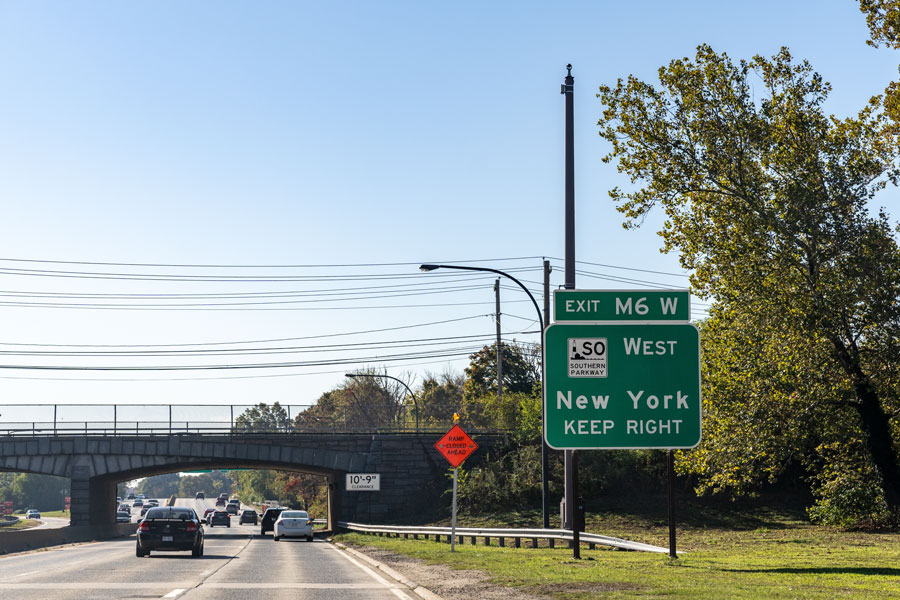
Numbered Exits (north → south)
| Exit | Destination / Roadway | Notes |
|---|---|---|
| M1 | Old Country Rd (CR 25) | Carle Place / Westbury; northern end near NSP/LIE. |
| M2E / M2W | Zeckendorf Blvd (CR 154) / Roosevelt Field Mall | Mall access and local arterials. |
| M3E / M3W | Merchants Concourse / Stewart Ave (CR 177) | Eisenhower Park / Nassau Hub area. |
| M4 | NY-24 Hempstead Tpke (westbound access) | Toward Hempstead / Nassau Coliseum. |
| M5 | NY-24 Hempstead Tpke (eastbound access) | Toward East Meadow / Farmingdale. |
| M6W / M6E | Southern State Pkwy — West / East | Major junction; to Queens (W) / Suffolk (E). |
| M7W / M7E | Babylon Turnpike — West / East | Roosevelt / North Merrick. |
| M8W / M8E | NY-27 Sunrise Hwy — West / East | Freeport / Merrick. |
| M9W / M9E | Merrick Rd (CR 27) — West / East | Freeport / Merrick; cloverleaf. |
| M10 | Loop Parkway | Access to Point Lookout / Long Beach barrier island. |
| — | Ocean Pkwy / Bay Pkwy (Jones Beach) | Southern terminus; beach approaches. |
(Numbers rise from M1 at Old Country Road to M10 near Loop Parkway; the roadway then continues a short distance to the Ocean/Bay Parkway cloverleaf inside Jones Beach State Park.)
Quick facts
- Length: ~12.5 miles; Nassau County only.
- Northern terminus: Near NSP / I-495 (LIE) at Carle Place.
- Southern terminus: Jones Beach State Park (Ocean & Bay Parkways).
- Restrictions: Passenger cars only (no trucks/commercial vehicles), like other LI parkways.
