
Reynolds Channel, Long Island, New York
Reynolds Channel is a tidal waterway located along Long Island’s South Shore, separating the mainland of Nassau County from the barrier island communities of Long Beach, Atlantic Beach, Lido Beach, and Point Lookout. The channel connects to both Jones Inlet and East Rockaway Inlet, making it an important route for boaters, fishing vessels, and local marine traffic. With scenic marshlands, bridges, and open water views, Reynolds Channel is a defining feature of the South Shore’s coastal landscape.
History
Reynolds Channel takes its name from the Reynolds family, who were early landowners and fishermen in the area during the 1800s. As nearby communities developed into beach destinations and residential neighborhoods, the channel grew in importance as both a transportation route and a natural resource.
Throughout the 20th century, the waterway supported commercial fishing, small boat marinas, and recreational use. Today, it continues to be used for boating, sightseeing, and outdoor activities, while also serving as a natural buffer between the Atlantic Ocean and the mainland.
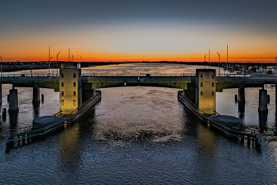
Geography & Setting
Reynolds Channel runs parallel to the Atlantic Ocean and stretches for several miles along the barrier island system. Salt marshes, wetlands, and bays surround much of the waterway, providing habitat for birds, fish, and other coastal wildlife.
The channel is crossed by several key bridges, including routes that connect the mainland with Long Beach and the neighboring barrier island communities. These crossings make the waterway highly visible to residents and visitors traveling through the South Shore.
Recreation & Things To Do
Reynolds Channel offers a wide variety of outdoor activities:
- Boating, kayaking, and paddleboarding
- Fishing from boats and designated piers
- Bird-watching along the marshlands
- Scenic photography and waterfront walks
Nearby parks and beaches also provide viewing points and access to the surrounding waterways.
Navigation & Boating
The channel forms part of the Atlantic Intracoastal Waterway, giving it ongoing importance for marine navigation. Local marinas serve recreational boaters, while marked channels and navigation aids help vessels move safely between inlets and nearby harbors.
Because this is a tidal waterway, conditions can change with weather and tide cycles, making awareness and caution important for anyone traveling by boat.
Vicinity of the Channel
Nearby Communities & Access
Communities along or near Reynolds Channel include:
These areas offer beaches, dining, fishing spots, and marinas, making the channel part of everyday coastal life.
Snapshot – Reynolds Channel
| Location | South Shore, Nassau County, Long Island |
|---|---|
| Borders | Mainland Nassau County and Long Beach barrier island communities |
| Water Type | Tidal waterway connected to Atlantic inlets |
| Known For | Boating, fishing, coastal scenery, and marine navigation |
| Nearby Beaches | Long Beach, Lido Beach, Jones Beach area |
| Primary Character | Natural waterway with marshlands, bridges, and boat traffic |
Whether viewed from a bridge, a marina, or a boat on the water, Reynolds Channel offers a memorable look at Long Island’s South Shore environment. With its mix of natural wetlands, open views, and active boating culture, it remains an essential part of the region’s seaside identity.
