
The Montauk Project
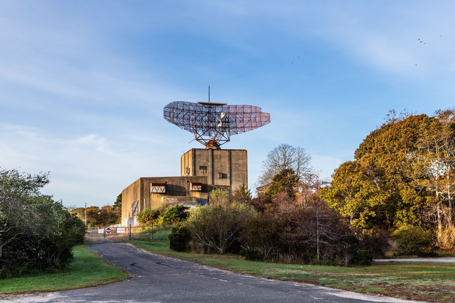
The Montauk Project is the name given to a bundle of conspiracy claims that say secret U.S. government experiments, ranging from psychological warfare to time travel, took place at Camp Hero / Montauk Air Force Station on the eastern tip of Long Island. The stories gained traction after a 1992 paperback, The Montauk Project: Experiments in Time, popularized the idea for a mainstream audience and spawned sequels and a dedicated subculture. Meanwhile, the real site, Camp Hero State Park, is a public coastal preserve notable for its hulking Cold War-era AN/FPS-35 radar tower, WWII gun batteries, trails, surfing and fishing.
Snapshot QuickFacts
| Topic | Fast Answer |
|---|---|
| Where is it? | Camp Hero State Park, 1898 Montauk Hwy, Montauk, NY, on Long Island’s easternmost bluffs. |
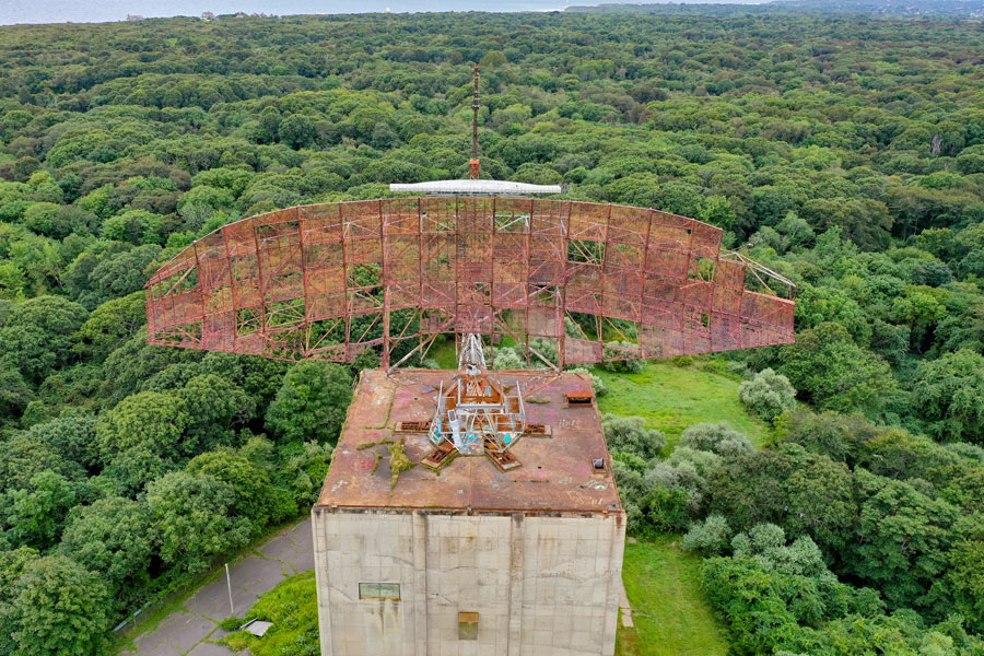
| What’s the big tower? | An AN/FPS-35 long-range search radar—one of a handful ever built; the last standing with its antenna is here at Montauk. |
| When did the base operate? | Montauk AFS operated through the Cold War; radar operations ended 1981 and the facility closed by 1982. |
| When did it become a park? | September 18, 2002—Camp Hero State Park officially opened to the public. |
| Is the “Montauk Project” proven? | No. It’s considered a conspiracy theory inspired by 1990s books; there’s no verified evidence the alleged experiments occurred. |
| Is the radar active? | No—decommissioned; the antenna is corroded and no longer rotates. |
| Can you visit the tower interior? | The exterior is a photo favorite. Interior access is restricted; the park is otherwise open year-round for trails and shoreline vistas. |
A Short, Straight Timeline
- 1942: U.S. Army commissions Camp Hero as a coastal defense post during WWII; disguised elements gave it a “fishing village” look. Massive 16-inch gun batteries protected the approaches to New York.
- 1951–1952: Portions of the property shift to the Air Force; the site becomes Montauk Air Force Station, home to the 773rd units and later a radar squadron.
- Late 1960 / early 1960s: Installation of the giant AN/FPS-35 search radar as part of continental air-defense integration (the broader SAGE era).
- 1981–1982: Radar operations cease (1981); facility closure follows (1982).
- 2002: Camp Hero State Park opens to the public; the radar tower remains a signature landmark on the bluffs.
What the Montauk Project Is (and Isn’t)
The claims (from the 1990s books and later retellings) describe secret research under Camp Hero involving mind control, remote viewing, the “Montauk Chair,” alleged abductions (“Montauk Boys”), time portals, and even a creature set loose on the base. These stories link themselves loosely to the earlier Philadelphia Experiment legend and Cold War black-budget lore.
What’s verified:
- Camp Hero/Montauk AFS is real, with documented roles in WWII coastal defense and Cold War radar surveillance.
- The AN/FPS-35 radar and gun batteries are historically significant and still visible today.
- Environmental investigations and federal/state documents describe routine military uses (artillery training, radar operations) and later remediation—not exotic experiments.
Bottom line: The Montauk Project belongs to conspiracy folklore, hugely influential in pop culture, but not accepted as historical fact by credible sources.
Pop Culture & “Stranger Things”
The Montauk lore helped inspire modern sci-fi. Early in development, Netflix’s hit series Stranger Things was reportedly pitched or framed as “Montauk”, with Cold War experiments near a coastal base as backdrop, before the setting shifted to fictional Hawkins, Indiana. The show’s themes echo the campfire stories around Camp Hero, even as the monsters and portals are pure fiction.
The Radar Tower: What You’re Looking At
- Type: AN/FPS-35 search radar (Sperry)
- Why it’s unique: It is widely cited as the last remaining tower of its type with antenna still on top. The unit at Montauk was the final one in operation (January 1981), and today the corroded antenna is fixed in place.
- Historic status: Elements of the site are listed on the National Register of Historic Places; the park opened in 2002.
How to Visit Camp Hero (Practical Info)
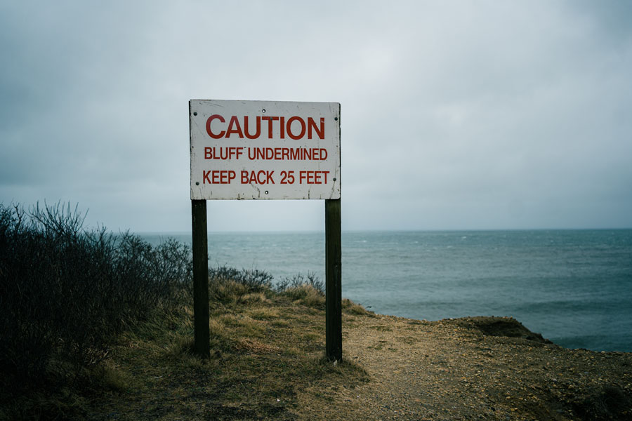
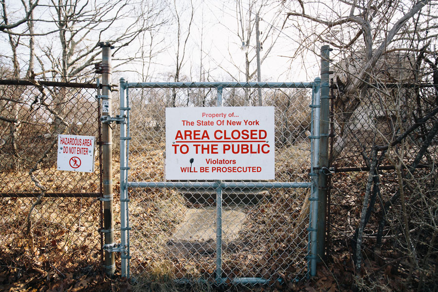
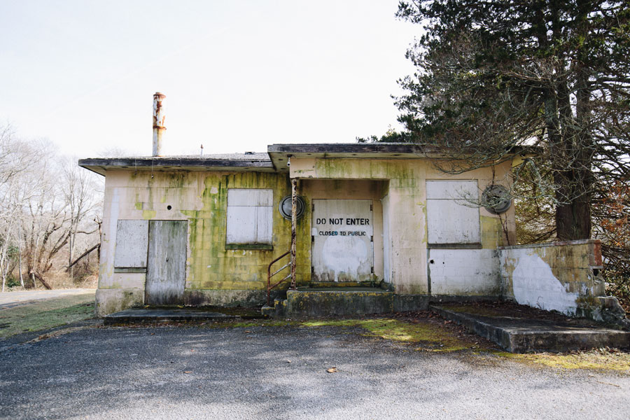
- Park: Camp Hero State Park, 1898 Montauk Hwy, Montauk, NY. Open year-round (day-use). Hiking/biking/horseback trails, coastal overlooks, fishing access (in season). Some former military areas remain restricted.
- What to bring: Sturdy shoes (uneven terrain), wind layer (the bluffs can whip), water/snacks (limited services inside the park).
- Photos: The radar tower is visible from multiple vantage points—respect all posted closures and fences.
- Context stop: Pair your visit with Montauk Point Lighthouse (for maritime history and views) and nearby Montauk village for dining.
- Safety/odd finds: If you encounter suspected old munitions or hazardous items, follow USACE guidance: Recognize, Retreat, Report (call 911).
Frequently Asked Questions
Did secret experiments really happen here?
No verified evidence has surfaced. The claims come chiefly from 1990s books that present anecdotal memories and speculative narratives, not documented records.
What was Camp Hero actually used for?
WWII coastal artillery (16-inch and 6-inch gun batteries) and, later, Cold War radar surveillance as Montauk Air Force Station.
What is SAGE and how does it relate?
SAGE (Semi-Automatic Ground Environment) was the pioneering U.S. air-defense computer network that linked long-range radars to command centers. Montauk’s radar history sits within that broader air-defense mission.
Can I go inside the radar tower?
Not as a general visitor. The structure is closed; you can photograph it from designated areas in the park.
Why do some sources say 1981 and others 1982 for closure?
Radar operations ceased in 1981, while administrative closure and transfers wrapped up by 1982, hence the differing dates.
Is Camp Hero environmentally safe?
USACE conducted multi-year investigations and concluded no further action is necessary for the site overall, with prior cleanups documented.
