

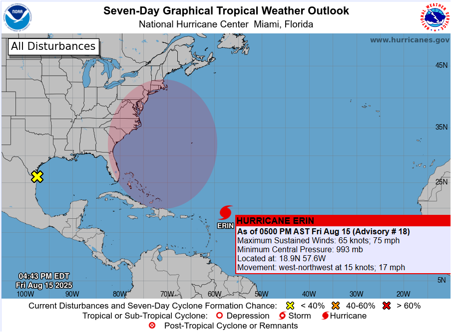
NEW YORK, NY – Hurricane Erin has strengthened into the first hurricane of the 2025 Atlantic season, with maximum sustained winds of 75 mph as of Friday evening, according to the National Hurricane Center. The storm, located well east of the Caribbean, is moving west at 17 mph and is expected to undergo rapid intensification over the next several days.
Forecast models now project Erin’s winds could peak between 140 and 145 mph early next week, placing it in the Category 4 major hurricane range. Current projections keep the system over open waters, passing between Bermuda and the U.S. East Coast before curving northward.
Long Island Impact: Not a Direct Hit, but Not Without Risks
While Long Island is not currently in the forecast cone for a direct landfall, forecasters caution that coastal impacts remain likely. Dangerous surf, strong rip currents, and possible minor coastal flooding could develop late this weekend and persist into the middle of next week.
Forecast Track and Cone
The latest official forecast shows Erin strengthening rapidly:
- Saturday PM – 105 mph (Category 2)
- Sunday PM – 130 mph (Category 4)
- Monday PM – 145 mph (Category 4)
- Tuesday PM – 140 mph (Category 4)
- Wednesday PM – 130 mph (Category 3)
The cone of uncertainty keeps Erin offshore, but a small westward shift could bring stronger impacts closer to the Northeast coastline.
Preparedness and Caution
Local officials advise residents to:
- Stay out of the ocean during high surf advisories.
- Check local forecasts daily, especially if you live or work near the shoreline.
- Be aware of rip current risks, particularly in unguarded beach areas.
Though a direct hit is not forecast, Long Island’s coastal communities should prepare for rough surf and beach erosion.
Summary Table
| Factor | Outlook for Long Island |
|---|---|
| Direct Landfall | Unlikely |
| Wind / Rain | Minimal direct impact expected |
| Coastal Flooding | Possible in low-lying areas |
| Rip Current Risk | High beginning late weekend |
For updated forecasts, visit the National Hurricane Center at hurricanes.gov and follow local emergency management advisories.
